Westerville, Ohio
| Westerville, Ohio | |
|---|---|
| City | |
 Location of Westerville in Ohio | |
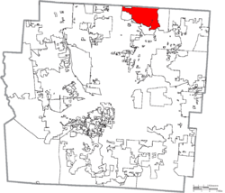 Location of Westerville in Franklin County | |
| Coordinates: 40°7′25″N 82°55′17″W / 40.12361°N 82.92139°WCoordinates: 40°7′25″N 82°55′17″W / 40.12361°N 82.92139°W | |
| Country | United States |
| State | Ohio |
| Counties | Delaware, Franklin |
| Incorporated | 1858 |
| Government | |
| • Mayor | Kathy Cocuzzi |
| • City Manager | David Collinsworth |
| Area[1] | |
| • Total | 12.61 sq mi (32.66 km2) |
| • Land | 12.47 sq mi (32.30 km2) |
| • Water | 0.14 sq mi (0.36 km2) |
| Elevation[2] | 875 ft (267 m) |
| Population (2010)[3] | |
| • Total | 36,120 |
| • Estimate (2012[4]) | 37,073 |
| • Density | 2,896.6/sq mi (1,118.4/km2) |
| Time zone | EST (UTC-5) |
| • Summer (DST) | EDT (UTC-4) |
| ZIP codes | 43081, 43082, 43086[5] |
| Area code(s) | 614 |
| Website |
www |

Westerville is a city in Delaware and Franklin counties in the U.S. state of Ohio. It is a northeastern suburb of Columbus. The population was 36,120 at the 2010 census.
Westerville was once known as "The Dry Capital of the World" for its strict laws prohibiting sales of alcohol.[6]
History
Early history
The land that is today Westerville was first settled around 1810. In 1818, Matthew, Peter, and William Westervelt, settlers of Dutch extraction, migrated to the area from New York. Matthew Westervelt donated land for the construction of a Methodist church in 1836, and the settlement was subsequently named in the family’s honor.[7] In 1839, the Blendon Young Men’s Seminary was chartered in Westerville;[8] Matthew Westervelt was one of its first trustees.[9] The Church of the United Brethren in Christ bought the seminary in 1846,[10] and the next year the seminary was reformed, and renamed Otterbein College after the church’s founder Philip William Otterbein. It continues today in Westerville as the private Otterbein University.[11]
Westerville was platted by 1856, and officially incorporated in August 1858. The town's population in that year was 275.[12]
Throughout the Antebellum era, several homes in Westerville were stations on the Underground Railroad. Among these is the Hanby House, located one block from the college. Benjamin Russell Hanby had moved to Westerville in 1849, at the age of sixteen, to enroll at Otterbein University.[13] Hanby went on to write many familiar hymns and songs, among them "Darling Nelly Gray" (inspired by his sympathy for Southern slaves[14]), "Who is He in Yonder Stall?", and the Christmas favorite "Up On The Housetop". His home in Westerville, listed on the National Register of Historic Places, was dedicated as a museum in 1937[15] and is now owned by the Ohio Historical Society and managed locally by the Westerville Historical Society. It is the only state memorial to a composer in the state of Ohio.
"Dry Capital of the World"
An 1859 town ordinance prohibited sales of alcohol in Westerville.[16] By the 1870s, a burgeoning conflict between pro- and anti-temperance forces boiled over into the so-called "Westerville Whiskey Wars". Twice, in 1875 and 1879, businessman Henry Corbin opened a saloon in Westerville, and each time the townspeople blew up his establishment with gunpowder. Westerville's reputation for temperance was so significant that in 1909 the Anti-Saloon League moved its national headquarters from Washington, D.C. to Westerville. The League, at the forefront of the Prohibition movement, gained its greatest triumph when the Eighteenth Amendment to the United States Constitution was ratified in 1919. The League printed so many leaflets in support of temperance and prohibition—over 40 tons of mail per month—that Westerville, by then known as "The Dry Capital of the World", was the smallest town in the nation to have a first class post office. The League's Westerville headquarters was given to the Westerville Public Library in 1973 and now serves as a museum attached to the library.[17] After Prohibition ended, Westerville remained dry for most of the twentieth century.[18]
Since 1915
In 1916, Westerville became the first village (and second municipality)[19] in Ohio to adopt a council-manager form of government, in which a city council makes policy but the town's administrative and many of its executive governmental functions are vested in an appointed, professional manager. Westerville retains the council-manager system to the present. The city elects seven council members at large for four-year terms; the council selects from among its own a member to serve as mayor, vice mayor, chair, and vice chair. Under the City Charter, the mayor is only "the ceremonial head of the government" of the city.[20] The council additionally selects the city manager, who serves indefinitely. In 2007, David Collinsworth replaced David Lindimore as city manager after the latter's tenure of twenty-two years.[21]
In 1995 the city annexed 941 non-dry acres of land to its north, which included several alcohol-selling businesses. Subsequently, voters have approved alcohol sales in old Westerville at a number of establishments through site-specific local options. In 2006 Michael's Pizza served the first beer in Uptown Westerville in over 70 years.[18][22][23]
Geography
Westerville is located at 40°7′25″N 82°55′17″W / 40.12361°N 82.92139°W (40.123496, -82.921432).[24]
According to the United States Census Bureau, the city has a total area of 12.61 square miles (32.66 km2), of which 12.47 square miles (32.30 km2) is land and 0.14 square miles (0.36 km2) is water.[1]
Demographics
| Historical population | |||
|---|---|---|---|
| Census | Pop. | %± | |
| 1860 | 668 | — | |
| 1870 | 741 | 10.9% | |
| 1880 | 1,148 | 54.9% | |
| 1890 | 1,329 | 15.8% | |
| 1900 | 1,462 | 10.0% | |
| 1910 | 1,903 | 30.2% | |
| 1920 | 2,480 | 30.3% | |
| 1930 | 2,879 | 16.1% | |
| 1940 | 3,146 | 9.3% | |
| 1950 | 4,112 | 30.7% | |
| 1960 | 7,011 | 70.5% | |
| 1970 | 12,530 | 78.7% | |
| 1980 | 22,960 | 83.2% | |
| 1990 | 30,269 | 31.8% | |
| 2000 | 35,318 | 16.7% | |
| 2010 | 36,120 | 2.3% | |
| Est. 2015 | 38,384 | [25] | 6.3% |
| Sources:[26][27][28][29][30][31][32][33] | |||
2010 census
As of the census[3] of 2010, there were 36,120 people, 13,859 households, and 9,800 families residing in the city. The population density was 2,896.6 inhabitants per square mile (1,118.4/km2). There were 14,467 housing units at an average density of 1,160.1 per square mile (447.9/km2). The racial makeup of the city was 88.6% White, 6.4% African American, 0.2% Native American, 2.3% Asian, 0.5% from other races, and 2.1% from two or more races. Hispanic or Latino of any race were 1.9% of the population.
There were 13,859 households, of which 31.9% had children under the age of 18 living with them, 58.7% were married couples living together, 9.1% had a female householder with no husband present, 2.9% had a male householder with no wife present, and 29.3% were non-families. 24.4% of all households were made up of individuals and 10.6% had someone living alone who was 65 years of age or older. The average household size was 2.48 and the average family size was 2.96.
The median age in the city was 41.2 years. 22.4% of residents were under the age of 18; 10.1% were between the ages of 18 and 24; 22.2% were from 25 to 44; 31.1% were from 45 to 64; and 14.3% were 65 years of age or older. The gender makeup of the city was 47.0% male and 53.0% female.
2000 census
As of the census[32] of 2000, there were 35,318 people, 12,663 households, and 9,547 families residing in the city. The population density was 2,851.1 people per square mile (1,100.6/km²). There were 13,143 housing units at an average density of 1,061.0 per square mile (409.6/km²). The racial makeup of the city was 93.54% White, 3.20% African American, 0.13% Native American, 1.55% Asian, 0.03% Pacific Islander, 0.36% from other races, and 1.19% from two or more races. Hispanic or Latino of any race were 1.07% of the population.
There were 12,663 households out of which 39.3% of those had children under the age of 18 living with them, 64.8% were married couples living together, 8.3% had a female householder with no husband present, and 24.6% were non-families. 20.9% of all households were made up of individuals and 8.0% had someone living alone who was 65 years of age or older. The average household size was 2.67 and the average family size was 3.11.
In the city the population was spread out with 26.9% under the age of 18, 9.1% from 18 to 24, 27.1% from 25 to 44, 26.5% from 45 to 64, and 10.4% who were 65 years of age or older. The median age was 38 years. For every 100 females there were 90.3 males. For every 100 females age 18 and over, there were 84.9 males.
The median income for a household in the city was $69,135, and the median income for a family was $82,163. Males had a median income of $55,053 versus $36,510 for females. The per capita income for the city was $29,401. About 2.5% of families and 3.5% of the population were below the poverty line, including 3.5% of those under the age of 18 and 5.0% of those ages 65 and older.
Education
Otterbein University, a private four-year liberal arts college, was founded by the United Brethren Church in 1847 and is now home to over 3,000 students. The United Brethren Church has since merged with the Methodist Church and is now the United Methodist Church, with which the college continues to be affiliated.
Other colleges and universities in Westerville Ohio include Hondros College, Franklin University (branch), Dominion University, The Ohio State School of Cosmetology, Columbus State Westerville Center (branch) and Fortis College.
Westerville is served by the Westerville City School District (Franklin County, Ohio)|Westerville City School District. The District operates three high schools: Westerville South High School, an International Baccalaureate School, which opened in 1960 as Westerville High School; Westerville North High School (opened 1975); and Westerville Central High School (opened 2003). In addition, Westerville has four middle and sixteen elementary schools. The middle schools are Blendon, Genoa, Heritage, and Walnut Springs. The elementary schools are Emerson (a magnet school that opened in 1896 as the Vine Street School), Central College (magnet), Hanby (magnet), Longfellow (magnet), Alcott, Annehurst, Cherrington, Fouse, Hawthorne, Huber Ridge, Mark Twain, McVay, Pointview, Robert Frost, Whittier, and Wilder.
Transportation
In the early days before the town's incorporation, Westerville was connected to Columbus by a plank road with a toll of ten cents.[34] Today, Westerville borders Interstate 71 and Interstate 270 (the Columbus Outerbelt), expressways that connect it with Columbus and other suburbs. Via the interstates, central Westerville is 16 miles (26 km) from downtown Columbus and 12 miles (19 km) from Port Columbus International Airport, Central Ohio's primary terminal for air passengers. State Route 3, the "3-C Highway" which connects Cleveland, Columbus, and Cincinnati, is the chief north-south thoroughfare of the old town center, known as Uptown Westerville, through which it is called State Street.
Streetcars plied the avenues of Westerville from the late nineteenth century[35] but service was discontinued in 1929.[36] Today, Westerville offers little in the way of public transportation. The city itself operates no public buses, but the Central Ohio Transit Authority (COTA) serves Westerville with five bus lines.[37]
Economy
Top employers
According to Westerville's 2010 Comprehensive Annual Financial Report,[38] the top employers in the city are:
| # | Employer | # of Employees |
|---|---|---|
| 1 | JPMorgan Chase | 4,601 |
| 2 | Mount Carmel Health | 2,352 |
| 3 | Westerville City School District | 2,231 |
| 4 | Otterbein University | 1,896 |
| 5 | Continental Message Solution | 1,451 |
| 6 | Alliance Data | 1,020 |
| 7 | GSW Worldwide | 848 |
| 8 | City of Westerville | 834 |
| 9 | HCR Manor Care | 716 |
| 10 | Progressive Medical | 602 |
Points of interest
Business and industry
- Cheryl&Co., originally and popularly known as Cheryl's Cookies, was founded in Westerville in 1981 and is still based there.
- Worthington Industries has a cylinder factory in Westerville.
- The American Ceramic Society, a non-profit professional organization founded in 1899 in Columbus, has its headquarters in Westerville.
Community
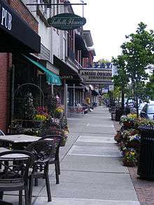
- The town center, home to many locally owned stores and boutiques, is referred to as "Uptown Westerville". The storefronts along State Street are mainly the original architecture.
- Westerville is served by the Westerville Public Library. In 2005, the library loaned more than 1.7 million items to its 78,000 cardholders. Total holdings are over 347,000 volumes with over 500 periodical subscriptions.[39] In late 2004, the library started a renovation that was completed in May 2006. The library is also home to the Anti-Saloon League Museum.
- Westerville is served by the local newspaper ThisWeek Westerville News & Public Opinion,[40] as well as by the newspapers of Columbus, including the daily Columbus Dispatch.
- The Ohio to Erie Trail runs through Westerville and provides miles of maintained bike paths as part of the Heart of Ohio branch.
- Blendon Woods, Sharon Woods, and Inniswood Botanical Garden and Nature Preserve are part of the Columbus and Franklin County Metropolitan Park District. All have several miles of walking trails; the last includes several exceptional gardens.
- The Westerville Community Center opened in 2001. The 96,600-square-foot (8,970 m2) building offers a track, gymnasium, pool, climbing wall, and other recreational facilities.[41]
- Westerville is home to a smaller and lesser-known Hoover Dam, where the Westerville Crew high school rowing team and the Ohio State University and Denison University sailing teams practice.
- Central High School is further north than North High School, a fact featured on The Daily Show with Jon Stewart in March 2008.[42] Central High, Genoa Middle and Hawthorne, Fouse and Alcott Elementary are outside of city limits.[43]
Recognition
- Westerville was named America's best suburb in 2013 by Movoto Real Estate[44]
- Westerville was ranked #15 on Money magazine's list of the Top 100 Best Places to Live in 2009[45] and ranked #46 on the list in 2007.[46]
- The Westerville Parks and Recreation Department has won the gold medal for Excellence in Parks and Recreation Management for Class IV in its last three years of eligibility (2001, 2007, and 2013), as a winner must wait five full years before applying again.[47]
- Westerville was named Sports Illustrated's "Sportstown Ohio" in 2003 as part of the magazine's 50th anniversary.[48]
Notable people
- Attack Attack! - Post-hardcore band signed to Rise Records
- Ki-Jana Carter — 1995 #1 pick, NFL draft with the Cincinnati Bengals
- Jason Day, professional golfer on the PGA Tour
- Jim Day - host of Reds Live for the Cincinnati Reds
- Jennifer Hetrick — actor, Star Trek: The Next Generation
- Benjamin Hanby - 19th-century composer
- Abhijat Joshi — Bollywood screenplay/script writer
- John Kasich - Governor of Ohio (2011–present)
- Andy Katzenmoyer — football player; Super Bowl Champion with the New England Patriots
- Bob Kennedy — two-time Olympian (1992, 1996)
- John William Lambert — early automotive pioneer, inventor, and automobile manufacturer[49]
- Lance Moore — wide receiver for the Detroit Lions; Super Bowl Champion with the New Orleans Saints
- Nick Moore, wide receiver for the Winnipeg Blue Bombers
- Dan O'Brien — General Manager, Cincinnati Reds
- Twenty One Pilots — band signed to Fueled by Ramen
In television and media
On the musical comedy television series Glee, Westerville is the location for a fictional private school, Dalton Academy, home to the Dalton Academy Warblers, a rival show choir. The city is located about two hours' drive southeast of Lima, Ohio, the series' main setting.
References
- 1 2 "US Gazetteer files 2010". United States Census Bureau. Archived from the original on 2012-01-24. Retrieved 2013-01-06.
- ↑ City-Data 2009
- 1 2 "American FactFinder". United States Census Bureau. Retrieved 2013-01-06.
- ↑ "Population Estimates". United States Census Bureau. Archived from the original on 2013-06-17. Retrieved 2013-06-17.
- ↑ "Westerville Zip Code Search Results". Retrieved 2007-09-19.
- ↑ Retrieved on 2008-09-03.
- ↑ Anita Palladino ed., Diary of a Yankee Engineer: The Civil War Diary of John Henry Westervelt x n.5 (1996).
- ↑ Edward Alanson Miller, The History of Educational Legislation in Ohio from 1803 to 1850, at 83 (1920).
- ↑ Palladino, supra, at x n.5.
- ↑ Henry Kiddle & Alexander J. Schem, eds., The Cyclopædia of Education (3d ed.), 1883, p. 823 (at Google Books).
- ↑ Quentin Charles Lansman, Higher Education in the Evangelical United Brethren Church, 1800–1954, at 18 (1972).
- ↑ Beth Berning Weinhardt, Westerville, p.13 (2004).
- ↑ C.B. Galbreath, Song Writers of Ohio, in 14 Ohio Archaeological and Historical Publications 180, 183 (1905).
- ↑ Id. at 185.
- ↑ Weinhardt, supra, at 17.
- ↑ "City of Westerville, Ohio Ordinance List" (PDF). Archived from the original (PDF) on October 1, 2008. Retrieved 2008-09-05.
- ↑ "Westerville Public Library, About Us: Our History". Archived from the original on 2008-06-07. Retrieved 2008-09-03.
- 1 2 Archived August 9, 2011, at the Wayback Machine.
- ↑ Retrieved on 2008-09-03.
- ↑ City of Westerville, Ohio Charter, Art. III, § 5 Archived June 22, 2008, at the Wayback Machine..
- ↑ Lin Rice, "Westerville Council set to hire city manager," DispatchPolitics.com, Oct. 23, 2007.. Retrieved on 2008-09-03. Archived July 21, 2011, at the Wayback Machine.
- ↑ Archived January 6, 2009, at the Wayback Machine.
- ↑ Mark Major, "Michael's uncorks Uptown liquor sales," Westerville News & Public Opinion, Jan. 18, 2006, reprinted at http://www.pizzamike.com/beer.html
- ↑ "US Gazetteer files: 2010, 2000, and 1990". United States Census Bureau. 2011-02-12. Retrieved 2011-04-23.
- ↑ "Annual Estimates of the Resident Population for Incorporated Places: April 1, 2010 to July 1, 2015". Retrieved July 2, 2016.
- ↑ "Population of Civil Divisions Less than Counties" (PDF). Statistics of the Population of the United States at the Tenth Census. U.S. Census Bureau. Retrieved 28 November 2013.
- ↑ "Population of Civil Divisions Less than Counties" (PDF). Statistics of the Population of the United States at the Tenth Census. U.S. Census Bureau. Retrieved 28 November 2013.
- ↑ "Population: Ohio" (PDF). 1910 U.S. Census. U.S. Census Bureau. Retrieved 28 November 2013.
- ↑ "Population: Ohio" (PDF). 1930 US Census. U.S. Census Bureau. Retrieved 28 November 2013.
- ↑ "Number of Inhabitants: Ohio" (PDF). 18th Census of the United States. U.S. Census Bureau. Retrieved 22 November 2013.
- ↑ "Ohio: Population and Housing Unit Counts" (PDF). U.S. Census Bureau. Retrieved 22 November 2013.
- 1 2 "American FactFinder". United States Census Bureau. Archived from the original on 2013-09-11. Retrieved 2008-01-31.
- ↑ "Incorporated Places and Minor Civil Divisions Datasets: Subcounty Population Estimates: April 1, 2010 to July 1, 2012". U.S. Census Bureau. Archived from the original on 17 June 2013. Retrieved 25 November 2013.
- ↑ "Ohio History Central, Westerville". Retrieved 2008-09-05.
- ↑ "Ohio History Central, Westerville". Archived from the original on February 20, 2008. Retrieved 2008-09-05. (citing the 1890s).
- ↑ "Columbusrailroads.com, Columbus Electric Railway Chronology" (PDF). Retrieved 2008-09-05.; Robert Vitale, "When streetcars ruled," Columbus Dispatch, Apr. 14, 2008.
- ↑ "Central Ohio Transit Authority System Map" (PDF). Retrieved 2014-05-05.
- ↑ City of Westerville CAFR
- ↑ "2005 Ohio Public Library Statistics:Statistics by County and Town". State Library of Ohio. Archived from the original on September 24, 2006. Retrieved October 30, 2006.
- ↑ "'ThisWeek Westerville News & Public Opinion' to debut April 26". http://www.thisweeknews.com. Retrieved 17 August 2012. External link in
|publisher=(help) - ↑ Retrieved on 2008-09-04. Archived October 4, 2011, at the Wayback Machine.
- ↑ Ultimate Last Final Showdown - The Daily Show with Jon Stewart - 03/03/08 - Video Clip | Comedy Central
- ↑ http://www.visitwesterville.org/maps/WESTERVILLEVISMAP08.pdf
- ↑ http://www.movoto.com/blog/top-ten/best-suburban-cities-in-america/. Missing or empty
|title=(help) - ↑ "Best Places to Live: Top 100". Retrieved on 2009-07-14.
- ↑ "Best Places to Live: Top 100". Retrieved on 2007-12-06.
- ↑ http://www.westerville.org/index.aspx?page=852
- ↑ "Locals enjoy gem of a parks and recreation department". CNN.
- ↑ Article on The Lambert-Parent House
External links
Municipalities and communities of Delaware County, Ohio, United States | ||
|---|---|---|
| Cities | 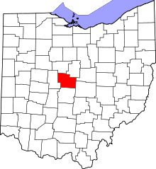 | |
| Villages | ||
| Townships | ||
| CDPs | ||
| Unincorporated communities | ||
| Ghost towns | ||
| Footnotes | ‡This populated place also has portions in an adjacent county or counties | |
Municipalities and communities of Franklin County, Ohio, United States | ||
|---|---|---|
| Cities | 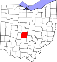 | |
| Villages | ||
| Townships | ||
| CDPs | ||
| Unincorporated communities | ||
| Footnotes | ‡This populated place also has portions in an adjacent county or counties | |