Estell Manor, New Jersey
| Estell Manor, New Jersey | |
|---|---|
| City | |
| City of Estell Manor | |
|
| |
| Motto: "Small City Charm in the Pines" | |
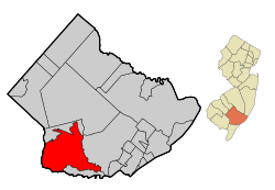 Map of Estell Manor in Atlantic County. Inset: Location of Atlantic County highlighted in the State of New Jersey. | |
 Census Bureau map of Estell Manor, New Jersey | |
| Coordinates: 39°21′14″N 74°46′30″W / 39.353933°N 74.775135°WCoordinates: 39°21′14″N 74°46′30″W / 39.353933°N 74.775135°W[1][2] | |
| Country |
|
| State |
|
| County | Atlantic |
| Incorporated | March 14, 1925 |
| Government[3] | |
| • Type | Faulkner Act (Small Municipality) |
| • Body | City Council |
| • Mayor | Stephen Teasenfitz (term ends December 31, 2017)[4][5] |
| • Clerk | Fern A. Brown (acting)[6] |
| Area[1] | |
| • Total | 55.099 sq mi (142.704 km2) |
| • Land | 53.321 sq mi (138.100 km2) |
| • Water | 1.778 sq mi (4.604 km2) 3.23% |
| Area rank |
28th of 566 in state 5th of 23 in county[1] |
| Elevation[7] | 39 ft (12 m) |
| Population (2010 Census)[8][9][10] | |
| • Total | 1,735 |
| • Estimate (2015)[11] | 1,731 |
| • Rank |
503rd of 566 in state 20th of 23 in county[12] |
| • Density | 32.5/sq mi (12.5/km2) |
| • Density rank |
560th of 566 in state 23rd of 23 in county[12] |
| Time zone | Eastern (EST) (UTC-5) |
| • Summer (DST) | Eastern (EDT) (UTC-4) |
| ZIP code | 08319[13][14] |
| Area code(s) | 609[15] |
| FIPS code | 3400121870[1][16][17] |
| GNIS feature ID | 0885212[1][18] |
| Website |
www |

Estell Manor is a city in Atlantic County, New Jersey, United States. As of the 2010 United States Census, the city's population was 1,735,[8][9][10] reflecting an increase of 150 (+9.5%) from the 1,585 counted in the 2000 Census, which had in turn increased by 181 (+12.9%) from the 1,404 counted in the 1990 Census.[19]
Estell Manor was incorporated as a city by an act of the New Jersey Legislature on March 14, 1925, from portions of Weymouth Township.[20]
Geography
According to the United States Census Bureau, the city had a total area of 55.099 square miles (142.704 km2), including 53.321 square miles (138.100 km2) of land and 1.778 square miles (4.604 km2) of water (3.23%).[1][2]
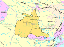
Unincorporated communities, localities and place names located partially or completely within the city include Estellville, Gibsons Landing, Head of River, Hunters Mill, Oakville, Old Etna Furnace, Russia, Steelmans Landing, Walkers Forge and Warners Mill.[21]
The city is one of 56 South Jersey municipalities that are included within the New Jersey Pinelands National Reserve, a protected natural area of unique ecology covering 1,100,000 acres (450,000 ha), that has been classified as a United States Biosphere Reserve and established by Congress in 1978 as the nation's first National Reserve.[22] All of the city is included either in the state-designated Pinelands area (which includes portions of Atlantic County, along with areas in Burlington, Camden, Cape May, Cumberland, Gloucester and Ocean counties) or in the Pinelands National Reserve.[23]
Demographics
| Historical population | |||
|---|---|---|---|
| Census | Pop. | %± | |
| 1930 | 423 | — | |
| 1940 | 406 | −4.0% | |
| 1950 | 381 | −6.2% | |
| 1960 | 496 | 30.2% | |
| 1970 | 539 | 8.7% | |
| 1980 | 848 | 57.3% | |
| 1990 | 1,404 | 65.6% | |
| 2000 | 1,585 | 12.9% | |
| 2010 | 1,735 | 9.5% | |
| Est. 2015 | 1,731 | [11][24] | −0.2% |
| Population sources: 1930-2000[25] 1930[26] 1930-1990[27] 2000[28][29] 2010[8][9][10] | |||
2010 Census
At the 2010 United States Census, there were 1,735 people, 619 households, and 487.8 families residing in the city. The population density was 32.5 per square mile (12.5/km2). There were 673 housing units at an average density of 12.6 per square mile (4.9/km2). The racial makeup of the city was 96.48% (1,674) White, 0.92% (16) Black or African American, 0.12% (2) Native American, 1.61% (28) Asian, 0.00% (0) Pacific Islander, 0.17% (3) from other races, and 0.69% (12) from two or more races. Hispanics or Latinos of any race were 1.04% (18) of the population.[8]
There were 619 households, of which 31.7% had children under the age of 18 living with them, 66.1% were married couples living together, 7.4% had a female householder with no husband present, and 21.2% were non-families. 16.2% of all households were made up of individuals, and 5.0% had someone living alone who was 65 years of age or older. The average household size was 2.79 and the average family size was 3.13.[8]
In the city, 23.9% of the population were under the age of 18, 7.9% from 18 to 24, 21.6% from 25 to 44, 35.6% from 45 to 64, and 11.1% who were 65 years of age or older. The median age was 43.4 years. For every 100 females there were 98.3 males. For every 100 females age 18 and over, there were 99.8 males.[8]
2000 Census
As of the 2000 United States Census[16] there were 1,585 people, 528 households, and 432 families residing in the city. The population density was 29.6 people per square mile (11.4/km2). There were 546 housing units at an average density of 10.2 per square mile (3.9/km2). The racial makeup of the city was 94.20% White, 3.60% African American, 0.44% Native American, 0.32% Asian, 0.13% from other races, and 1.32% from two or more races. Hispanic or Latino of any race were 0.95% of the population.[28][29]
There were 528 households out of which 41.1% had children under the age of 18 living with them, 71.0% were married couples living together, 7.4% had a female householder with no husband present, and 18.0% were non-families. 13.8% of all households were made up of individuals and 6.8% had someone living alone who was 65 years of age or older. The average household size was 2.95 and the average family size was 3.27.[28][29]
In the city the population was spread out with 30.2% under the age of 18, 6.5% from 18 to 24, 30.1% from 25 to 44, 23.6% from 45 to 64, and 9.7% who were 65 years of age or older. The median age was 37 years. For every 100 females there were 101.9 males. For every 100 females age 18 and over, there were 101.6 males.[28][29]
The median income for a household in the city was $54,653, and the median income for a family was $56,548. Males had a median income of $42,305 versus $29,219 for females. The per capita income for the city was $19,469. About 4.9% of families and 4.9% of the population were below the poverty line, including 4.9% of those under age 18 and 7.1% of those age 65 or over.[28][29]
Government
Local government
Estell Manor operates within the Faulkner Act (formally known as the Optional Municipal Charter Law) under the Faulkner Act (Small Municipality) form of New Jersey municipal government (Plan D), implemented by direct petition as of January 1, 1977.[30] The city is governed by a mayor and a four-member City Council. The mayor is directly elected to a four-year term of office and the city council members are elected at-large in partisan elections to serve three-year terms in office on a staggered basis with either one or two seats up for vote as part of the November general election in a three-year cycle.[3]
As of 2016, the Mayor of Estell Manor is Republican Stephen Teasenfitz, whose term of office ends December 31, 2017. Members of the City Council are Linda Givens (R, 2016), Kris Haeser (R, 2016) and Lawrence T. Hughes (R, 2017) and Joseph Venezia (I, 2018).[4][31][32][33][34][35]
Federal, state and county representation
Estell Manor is located in the 2nd Congressional District[36] and is part of New Jersey's 1st state legislative district.[9][37][38] Prior to the 2011 reapportionment following the 2010 Census, Estell Manor had been in the 2nd state legislative district.[39]
New Jersey's Second Congressional District is represented by Frank LoBiondo (R, Ventnor City).[40] New Jersey is represented in the United States Senate by Cory Booker (D, Newark, term ends 2021)[41] and Bob Menendez (D, Paramus, 2019).[42][43]
For the 2016–2017 session (Senate, General Assembly), the 1st Legislative District of the New Jersey Legislature is represented in the State Senate by Jeff Van Drew (D, Dennis Township) and in the General Assembly by Bob Andrzejczak (D, Middle Township) and R. Bruce Land (D, Vineland).[44] The Governor of New Jersey is Chris Christie (R, Mendham Township).[45] The Lieutenant Governor of New Jersey is Kim Guadagno (R, Monmouth Beach).[46]
Atlantic County is governed by a directly elected executive and a nine-member Board of Chosen Freeholders, responsible for legislation. The executive serves a four-year term and the freeholders are elected to staggered three-year terms, of which four are elected from the county on an at-large basis and five of the freeholders represent equally populated districts.[47][48] As of 2015, Atlantic County's Executive is Republican Dennis Levinson, whose term of office ends December 31, 2015.[49] Members of the Board of Chosen Freeholders are Chairman Frank D. Formica, Freeholder District 2, including Atlantic City (part), Egg Harbor Township (part), Linwood, Longport, Margate, Northfield, Somers Point and Ventnor (R, 2015),[50] Vice Chairman James A. Bertino, Freeholder District 5, including Buena Borough, Buena Vista Township, Corbin City, Egg Harbor City, Estell Manor, Folsom, Hamilton Township (part), Hammonton, Mullica Township and Weymouth (R, 2015),[51] Colin G. Bell, Freeholder At-Large (R, 2015),[52] John Carman, Freeholder District 3, including Egg Harbor Township (part) and Hamilton Township (part) (R, 2017),[53] Ernest D. Coursey, Freeholder District 1, including Atlantic City (part), Egg Harbor Township (part) and Pleasantville (R, 2016),[54] Richard Dase, Freeholder District 4, including Absecon, Brigantine, Galloway Township and Port Republic (D, 2016),[55] Alexander C. Marino, Freeholder At-Large (R, 2017),[56] Will Pauls, Freeholder At-Large (R, 2016)[57] and John W. Risley, Freeholder At-Large (R, 2017).[58][59][60] Constitutional officers are County Clerk Edward P. McGettigan (2016),[61] Sheriff Frank X. Balles (R, 2017)[62] and Surrogate James Curcio (2015).[63][64]
Politics
As of March 23, 2011, there were a total of 1,209 registered voters in Estell Manor, of which 269 (22.2% vs. 30.5% countywide) were registered as Democrats, 388 (32.1% vs. 25.2%) were registered as Republicans and 552 (45.7% vs. 44.3%) were registered as Unaffiliated. There were no voters registered to other parties.[65] Among the city's 2010 Census population, 69.7% (vs. 58.8% in Atlantic County) were registered to vote, including 91.5% of those ages 18 and over (vs. 76.6% countywide).[65][66]
In the 2012 presidential election, Republican Mitt Romney received 525 votes in the city (57.4% vs. 41.1% countywide), ahead of Democrat Barack Obama with 368 votes (40.2% vs. 57.9%) and other candidates with 7 votes (0.8% vs. 0.9%), among the 915 ballots cast by the city's 1,249 registered voters, for a turnout of 73.3% (vs. 65.8% in Atlantic County).[67][68] In the 2008 presidential election, Republican John McCain received 581 votes (59.3% vs. 41.6% countywide), ahead of Democrat Barack Obama with 385 votes (39.3% vs. 56.5%) and other candidates with 5 votes (0.5% vs. 1.1%), among the 980 ballots cast by the city's 1,302 registered voters, for a turnout of 75.3% (vs. 68.1% in Atlantic County).[69] In the 2004 presidential election, Republican George W. Bush received 556 votes in Estell Manor (58.8% vs. 46.2% countywide), ahead of Democrat John Kerry with 373 votes (39.5% vs. 52.0%) and other candidates with 9 votes (1.0% vs. 0.8%), among the 945 ballots cast by the city's 1,210 registered voters, for a turnout of 78.1% (vs. 69.8% in the whole county).[70]
In the 2013 gubernatorial election, Republican Chris Christie received 560 votes in the city (71.3% vs. 60.0% countywide), ahead of Democrat Barbara Buono with 182 votes (23.2% vs. 34.9%) and other candidates with 10 votes (1.3% vs. 1.3%), among the 785 ballots cast by the city's 1,281 registered voters, yielding a 61.3% turnout (vs. 41.5% in the county).[71][72] In the 2009 gubernatorial election, Republican Chris Christie received 451 votes (54.9% vs. 47.7% countywide), ahead of Democrat Jon Corzine with 264 votes (32.2% vs. 44.5%), Independent Chris Daggett with 51 votes (6.2% vs. 4.8%) and other candidates with 23 votes (2.8% vs. 1.2%), among the 821 ballots cast by the city's 1,252 registered voters, yielding a 65.6% turnout (vs. 44.9% in the county).[73]
Education
Public school students in Kindergarten through eighth grade attend the Estell Manor School District at Estell Manor Elementary School.As of the 2012-13 school year, the district's one school had an enrollment of 187 students and 13.9 classroom teachers (on an FTE basis), for a student–teacher ratio of 13.45:1.[74]
For ninth through twelfth grades, public school students attend Buena Regional High School, which serves students from Buena Borough and Buena Vista Township, together with students from Estell Manor City Newfield and Weymouth Township who attend the school as part of sending/receiving relationships with the Buena Regional School District.[75][76]
City public school students are also eligible to attend the Atlantic County Institute of Technology[77] or the Charter-Tech High School for the Performing Arts, located in Somers Point.[78]
Transportation
Roads and highways
As of May 2010, the city had a total of 56.55 miles (91.01 km) of roadways, of which 26.07 miles (41.96 km) were maintained by the municipality, 19.97 miles (32.14 km) by Atlantic County and 10.51 miles (16.91 km) by the New Jersey Department of Transportation.[79]
Route 49 and Route 50 both pass through Estell Manor, as do County Route 557, County Route 649 and County Route 666.
Public transportation
New Jersey Transit provides bus service on the 315 route that runs between Cape May and Philadelphia.[80][81]
References
- 1 2 3 4 5 6 2010 Census Gazetteer Files: New Jersey County Subdivisions, United States Census Bureau. Accessed May 21, 2015.
- 1 2 US Gazetteer files: 2010, 2000, and 1990, United States Census Bureau. Accessed September 4, 2014.
- 1 2 2012 New Jersey Legislative District Data Book, Rutgers University Edward J. Bloustein School of Planning and Public Policy, March 2013, p. 13.
- 1 2 Mayor and Council, City of Estell Manor. Accessed June 14, 2016.
- ↑ 2016 New Jersey Mayors Directory, New Jersey Department of Community Affairs. Accessed June 14, 2016.
- ↑ Contact Us, Estell Manor, New Jersey. Accessed July 10, 2013.
- ↑ U.S. Geological Survey Geographic Names Information System: City of Estell Manor, Geographic Names Information System. Accessed March 5, 2013.
- 1 2 3 4 5 6 DP-1 - Profile of General Population and Housing Characteristics: 2010 Demographic Profile Data for Estell Manor city, New Jersey, United States Census Bureau. Accessed May 15, 2012.
- 1 2 3 4 Municipalities Grouped by 2011-2020 Legislative Districts, New Jersey Department of State, p. 1. Accessed January 6, 2013.
- 1 2 3 Profile of General Demographic Characteristics: 2010 for Estell Manor city, New Jersey Department of Labor and Workforce Development. Accessed May 15, 2012.
- 1 2 PEPANNRES - Annual Estimates of the Resident Population: April 1, 2010 to July 1, 2015 - 2015 Population Estimates for New Jersey municipalities, United States Census Bureau. Accessed May 22, 2016.
- 1 2 GCT-PH1 Population, Housing Units, Area, and Density: 2010 - State -- County Subdivision from the 2010 Census Summary File 1 for New Jersey, United States Census Bureau. Accessed July 10, 2013.
- ↑ Look Up a ZIP Code for Estell Manor, NJ, United States Postal Service. Accessed May 15, 2012.
- ↑ Zip Codes, State of New Jersey. Accessed November 17, 2013.
- ↑ Area Code Lookup - NPA NXX for Estell Manor, NJ, Area-Codes.com. Accessed November 17, 2013.
- 1 2 American FactFinder, United States Census Bureau. Accessed September 4, 2014.
- ↑ A Cure for the Common Codes: New Jersey, Missouri Census Data Center. Accessed May 15, 2012.
- ↑ US Board on Geographic Names, United States Geological Survey. Accessed September 4, 2014.
- ↑ Table 7. Population for the Counties and Municipalities in New Jersey: 1990, 2000 and 2010, New Jersey Department of Labor and Workforce Development, February 2011. Accessed July 10, 2013.
- ↑ Snyder, John P. The Story of New Jersey's Civil Boundaries: 1606-1968, Bureau of Geology and Topography; Trenton, New Jersey; 1969. p. 69. Accessed May 15, 2012.
- ↑ Locality Search, State of New Jersey. Accessed May 21, 2015.
- ↑ The Pinelands National Reserve, New Jersey Pinelands Commission. Accessed November 18, 2013.
- ↑ Pinelands Municipalities, New Jersey Pinelands Commission, April 2003. Accessed November 18, 2013.
- ↑ Census Estimates for New Jersey April 1, 2010 to July 1, 2015, United States Census Bureau. Accessed May 22, 2016.
- ↑ Barnett, Bob. Population Data for Atlantic County Municipalities, 1840 - 2000, WestJersey.org. December 6, 2010. Accessed November 17, 2013.
- ↑ Fifteenth Census of the United States : 1930 - Population Volume I, United States Census Bureau, p. 714. Accessed May 15, 2012.
- ↑ New Jersey Resident Population by Municipality: 1930 - 1990, Workforce New Jersey Public Information Network. Accessed June 28, 2015.
- 1 2 3 4 5 Census 2000 Profiles of Demographic / Social / Economic / Housing Characteristics for Estell Manor city, New Jersey, United States Census Bureau. Accessed July 10, 2013.
- 1 2 3 4 5 DP-1: Profile of General Demographic Characteristics: 2000 - Census 2000 Summary File 1 (SF 1) 100-Percent Data for Estell Manor city, Atlantic County, New Jersey, United States Census Bureau. Accessed July 10, 2013.
- ↑ "The Faulkner Act: New Jersey's Optional Municipal Charter Law", New Jersey State League of Municipalities, July 2007. Accessed November 17, 2013.
- ↑ 2016 Municipal User Friendly Budget, City of Estell Manor. Accessed June 14, 2016.
- ↑ Municipal Governments in Atlantic County, Atlantic County, New Jersey, updated June 2, 2016. Accessed June 14, 2016.
- ↑ General Election November 3, 2015 Official Results, Atlantic County, New Jersey Clerk. Accessed June 14, 2016.
- ↑ General Election Results - November 4, 2014 Official Results, Atlantic County, New Jersey Clerk. Accessed June 14, 2016.
- ↑ General Election November 5, 2013 Official Results, Atlantic County, New Jersey Clerk. Accessed June 14, 2016.
- ↑ Plan Components Report, New Jersey Redistricting Commission, December 23, 2011. Accessed January 6, 2013.
- ↑ 2016 New Jersey Citizen's Guide to Government, p. 57, New Jersey League of Women Voters. Accessed July 20, 2016.
- ↑ Districts by Number for 2011-2020, New Jersey Legislature. Accessed January 6, 2013.
- ↑ 2011 New Jersey Citizen's Guide to Government, p. 57, New Jersey League of Women Voters. Accessed May 22, 2015.
- ↑ Directory of Representatives: New Jersey, United States House of Representatives. Accessed January 5, 2012.
- ↑ About Cory Booker, United States Senate. Accessed January 26, 2015. "He now owns a home and lives in Newark's Central Ward community."
- ↑ Biography of Bob Menendez, United States Senate, January 26, 2015. "He currently lives in Paramus and has two children, Alicia and Robert."
- ↑ Senators of the 114th Congress from New Jersey. United States Senate. Accessed January 26, 2015. "Booker, Cory A. - (D - NJ) Class II; Menendez, Robert - (D - NJ) Class I"
- ↑ Legislative Roster 2016-2017 Session, New Jersey Legislature. Accessed January 17, 2016.
- ↑ "About the Governor". State of New Jersey. Retrieved 2010-01-21.
- ↑ "About the Lieutenant Governor". State of New Jersey. Retrieved 2010-01-21.
- ↑ 2013 Atlantic County District Map, Atlantic County, New Jersey. Accessed March 7, 2015.
- ↑ Board of Chosen Freeholders, Atlantic County, New Jersey. Accessed March 7, 2015.
- ↑ County Executive, Atlantic County, New Jersey. Accessed March 7, 2015.
- ↑ Frank D. Formica, Atlantic County, New Jersey. Accessed March 7, 2015.
- ↑ James A. Bertino, Atlantic County, New Jersey. Accessed March 7, 2015.
- ↑ Colin G. Bell, Atlantic County, New Jersey. Accessed March 7, 2015.
- ↑ John Carman, Atlantic County, New Jersey. Accessed March 7, 2015.
- ↑ Ernest D. Coursey, Atlantic County, New Jersey. Accessed March 7, 2015.
- ↑ Richard Dase, Atlantic County, New Jersey. Accessed March 7, 2015.
- ↑ Alexander C. Marino, Atlantic County, New Jersey. Accessed March 7, 2015.
- ↑ Will Pauls, Atlantic County, New Jersey. Accessed March 7, 2015.
- ↑ John W. Risley, Atlantic County, New Jersey. Accessed March 7, 2015.
- ↑ Atlantic County Board of Chosen Freeholders, Atlantic County, New Jersey. Accessed March 7, 2015.
- ↑ 2014 Atlantic County Board of Chosen Freeholders, Atlantic County, New Jersey. Accessed March 7, 2015.
- ↑ Ed McGettigan, Atlantic County Clerk. Accessed March 7, 2015.
- ↑ Frank X. Balles, Sheriff, Atlantic County Sheriff's Office. Accessed March 7, 2015.
- ↑ Atlantic County Surrogate's Court, Atlantic County, New Jersey. Accessed March 7, 2015.
- ↑ Constitutional Officers, Atlantic County, New Jersey. Accessed March 7, 2015.
- 1 2 Voter Registration Summary - Atlantic, New Jersey Department of State Division of Elections, March 23, 2011. Accessed December 24, 2014.
- ↑ GCT-P7: Selected Age Groups: 2010 - State -- County Subdivision; 2010 Census Summary File 1 for New Jersey, United States Census Bureau. Accessed December 24, 2014.
- ↑ Presidential November 6, 2012 General Election Results - Atlantic County, New Jersey Department of State Division of Elections, March 15, 2013. Accessed December 24, 2014.
- ↑ Number of Registered Voters and Ballots Cast November 6, 2012 General Election Results - Atlantic County, New Jersey Department of State Division of Elections, March 15, 2013. Accessed December 24, 2014.
- ↑ 2008 Presidential General Election Results: Atlantic County, New Jersey Department of State Division of Elections, December 23, 2008. Accessed December 24, 2014.
- ↑ 2004 Presidential Election: Atlantic County, New Jersey Department of State Division of Elections, December 13, 2004. Accessed December 24, 2014.
- ↑ 2013 Governor: Atlantic County, New Jersey Department of State Division of Elections, January 29, 2014. Accessed December 24, 2014.
- ↑ Number of Registered Voters and Ballots Cast November 5, 2013 General Election Results : Atlantic County, New Jersey Department of State Division of Elections, January 29, 2014. Accessed December 24, 2014.
- ↑ 2009 Governor: Atlantic County, New Jersey Department of State Division of Elections, December 31, 2009. Accessed December 24, 2014.
- ↑ District information for Estell Manor School District, National Center for Education Statistics. Accessed February 17, 2015.
- ↑ About Us, Buena Regional School District. Accessed November 17, 2013. "The Buena Regional School District is proud to provide educational and supportive services to students from preschool through grades twelve. The district is comprised of four elementary schools, one middle school and one high school. Students from Weymouth and Estell Manor join students from Buena Vista Township, Buena Borough, and Newfield at the high school."
- ↑ Buena Regional School District 2014 Report Card Narrative, New Jersey Department of Education. Accessed June 14, 2016. "The Buena Regional Schools offer a Pre-K through Grade 12 learning opportunity for the children of the Buena Vista Township and the Buena Borough communities as well as grade 9 through 12 experiences for the students of Estell Manor and Weymouth Townships."
- ↑ Mission, Atlantic County Institute of Technology. Accessed November 17, 2013.
- ↑ Profile, Charter-Tech High School for the Performing Arts. Accessed November 17, 2013.
- ↑ Atlantic County Mileage by Municipality and Jurisdiction, New Jersey Department of Transportation, May 2010. Accessed November 17, 2013.
- ↑ Atlantic County Bus / Rail Connections, New Jersey Transit, backed up by the Internet Archive as of May 22, 2009. Accessed November 17, 2013.
- ↑ South Jersey Transit Guide, Cross County Connection, as of April 1, 2010. Accessed November 17, 2013.
External links
- Estell Manor municipal website
- Estell Manor School
- Estell Manor School's 2014–15 School Report Card from the New Jersey Department of Education
- School Data for the Estell Manor School, National Center for Education Statistics
- Buena Regional High School
Municipalities and communities of Atlantic County, New Jersey, United States | ||
|---|---|---|
| Cities |  | |
| Boroughs | ||
| Town | ||
| Townships | ||
| CDPs | ||
| Other unincorporated communities | ||