Gloucester County, New Jersey
| Gloucester County, New Jersey | |||
|---|---|---|---|
|
| |||
| |||
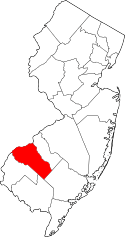 Location in the U.S. state of New Jersey | |||
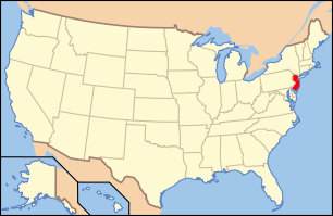 New Jersey's location in the U.S. | |||
| Founded | 1686 | ||
| Named for | Gloucester / Gloucestershire, U.K. | ||
| Seat | Woodbury[1] | ||
| Largest city |
Washington Township (population) Franklin Township (area) | ||
| Area | |||
| • Total | 337.18 sq mi (873 km2) | ||
| • Land | 322.00 sq mi (834 km2) | ||
| • Water | 15.17 sq mi (39 km2), 4.50% | ||
| Population | |||
| • (2010) |
288,288[2] 291,479 (2015 est.)[3] | ||
| • Density | 905/sq mi (349.5/km²) | ||
| Congressional districts | 1st, 2nd | ||
| Website |
www | ||


Gloucester County is a county located in the U.S. state of New Jersey. As of 2015, Gloucester County's Census-estimated population was 291,479, an increase of 1.1% from the 2010 United States Census, when its population was enumerated at 288,288,[3] in turn an increase of 33,615 (+13.2%) from the 254,673 counted in the 2000 U.S. Census,[4] retaining its position as the state's 14th-most populous county. The percentage increase in the county's population between 2000 and 2010 was the largest in New Jersey, almost triple the statewide increase of 4.5%, and the absolute increase in residents was the third highest.[5][6] Its county seat is Woodbury.[1][7]
Gloucester County is located south of Philadelphia and northwest of Atlantic City. It is part of the Camden, New Jersey Metropolitan Division of the Philadelphia-Camden-Wilmington Primary Metropolitan Statistical Area[8] as well as the Delaware Valley Combined Statistical Area.[9]
Geography
According to the 2010 Census, the county had a total area of 337.18 square miles (873.3 km2), including 322.00 square miles (834.0 km2) of land (95.5%) and 15.17 square miles (39.3 km2) of water (4.5%).[10]
Gloucester County is largely composed of low-lying rivers and coastal plains. The highest elevation in the county is a slight rise along County Route 654 southeast of Cross Keys that reaches approximately 180 feet (55 m) above sea level;[11] the lowest point is at sea level on the Delaware River.
Adjacent counties
- Philadelphia County, Pennsylvania – north
- Camden County, New Jersey – northeast
- Atlantic County, New Jersey – southeast
- Cumberland County, New Jersey – south
- Salem County, New Jersey – southwest
- New Castle County, Delaware – west
- Delaware County, Pennsylvania – northwest
National protected area
History

Swedesboro and Bridgeport were the among the earliest European settlements in New Jersey as a part of the 17th century New Sweden colony. Gloucester dates back to May 26, 1686, when courts were established separate from those of Burlington. It was officially formed and its boundaries defined as part of West Jersey on May 17, 1694. Portions of Gloucester County were set off on February 7, 1837, to create Atlantic County, and on March 13, 1844 to create Camden County.[12] The county was named for the city of Gloucester / county of Gloucestershire in England.[13]
Woodbury, founded in 1683 by Henry Wood, is the oldest municipality in the county.[14] National Park, another town in the county, was the site of the Revolutionary War Battle of Red Bank where Fort Mercer once stood. It is now the site of Red Bank Battlefield Park and the remains of the HMS Augusta laid there until they were moved and subsequently re sunk in Gloucester City on their way to Philadelphia. During the colonial era, Gloucester County's main economic activity was agriculture. Woodbury was the site of the county courthouse, the county jail, a Quaker meeting house (still in existence), and an inn (on the current location of Woodbury Crossings). Because of the county's many creeks leading to the Delaware River and the Atlantic Ocean, smuggling was very common.
In 2014, the county heroin death rate was 17.3 deaths per 100,000 people in 2014 — nearly seven times the national average.[15]
Demographics
| Historical population | |||
|---|---|---|---|
| Census | Pop. | %± | |
| 1790 | 13,363 | — | |
| 1800 | 16,115 | 20.6% | |
| 1810 | 19,744 | 22.5% | |
| 1820 | 23,089 | 16.9% | |
| 1830 | 28,431 | 23.1% | |
| 1840 | 25,438 | * | −10.5% |
| 1850 | 14,655 | * | −42.4% |
| 1860 | 18,444 | 25.9% | |
| 1870 | 21,562 | 16.9% | |
| 1880 | 25,886 | 20.1% | |
| 1890 | 28,649 | 10.7% | |
| 1900 | 31,905 | 11.4% | |
| 1910 | 37,368 | 17.1% | |
| 1920 | 48,224 | 29.1% | |
| 1930 | 70,802 | 46.8% | |
| 1940 | 72,219 | 2.0% | |
| 1950 | 91,727 | 27.0% | |
| 1960 | 134,840 | 47.0% | |
| 1970 | 172,681 | 28.1% | |
| 1980 | 199,917 | 15.8% | |
| 1990 | 230,082 | 15.1% | |
| 2000 | 254,673 | 10.7% | |
| 2010 | 288,288 | 13.2% | |
| Est. 2015 | 291,479 | [3][16] | 1.1% |
| Historical sources: 1790–1990[17] 1970–2010[6] 2000[4] 2010[2] * = Lost territory in previous decade.[12] | |||
Census 2010
At the 2010 United States Census, there were 288,288 people, 104,271 households, and 75,805 families residing in the county. The population density was 895.3 per square mile (345.7/km2). There were 109,796 housing units at an average density of 341 per square mile (132/km2). The racial makeup of the county was 83.56% (240,890) White, 10.06% (29,006) Black or African American, 0.17% (501) Native American, 2.64% (7,609) Asian, 0.03% (95) Pacific Islander, 1.41% (4,055) from other races, and 2.13% (6,132) from two or more races. Hispanics or Latinos of any race were 4.76% (13,712) of the population.[2]
There were 104,271 households, of which 33.4% had children under the age of 18 living with them, 55.6% were married couples living together, 12.4% had a female householder with no husband present, and 27.3% were non-families. 22% of all households were made up of individuals, and 8.9% had someone living alone who was 65 years of age or older. The average household size was 2.72 and the average family size was 3.2.[2]
In the county, 24.4% of the population were under the age of 18, 9.4% from 18 to 24, 25.6% from 25 to 44, 28.3% from 45 to 64, and 12.4% who were 65 years of age or older. The median age was 38.7 years. For every 100 females there were 94.4 males. For every 100 females age 18 and over, there were 91.1 males.[2]
Census 2000
As of the 2000 United States Census[18] there were 254,673 people, 90,717 households, and 67,221 families residing in the county. The population density was 784 people per square mile (303/km²). There were 95,054 housing units at an average density of 293 per square mile (113/km²). The racial makeup of the county was 87.07% White, 9.06% Black or African American, 0.19% Native American, 1.49% Asian, 0.03% Pacific Islander, 0.85% from other races, and 1.30% from two or more races. 2.58% of the population were Hispanic or Latino of any race.[4][19] Among those residents listing their ancestry, 26.9% were of Italian, 24.4% Irish, 22.9% German and 11.5% English ancestry according to Census 2000.[19][20]
There were 90,717 households out of which 36.7% had children under the age of 18 living with them, 58.3% were married couples living together, 11.6% had a female householder with no husband present, and 25.9% were non-families. 25.9% of all households were made up of individuals and 23.3% had someone living alone who was 65 years of age or older. The average household size was 2.75 and the average family size was 3.22.[4]
In the county the population was spread out with 26.40% under the age of 18, 8.90% from 18 to 24, 30.40% from 25 to 44, 22.60% from 45 to 64, and 11.70% who were 65 years of age or older. The median age was 36 years. For every 100 females there were 93.70 males. For every 100 females age 18 and over, there were 90.20 males.[4]
The median income for a household in the county was $54,273, and the median income for a family was $62,482. Males had a median income of $43,825 versus $31,077 for females. The per capita income for the county was $22,708. About 4.3% of families and 6.2% of the population were below the poverty line, including 6.6% of those under age 18 and 7.0% of those age 65 or over.[19][21]
Government
Gloucester County is governed by a Board of Chosen Freeholders consisting of seven members. Freeholders are elected at large by the voters of Gloucester County in partisan elections and serve three-year terms of office on a staggered basis, with two or three seats coming up for election each year. At a reorganization meeting held each January, the Board selects a Freeholder Director and a Deputy Freeholder Director from among its members. Gloucester County's Freeholders are:[22][23][24][25][26]
- Freeholder Director Robert M. Damminger (D, West Deptford Township; term ends December 31, 2015)[27]
- Deputy Freeholder Director Giuseppe "Joe" Chila (D, Woolwich Township; 2015)[28]
- Lyman J. Barnes (D, Logan Township; 2017)[25][29]
- Daniel Christy (D, Washington Township; 2016)[26][30]
- Frank J. DiMarco (D, Deptford Township; 2016)[26][31]
- Jim Jefferson (D, Woodbury; 2015)[25][32]
- Heather Simmons (D, Glassboro; 2017)[33]
| Year | Republican | Democratic |
|---|---|---|
| 2016 | 47.8% 66,949 | 47.4% 66,355 |
| 2012 | 43.9% 59,456 | 54.6% 74,013 |
| 2008 | 43.1% 60,315 | 55.2% 77,267 |
| 2004 | 46.9% 60,033 | 52.2% 66,835 |
| 2000 | 39.4% 42,315 | 56.9% 61,095 |
| 1996 | 32.0% 32,116 | 51.7% 51,915 |
| 1992 | 35.7% 37,335 | 40.6% 42,425 |
| 1988 | 58.7% 51,708 | 40.3% 35,479 |
| 1984 | 62.1% 54,041 | 37.6% 32,702 |
| 1980 | 51.1% 40,306 | 37.8% 29,804 |
| 1976 | 46.3% 34,888 | 51.4% 38,726 |
| 1972 | 62.9% 44,806 | 35.8% 25,509 |
| 1968 | 44.5% 30,596 | 39.9% 27,438 |
| 1964 | 37.0% 23,702 | 62.9% 40,305 |
| 1960 | 52.2% 32,474 | 47.8% 29,752 |
Gloucester County's constitutional officers are County Clerk James N. Hogan, County Surrogate Helene M. Reed and County Sheriff Carmel Morina.[35]
Cumberland County is a part of Vicinage 15 of the New Jersey Superior Court (along with Cumberland County and Salem County), which is seated at the Gloucester County Courthouse in Woodbury; the Assignment Judge for Vicinage 15 is the Honorable Georgia M. Curio.[36][37]
Gloucester County is included in the 1st and 2nd Congressional Districts.[38][39] New Jersey's First Congressional District is represented by Donald Norcross (D, Camden).[40] New Jersey's Second Congressional District is represented by Frank LoBiondo (R, Ventnor City).[41]
The county is part of the 3rd, 4th and 5th Districts in the New Jersey Legislature.[42] For the 2016–2017 session (Senate, General Assembly), the 3rd Legislative District of the New Jersey Legislature is represented in the State Senate by Stephen M. Sweeney (D, West Deptford Township) and in the General Assembly by John J. Burzichelli (D, Paulsboro) and Adam Taliaferro (D, Woolwich Township).[43] For the 2016–2017 session (Senate, General Assembly), the 4th Legislative District of the New Jersey Legislature is represented in the State Senate by Fred H. Madden (D, Washington Township, Gloucester County) and in the General Assembly by Paul Moriarty (D, Washington Township, Gloucester County) and Gabriela Mosquera (D, Gloucester Township).[44] For the 2016–2017 session (Senate, General Assembly), the 5th Legislative District of the New Jersey Legislature is represented in the State Senate by Nilsa Cruz-Perez (D, Barrington) and in the General Assembly by Arthur Barclay (D, Camden) and Patricia Egan Jones (D, Barrington).[45]
Politics
The county leans toward the Democratic Party, though to a slightly lesser degree than the state of New Jersey as a whole. In the 2004 U.S. Presidential election, John Kerry carried Gloucester County by a 5.3% margin over George W. Bush, while Kerry carried the state by 6.7% over Bush.[46]
In the 2008 U.S. Presidential election, Barack Obama carried Gloucester County by a 12.2% margin over John McCain, while Obama carried the state by 15.5% over McCain.[47] However, in the 2009 Gubernatorial Election, Republican Chris Christie received 47% of the vote, defeating Democrat Jon Corzine, who received around 43%.
Transportation
Roads and highways
As of 2010, the county had a total of 1,698.59 miles (2,733.62 km) of roadways, of which 1,126.99 miles (1,813.71 km) were maintained by the local municipality, 406.47 miles (654.15 km) by Gloucester County and 145.11 miles (233.53 km) by the New Jersey Department of Transportation and 20.02 miles (32.22 km) by the New Jersey Turnpike Authority.[48]
Various county, state, U.S. routes and interstates pass through the county. Major county highways include County Road 534, County Road 536, County Road 538, County Road 544, County Road 551, County Road 553, County Road 555 and County Road 557.
State Routes include Route 41, Route 42 (part of the North-South Freeway), Route 45, Route 47, Route 55, Route 77, Route 168 and Route 324 (only in Logan). The three U.S. routes that traverse include U.S. Route 130 in the northwest, U.S. Route 322 near the center, and U.S. Route 40 in the southern tip.
Interstate 295 is the only interstate in the county which also runs through the northwest for about 14 miles. The New Jersey Turnpike also passes through in the northwest. Only one turnpike interchange is located within Gloucester: Exit 2 in Woolwich.
Public transportation
The Glassboro–Camden Line is a proposed 18-mile (28.97 km) diesel multiple unit (DMU) light rail system planned to connect with the River LINE and PATCO Speedline in Camden and expected to be in operation in 2019.[49][50]
Located within the Conrail South Jersey/Philadelphia Shared Assets Area.[51] freight rail in the county travels along Penns Grove Secondary, the Salem Branch, and the Vineland Secondary. SMS Rail Lines handles interchanges with CSX Transportation and Norfolk Southern Railway.
Port
The Port of Paulsboro is located on the Delaware River and Mantua Creek in and around Paulsboro. Traditionally one of the nation's busiest for marine transfer operations of petroleum products, the port is being redeveloped as an adaptable omniport able to handle bulk, break bulk cargo and shipping containers. Studies completed in 2012[52][53] concluded that the port is well suited to become a center for the manufacture, assembly, and transport of wind turbines and platforms the development of wind power in New Jersey[54][55][56][57][58][59]
Municipalities

The following municipalities are located in Gloucester County. The municipality type is listed in parentheses after the name, except where the type is included as part of the name. Census-designated places and other unincorporated communities are listed under their municipalities.
- Clayton (borough)
- Deptford Township
- Westville Grove
- Blackwood Terrace
- Oak Valley
- Almonesson
- Jericho
- Salina
- Good Intent
- Gardenville Center
- East Greenwich Township
- Mount Royal
- Mickleton
- Wolfert
- Tomlin
- Elk Township
- Franklin Township
- Franklinville
- Fries Mill
- Star Cross
- Janvier
- Porchtown
- Plainville
- Malaga
- Forest Grove
- Glassboro (borough)
- Greenwich Township
- Harrison Township
- Mullica Hill
- Richwood
- Ewan
- Wrights Mill
- Logan Township
- Beckett
- Bridgeport
- Center Square
- Nortonville
- Repaupo
- Mantua Township
- Monroe Township
- Victory Lakes
- Williamstown
- Cross Keys
- New Brooklyn
- Broad Lane
- Cecil
- National Park (borough)
- Newfield (borough)
- Paulsboro (borough)
- Pitman (borough)
- South Harrison Township
- Swedesboro (borough)
- Washington Township
- Wenonah (borough)
- West Deptford Township
- Colonial Manor
- Greenfields Village
- Mantua Grove
- Red Bank
- Thorofare
- Verga
- Westville (borough)
- Woodbury (city)
- Woodbury Heights (borough)
- Woolwich Township
- Asbury
- Sandy Hill
- Grand Sprute
- Porches Mill
Emergency services
Gloucester County is home to the first county based EMS agency in New Jersey providing services to the municipalities of Logan, Woolwich, Swedesboro, East Greenwich, Gibbstown, Paulsboro, West Deptford, National Park, Mantua, Pitman, Glassboro, Clayton, Woodbury, South Harrison and Wenonah. GCEMS was started in September 2007; its goal is to provide emergency medical services to the residents of the county within nine minutes from the time of dispatch 90% of the time (considered to be the gold standard in EMS). Currently GCEMS has 10 ambulances in service around the clock and two "power shift" ambulances on duty from the hours of 8AM to 9PM seven days a week. The department operates out of 11 stations spread strategically throughout the county. The Gloucester County EMS administrative offices are located at the county's Emergency Response Center at 1200 N. Delsea Drive, Clayton, New Jersey 08312.[60] It was the winner of the 2010 Outstanding Public EMS Agency by the State of New Jersey.[61]
Gloucester County SWAT is a multi-jurisdictional team, composed of police officers from departments within the county. Officers are on-call 24/7 for emergency situations such as barricaded subjects, suicidal subjects and hostage rescue. They also provide high-risk warrant service, dignitary protection and counter-terrorism response.[62]
Education
Unified school districts
School districts in the county include the Gloucester County Vocational-Technical School District, with its one school being the Gloucester County Institute of Technology, which operates as a four-year vocational-technical high school that serves students from across the county.[63]
Colleges and universities
Rowan University in Glassboro, is a public university that was founded in 1923 as Glassboro Normal School on a 25-acre (10 ha) site donated by the borough.[64] After a series of alternative titles over the years, in 1992 the school was renamed Rowan College of New Jersey after Henry Rowan and his wife Betty gave the school $100 million, at the time the largest gift to a public college.[65] It became Rowan University on March 21, 1997, when it won approval for university status from the New Jersey Commission on Higher Education.[66] The Cold War Glassboro Summit Conference between U.S. President Lyndon Johnson and Soviet Premier Alexei Kosygin took place from June 23–25, 1967, in Hollybush Mansion. The site was chosen because of its location equidistant between New York City, where Kosygin was making a speech at the U.N., and Washington, D.C.[67]
The county college is Rowan College at Gloucester County, having been established in 1966 as Gloucester County College and first opening to students two years later.[68]
Wineries
- Cedarvale Winery
- Coda Rossa Winery
- DiBella Winery
- Heritage Vineyards
- Summit City Winery
- Wagonhouse Winery
Notable people
- Seymour W. Duncan, is an American guitarist and guitar repairman and a co-founder of the Seymour Duncan Company(Paulsboro)
- Linda Fiorentino, actress (Mantua Township).
- Grace Helbig, comedian, actress, author, talk show host, and YouTube personality (Woodbury/Woodbury Heights).
- Michael Johns, health care executive, former White House speechwriter, conservative policy analyst and writer (Deptford).[69]
- Tara Lipinski, Olympic gold medal winner, figure skating (Mantua Township).
- Bryant McKinnie, professional football player, Minnesota Vikings (Woodbury).
- J. Hampton Moore, former Mayor of Philadelphia (Woodbury).
- Milt Plum, former professional football player, Cleveland Browns, Detroit Lions, Los Angeles Rams and New York Giants (Westville).
- Jimmy Rollins, professional baseball player, Philadelphia Phillies (Woolwich Township).
- Patti Smith, punk rock musician (Woodbury).
- Steven Squyres, scientist, Squyres is the Goldwin Smith Professor of Astronomy at Cornell University in Ithaca, New York. He is principal investigator of the Mars Exploration Rover Mission (MER) (Wenonah).
- Charles C. Stratton, former Member of Congress (Swedesboro).
Climate and weather
| Woodbury, New Jersey | ||||||||||||||||||||||||||||||||||||||||||||||||||||||||||||
|---|---|---|---|---|---|---|---|---|---|---|---|---|---|---|---|---|---|---|---|---|---|---|---|---|---|---|---|---|---|---|---|---|---|---|---|---|---|---|---|---|---|---|---|---|---|---|---|---|---|---|---|---|---|---|---|---|---|---|---|---|
| Climate chart (explanation) | ||||||||||||||||||||||||||||||||||||||||||||||||||||||||||||
| ||||||||||||||||||||||||||||||||||||||||||||||||||||||||||||
| ||||||||||||||||||||||||||||||||||||||||||||||||||||||||||||
In recent years, average temperatures in the county seat of Woodbury have ranged from a low of 26 °F (−3 °C) in January to a high of 87 °F (31 °C) in July, although a record low of −11 °F (−24 °C) was recorded in February 1934 and a record high of 106 °F (41 °C) was recorded in August 1918. Average monthly precipitation ranged from 2.75 inches (70 mm) in February to 4.35 inches (110 mm) in July.[70]
See also
References
- 1 2 Gloucester County, NJ, National Association of Counties. Accessed January 20, 2013.
- 1 2 3 4 5 DP1 – Profile of General Population and Housing Characteristics: 2010 Demographic Profile Data for Gloucester County, New Jersey, United States Census Bureau. Accessed March 26, 2016.
- 1 2 3 State & County QuickFacts – Gloucester County, New Jersey, United States Census Bureau. Accessed July 3, 2016.
- 1 2 3 4 5 DP-1 – Profile of General Demographic Characteristics: 2000; Census 2000 Summary File 1 (SF 1) 100-Percent Data for Gloucester County, New Jersey, United States Census Bureau. Accessed September 30, 2013.
- ↑ NJ Labor Market Views, New Jersey Department of Labor and Workforce Development, March 15, 2011. Accessed October 4, 2013.
- 1 2 New Jersey: 2010 - Population and Housing Unit Counts; 2010 Census of Population and Housing, p. 6, CPH-2-32. United States Census Bureau, August 2012. Accessed August 29, 2016.
- ↑ "Find a County". National Association of Counties. Archived from the original on May 31, 2011. Retrieved 2011-06-07.
- ↑ May 2012 Metropolitan and Nonmetropolitan Area Definitions, Bureau of Labor Statistics. Accessed October 4, 2013.
- ↑ Revised Delineations of Metropolitan Statistical Areas, Micropolitan Statistical Areas, and Combined Statistical Areas, and Guidance on Uses of the Delineations of These Areas, Office of Management and Budget, February 28, 2013. Accessed October 4, 2013.
- ↑ Census 2010 U.S. Gazetteer Files: New Jersey Counties, United States Census Bureau, Backed up by the Internet Archive as of June 11, 2012. Accessed October 4, 2013.
- ↑ New Jersey County High Points, Peakbagger.com. Accessed October 4, 2013.
- 1 2 Snyder, John P. The Story of New Jersey's Civil Boundaries: 1606–1968, Bureau of Geology and Topography; Trenton, New Jersey; 1969. p. 137. Accessed January 21, 2013.
- ↑ Kane, Joseph Nathan; and Aiken, Charles Curry. The American Counties: Origins of County Names, Dates of Creation, and Population Data, 1950–2000, p. 112. Scarecrow Press, 2005. ISBN 0810850362. Accessed January 21, 2013.
- ↑ History of Woodbury, accessed January 26, 2007.
- ↑ Polhamus, Andy (29 January 2016). "Inside the N.J. town with a heroin death-rate 25 times the national average". NJ.com. Retrieved 29 January 2016.
- ↑ Annual Estimates of the Resident Population: April 1, 2010 to July 1, 2015 – 2015 Population Estimates, United States Census Bureau. Accessed July 3, 2016.
- ↑ Forstall, Richard L. Population of states and counties of the United States: 1790 to 1990 from the Twenty-one Decennial Censuses, pp. 108–109. United States Census Bureau, March 1996. ISBN 9780934213486. Accessed October 3, 2013.
- ↑ American FactFinder, United States Census Bureau. Accessed September 4, 2014.
- 1 2 3 Tables DP-1 to DP-4 from Census 2000 for Somerset County, New Jersey, United States Census Bureau, backed up by the Internet Archive as of July 24, 2008. Accessed October 4, 2013.
- ↑ DP-2 – Profile of Selected Social Characteristics: 2000 from the Census 2000 Summary File 3 (SF 3) – Sample Data for Gloucester County, New Jersey, United States Census Bureau. Accessed September 30, 2013.
- ↑ DP-3 – Profile of Selected Economic Characteristics: 2000 from Census 2000 Summary File 3 (SF 3) – Sample Data for Gloucester County, New Jersey, United States Census Bureau. Accessed September 30, 2013.
- ↑ Board of Freeholders, Gloucester County, New Jersey. Accessed December 24, 2015.
- ↑ 2015 County Data Sheet, Gloucester County, New Jersey. Accessed December 24, 2015.
- ↑ Staff. "Cutting Spending, Smaller Government & More Shared Services on Agenda for 2012", Gloucester County, New Jersey, January 6, 2012. Accessed January 8, 2012. "The Gloucester County Board of Chosen Freeholder held its 326th Annual Reorganization meeting tonight where new Freeholders Adam Taliaferro and Lyman Barnes were sworn in and Freeholder Heather Simmons was returned to the Board to serve a full term. Freeholder Robert M. Damminger was chosen by his colleagues to serve as Director of the Board for the second consecutive year and Freeholder Giuseppe 'Joe' Chila as Deputy Director."
- 1 2 3 Romalino, Carly Q. "Democrats win Gloucester County freeholder seats", Gloucester County Times, November 8, 2011. Accessed January 8, 2012. "Democrats Adam Taliaferro, Lyman Barnes and Heather Simmons defeated Republican challengers for three open seats on the Gloucester County freeholder board, keeping the Democrats as the majority party on the board. Taliaferro, of Woolwich Township, garnered the most votes Tuesday, despite being a newcomer to both the county and its political scene. Of more than 54,500 voters who turned out to polls on Election Day, Taliaferro nabbed 31,956 votes. Simmons, an incumbent freeholder and Glassboro resident, trailed close behind with 31,116, and Logan Township's Lyman Barnes received 29,601 votes."
- 1 2 3 Romalino, Carly Q. "Gloucester County Democrats Frank DiMarco, Daniel Christy win freeholder race", South Jersey Times, November 5, 2013. Accessed September 11, 2014. "Democrats Frank DiMarco and Daniel Christy have reclaimed the two seats on the Gloucester County Freeholder Board that were lost to Republicans three years ago. DiMarco (40,623), a three-term freeholder and Deptford Councilman, and Christy (39,371) a newcomer from Washington Township, defeated Republicans Ed Selb (33,841), a retired police officer from Harrison Township, and Margie Love (34,603) a Mantua business owner."
- ↑ Robert M. Damminger, Gloucester County, New Jersey. Accessed September 11, 2014.
- ↑ Giuseppe (Joe) Chila, Gloucester County, New Jersey. Accessed September 11, 2014.
- ↑ Lyman Barnes, Gloucester County, New Jersey. Accessed December 24, 2015.
- ↑ Daniel Christy, Gloucester County, New Jersey. Accessed September 11, 2014.
- ↑ Frank J. DiMarco, Gloucester County, New Jersey. Accessed September 11, 2014.
- ↑ Jim Jefferson, Gloucester County, New Jersey. Accessed December 24, 2015.
- ↑ Heather Simmons, Gloucester County, New Jersey. Accessed December 24, 2015.
- ↑ http://uselectionatlas.org/RESULTS/
- ↑ Row Officers, Gloucester County, New Jersey. Accessed December 24, 2015.
- ↑ "Welcome to the New Jersey Court System". New Jersey Courts. New Jersey Courts. Retrieved 28 February 2016.
- ↑ "Local Court Addresses". New Jersey Courts. New Jersey Courts. Retrieved 28 February 2016.
- ↑ 2012 Congressional Districts by County, New Jersey Department of State Division of Elections. Accessed October 4, 2013.
- ↑ Plan Components Report, New Jersey Department of State Division of Elections, December 23, 2011. Accessed October 4, 2013.
- ↑ Directory of Representatives: New Jersey, United States House of Representatives. Accessed January 5, 2012.
- ↑ Directory of Representatives: New Jersey, United States House of Representatives. Accessed January 5, 2012.
- ↑ 2011 Legislative Districts by County, New Jersey Department of State Division of Elections. Accessed October 4, 2013.
- ↑ Legislative Roster 2016-2017 Session, New Jersey Legislature. Accessed January 17, 2016.
- ↑ Legislative Roster 2016-2017 Session, New Jersey Legislature. Accessed January 17, 2016.
- ↑ Legislative Roster 2016-2017 Session, New Jersey Legislature. Accessed January 17, 2016.
- ↑ New Jersey Presidential Election Returns by County 2004, Eagleton Institute of Politics at Rutgers University. Accessed August 31, 2008.
- ↑ U.S. Election Atlas
- ↑ Gloucester County Mileage by Municipality and Jurisdiction, New Jersey Department of Transportation, May 2010. Accessed July 18, 2014.
- ↑ "Fact Sheet 2013" (PDF). Glassboro-Camden Line. DVPA & PATCO. Retrieved April 8, 2012.
- ↑ "NJ Transit Board Advances South Jersey Transportation Projects" (Press release). New Jersey Transit. December 9, 2009. Retrieved April 8, 2012.
- ↑ "Conrail in South Jersey". Conrail Historical Society. Retrieved July 14, 2013.
- ↑ Laday, Jason (December 11, 2012). "Paulsboro port site vetted by wind energy firm". South Jersey Times. Retrieved July 17, 2013.
- ↑ "AWC Study Confirms Feasibility Of Paulsboro Marine Terminal Site". North American Wind Power. April 25, 2013. Retrieved July 17, 2013.
- ↑ "AWC to Build Manufacturing Facility in Paulsboro, USA". Off shore Wind Biz. December 6, 2012. Retrieved July 27, 2013.
- ↑ Merritt, Athena D. (January 19, 2009). "$250M port will be built in Paulsboro". Philadelphia Business Journal. Retrieved July 8, 2013.
- ↑ Forand, Rebecca (April 23, 2013). "Port of Paulsboro could be construction site for off-shore wind structures". South Jersey Times. Retrieved July 8, 2013.
- ↑ Belier, Carolyn (April 24, 2013). "Companies Betting Big on New Jersey's Offshore Wind". WCAU. Retrieved July 8, 2013.
- ↑ Paciolla, Christina (February 2012). "The Port of Paulsboro". South Jersey Biz. Retrieved July 8, 2013.
- ↑ Loyd, Linda (April 13, 2012). "Construction under way at new Paulsboro port". Philadelphia Inquirer. Retrieved July 8, 2013.
- ↑ "Gloucester County Celebrates Emergency Medical Services Week", Gloucester County press release, dated May 21, 2008. Accessed June 28, 2008.
- ↑ "2010 EMS Award Recipients", November 12, 2010, New Jersey Statewide Conference on EMS. Accessed October 4, 2013.
- ↑ Gloucester County SWAT Team, Gloucester County, New Jersey. Accessed June 30, 2015.
- ↑ About GCIT, Gloucester County Institute of Technology. Accessed October 4, 2013.
- ↑ From Normal to Extraordinary: The History of Rowan University, Rowan University. Accessed October 4, 2013.
- ↑ Gurney, Kaitlin. "10 years later, Rowan still reaps gift's rewards – Rowan Milestones", The Philadelphia Inquirer, July 9, 2002. Accessed October 4, 2013. "Rowan University catapulted onto the national stage a decade ago when industrialist Henry Rowan gave sleepy Glassboro State College $100 million, the largest single sum ever donated to a public institution.... Rowan and his late wife, Betty, gave the money on July 6, 1992, with just one requirement: that a first-rate engineering school be built. In gratitude, Glassboro State changed its name to Rowan College."
- ↑ O'Brien, Gina. "R U READY? / ROWAN CELEBRATES ITS NEW STATUS AS A UNIVERSITY", The Press of Atlantic City, April 8, 1997. Accessed October 4, 2013. "For years, Rowan had the makings of a university, but it just recently applied for university status, achieving it with a nod of approval from the New Jersey Commission on Higher Education on March 21."
- ↑ Shyrock, Bob. "Bob Shryock: It was a significant front page", South Jersey Times, November 8, 2009. Accessed October 4, 2013. "The staff was disbelieving or at best skeptical at first. Why would an American president and a Soviet premier meet in tiny Glassboro, N.J. to discuss Vietnam and problems in the Mideast? The explanation: Glassboro was viewed as the midway point between New York City, where Kosygin was attending a United Nations General Assembly meeting, and Washington, where LBJ lived."
- ↑ College Overview: History, Gloucester County College. Accessed October 4, 2013.
- ↑ House editorial. "Different cup of tea", Gloucester County Times, February 24, 2010
- 1 2 "Monthly Averages for Woodbury, New Jersey". The Weather Channel. Retrieved October 13, 2012.
External links
| Wikimedia Commons has media related to Gloucester County, New Jersey. |
- Gloucester County Historic Photos, Part I (Clayton, New Jersey to Harrison Township, New Jersey)
- Gloucester County Historic Photos, Part II (Logan Township, New Jersey to South Harrison, New Jersey)
- Gloucester County Historic Photos, Part III (Swedesboro, New Jersey to Woolwich Township, New Jersey)
 |
Delaware County, Pennsylvania | Philadelphia County, Pennsylvania | Camden County | |
| New Castle County, Delaware | |
|||
| ||||
| | ||||
| Salem County | Cumberland County | Atlantic County |
| Counties |  | |
|---|---|---|
| Major cities | ||
| Cities and towns 50k-99k | ||
| Cities and towns 30k-50k | ||
Coordinates: 39°43′N 75°08′W / 39.71°N 75.14°W