Ervin Township, Howard County, Indiana
| Ervin Township | |
|---|---|
| Township | |
|
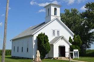
Former Poplar Grove Methodist Church | |
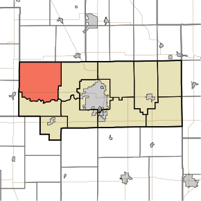 Location in Howard County | |
| Coordinates: 40°31′20″N 86°18′33″W / 40.52222°N 86.30917°WCoordinates: 40°31′20″N 86°18′33″W / 40.52222°N 86.30917°W | |
| Country | United States |
| State | Indiana |
| County | Howard |
| Government | |
| • Type | Indiana township |
| Area | |
| • Total | 42.24 sq mi (109.4 km2) |
| • Land | 42.24 sq mi (109.4 km2) |
| • Water | 0 sq mi (0 km2) 0% |
| Elevation | 791 ft (241 m) |
| Population (2010) | |
| • Total | 2,227 |
| • Estimate (2012[1]) | 2,234 |
| • Density | 52.7/sq mi (20.3/km2) |
| GNIS feature ID | 0453279 |
Ervin Township is one of eleven townships in Howard County, Indiana, United States. As of the 2010 census, its population was 2,227 and it contained 879 housing units.[2]
History
Ervin township was named for Robert Ervin, a county judge.[3]
Geography
| Historical population | |||
|---|---|---|---|
| Census | Pop. | %± | |
| 2000 | 2,331 | — | |
| 2010 | 2,227 | −4.5% | |
| Est. 2012 | 2,234 | 0.3% | |
| U.S. Census[4] | |||
According to the 2010 census, the township has a total area of 42.24 square miles (109.4 km2), all land.[2] The stream of Petes Run runs through this township.
Unincorporated towns
- Judson
- Kappa Corner
- Poplar Grove
- Ridgeway
(This list is based on USGS data and may include former settlements.)
Former Settlements
- Bassett
- Ervin
- Noble
Adjacent townships
- Deer Creek Township, Cass County (north)
- Jackson Township, Cass County (northeast)
- Clay Township (east)
- Monroe Township (south)
- Burlington Township, Carroll County (west)
- Carrollton Township, Carroll County (west)
Cemeteries
The township contains ten cemeteries: Barnett, Brown, Kappa, Mound, North Union, Petes Run, Pickett, Price, Rush and South Union.
Major highways
References
- "Ervin Township, Howard County, Indiana". Geographic Names Information System. United States Geological Survey. Retrieved 2009-09-24.
- United States Census Bureau cartographic boundary files
- ↑ "Population Estimates". United States Census Bureau. Retrieved 2013-06-25.
- 1 2 "Population, Housing Units, Area, and Density: 2010 - County -- County Subdivision and Place -- 2010 Census Summary File 1". United States Census. Retrieved 2013-05-10.
- ↑ "Howard County's Townships and Their Early Settlements and Towns". Kokomo-Howard County Public Library. Retrieved 2 June 2014.
- ↑ "US Census Data". US Government Census Agency. Retrieved 26 February 2014.
- ↑ "Early Settlements". Kokomo Library Genealogy Department. Retrieved 22 December 2013.
External links
Municipalities and communities of Howard County, Indiana, United States | ||
|---|---|---|
| City | ||
| Towns | ||
| Townships | ||
| Other unincorporated communities |
| |
This article is issued from Wikipedia - version of the 7/4/2016. The text is available under the Creative Commons Attribution/Share Alike but additional terms may apply for the media files.