Clay Township, Howard County, Indiana
| Clay Township | |
|---|---|
| Township | |
|
Henry W. Smith House, a historic site in the township | |
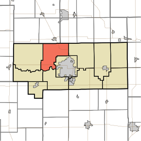 Location in Howard County | |
| Coordinates: 40°31′22″N 86°11′37″W / 40.52278°N 86.19361°WCoordinates: 40°31′22″N 86°11′37″W / 40.52278°N 86.19361°W | |
| Country | United States |
| State | Indiana |
| County | Howard |
| Government | |
| • Type | Indiana township |
| Area | |
| • Total | 28.74 sq mi (74.4 km2) |
| • Land | 28.7 sq mi (74 km2) |
| • Water | 0.04 sq mi (0.1 km2) 0.14% |
| Elevation | 820 ft (250 m) |
| Population (2010) | |
| • Total | 3,885 |
| • Estimate (2012[1]) | 3,894 |
| • Density | 135.4/sq mi (52.3/km2) |
| GNIS feature ID | 0453211 |

Clay Township is one of eleven townships in Howard County, Indiana, United States. As of the 2010 census, its population was 3,885 and it contained 1,565 housing units.[2] This township also contains a small portion of Kokomo. The population of the Kokomo portion, however, is zero.
History
Clay Township was named for Henry Clay, a politician and statesman from Kentucky.[3]
The Henry W. Smith House was listed on the National Register of Historic Places in 1979.[4]
Geography
| Historical population | |||
|---|---|---|---|
| Census | Pop. | %± | |
| 2000 | 4,042 | — | |
| 2010 | 3,885 | −3.9% | |
| Est. 2012 | 3,894 | 0.2% | |
| U.S. Census[5] | |||
According to the 2010 census, the township has a total area of 28.74 square miles (74.4 km2), of which 28.7 square miles (74 km2) (or 99.86%) is land and 0.04 square miles (0.10 km2) (or 0.14%) is water.[2] The stream of Villa Run runs through this township.
Former Settlements
- Jewell Station
Adjacent townships
- Jackson Township, Cass County (north)
- Deer Creek Township, Miami County (northeast)
- Howard Township (east)
- Center Township (southeast)
- Harrison Township (south)
- Monroe Township (southwest)
- Ervin Township (west)
Major highways
Airports and landing strips
- Hartman Farms Field
References
- "Clay Township, Howard County, Indiana". Geographic Names Information System. United States Geological Survey. Retrieved 2009-09-24.
- United States Census Bureau cartographic boundary files
- ↑ "Population Estimates". United States Census Bureau. Archived from the original on 2013-06-17. Retrieved 2013-06-25.
- 1 2 "Population, Housing Units, Area, and Density: 2010 - County -- County Subdivision and Place -- 2010 Census Summary File 1". United States Census. Retrieved 2013-05-10.
- ↑ "Howard County's Townships and Their Early Settlements and Towns". Kokomo-Howard County Public Library. Retrieved 2 June 2014.
- ↑ National Park Service (2010-07-09). "National Register Information System". National Register of Historic Places. National Park Service.
- ↑ "US Census Data". US Government Census Agency. Retrieved 26 February 2014.
- ↑ "Early Settlements". KHPL Genealogy.
External links
Municipalities and communities of Howard County, Indiana, United States | ||
|---|---|---|
| City | ||
| Towns | ||
| Townships | ||
| Other unincorporated communities |
| |
This article is issued from Wikipedia - version of the 11/26/2016. The text is available under the Creative Commons Attribution/Share Alike but additional terms may apply for the media files.