Dayville Historic District
|
Dayville Historic District | |
 | |
  | |
| Location | Main and Pleasant Sts., Killingly, Connecticut |
|---|---|
| Coordinates | 41°50′45″N 71°53′8″W / 41.84583°N 71.88556°WCoordinates: 41°50′45″N 71°53′8″W / 41.84583°N 71.88556°W |
| Architect | Blanchard,Alexander; Et al. |
| Architectural style | Greek Revival, Italianate, Queen Anne |
| NRHP Reference # | 88001422[1] |
| Added to NRHP | August 25, 1988 |
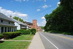
The Dayville Historic District is a historic district in the town of Killingly, Connecticut. The district was added to the National Register of Historic Places in 1988.[1] The community or village of Dayville was named after Capt. John Day, who owned the water privileges on the Five Mile River. With the opening of the Norwich and Worcester Railroad in 1830, Dayville also became a hub for freight transport for other manufacturing villages along the river. By 1849, the village had grown sufficiently in population to have its own church, the Dayville Congregational Church, a Greek revival building built by Alexander Blanchard. The church was heavily damaged in a hurricane in 1938. Killingly Intermediate School is located in the area. The district is mostly residential in character, with houses built in Greek Revival and Italianate style in the mid-19th century.[2]
See also
References
- 1 2 National Park Service (2009-03-13). "National Register Information System". National Register of Historic Places. National Park Service.
- ↑ "NRHP nomination for Dayville Historic District" (PDF). National Park Service. Retrieved 2015-01-08.
| Topics | |
|---|---|
| Lists by states |
|
| Lists by insular areas | |
| Lists by associated states | |
| Other areas | |
| |
Municipalities and communities of Windham County, Connecticut, United States | ||
|---|---|---|
| Towns | 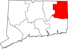 | |
| Borough | ||
| Other communities | ||