Colonsay, Saskatchewan
| Colonsay | |
|---|---|
| Town | |
|
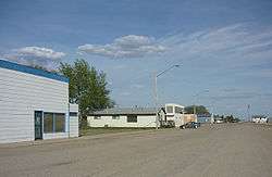
Railway Avenue | |
| Motto: "Isle of the Prairies" | |
 Colonsay  Colonsay Location of Colonsay in Saskatchewan | |
| Coordinates: 51°59′N 105°53′W / 51.983°N 105.883°W | |
| Country | Canada |
| Province | Saskatchewan |
| Rural Municipalities (R.M.) | Colonsay No. 342, Saskatchewan |
| Post office Founded | 1908-05-21 |
| Village established | 1907 |
| Town incorporated | 1910 |
| Government | |
| • Mayor | James Gray[1] |
| • Federal Electoral District Blackstrap (historical riding Rosthern) M.P. | Lynne Yelich |
| • provincial electoral districts Constituency of Humboldt M.L.A. | Donna Harpauer |
| Area | |
| • Total | 6.4 km2 (2.46 sq mi) |
| Population (2011) | |
| • Total | 475 |
| • Density | 193.1/km2 (500/sq mi) |
| Website | Town Website |
| [2][3][4] | |
Colonsay /kəˈlɒnziː/ is a town in the rural municipality of Colonsay No. 342, Saskatchewan, in the Canadian province of Saskatchewan. Colonsay is located on Highway 16 (the Yellowhead Highway part of the Trans-Canada Highway) running east-west in central Saskatchewan near the intersection with Highway 2.
Colonsay derived its name from the Inner Hebrides Scottish island of Colonsay [5] All the streets in the village are also named after islands located along the west coast of Scotland.
History
Colonsay experienced a record setting 167-day-long frost-free period in 1978, which was, to the dismay of a number of residents, still not a long enough growing season for yams or sweet potatoes.[6]
The ship U-Sea Colonsay is named after the local potash mine.[7][8]
Demographics
| Canada census – Colonsay, Saskatchewan community profile | |||
|---|---|---|---|
| 2011 | 2006 | 2001 | |
| Population: | 475 (+11.8% from 2006) | 425 (-0.2% from 2001) | 426 (-0.5% from 1996) |
| Land area: | 2.46 km2 (0.95 sq mi) | 2.46 km2 (0.95 sq mi) | 15.59 km2 (6.02 sq mi) |
| Population density: | 193.1/km2 (500/sq mi) | 172.8/km2 (448/sq mi) | 137.0/km2 (355/sq mi) |
| Median age: | 38.8 (M: 37.6, F: 39.6) | 41.9 (M: 40.4, F: 43.2) | 39.6 (M: 36.0, F: 42.0) |
| Total private dwellings: | 202 | 184 | 184 |
| Median household income: | $65,700 | $52,417 | |
| References: 2011[9] 2006[10] 2001[11] | |||
- Lat (DMS) 51°59′00″ N
- Long (DMS) 105°53′00″ W
- Dominion Land Survey Section 1, Township 35, Range 28 West of the 2nd Meridian
- Time zone (cst) UTC−6
Climate
| Climate data for Colonsay | |||||||||||||
|---|---|---|---|---|---|---|---|---|---|---|---|---|---|
| Month | Jan | Feb | Mar | Apr | May | Jun | Jul | Aug | Sep | Oct | Nov | Dec | Year |
| Record high °C (°F) | 7 (45) |
9 (48) |
19 (66) |
31 (88) |
37.2 (99) |
40 (104) |
37 (99) |
36.1 (97) |
33.5 (92.3) |
27.8 (82) |
19.4 (66.9) |
10 (50) |
40 (104) |
| Average high °C (°F) | −10.6 (12.9) |
−8.3 (17.1) |
−0.9 (30.4) |
9.7 (49.5) |
18.1 (64.6) |
22.3 (72.1) |
24.7 (76.5) |
23.7 (74.7) |
17 (63) |
10.1 (50.2) |
−1.9 (28.6) |
−9.5 (14.9) |
7.9 (46.2) |
| Daily mean °C (°F) | −15.4 (4.3) |
−12.9 (8.8) |
−5.6 (21.9) |
4.1 (39.4) |
11.8 (53.2) |
16.3 (61.3) |
18.6 (65.5) |
17.4 (63.3) |
11.2 (52.2) |
4.7 (40.5) |
−5.9 (21.4) |
−14 (7) |
2.5 (36.5) |
| Average low °C (°F) | −20.3 (−4.5) |
−17.6 (0.3) |
−10.3 (13.5) |
−1.6 (29.1) |
5.4 (41.7) |
10.2 (50.4) |
12.4 (54.3) |
10.9 (51.6) |
5.4 (41.7) |
−0.8 (30.6) |
−10 (14) |
−18.5 (−1.3) |
−2.9 (26.8) |
| Record low °C (°F) | −44.4 (−47.9) |
−39 (−38) |
−36.7 (−34.1) |
−24.4 (−11.9) |
−7 (19) |
1 (34) |
4 (39) |
−1.5 (29.3) |
−5 (23) |
−21 (−6) |
−32 (−26) |
−47 (−53) |
−47 (−53) |
| Average precipitation mm (inches) | 11.8 (0.465) |
9.8 (0.386) |
10.5 (0.413) |
21.8 (0.858) |
46.3 (1.823) |
59.1 (2.327) |
64.9 (2.555) |
47.4 (1.866) |
31.8 (1.252) |
17.9 (0.705) |
9.4 (0.37) |
13.8 (0.543) |
344.4 (13.559) |
| Source: Environment Canada[12] | |||||||||||||
Economy
The main economy of the area is agriculture featuring grain crops such as wheat, canola, barley, oats, rye, as well as lentils and peas. Livestock raised in the vicinity are cattle, hogs, sheep, and buffalo.[13] The potash mine of Colonsay was first named Potash Corporation of Saskatchewan, Colonsay, IMC Potash Colonsay and is now Mosaic Potash Colonsay.[14] Potash is mined and sold to crop nutrient manufacturers for fertilizer, as well as for use as icemelter ingredient and water softener regenerant.[15]
Sports
Colonsay & District Sports Centre was re-opened in 2006 following fund raising efforts by the community as well as funding initiatives such as the Green Municipal Investment Fund, a joint venture of the Government of Canada and the Federation of Canadian Municipalities. The Sports Centre has a new heating system as well as ice-cube heat which will allow a longer artificial ice season for skaters, curlers and ice hockey players.[16]
The Colonsay Monarchs were a team that played for the Northern Saskatchewan Baseball League as of 1951.[17][18]
See also
References
- ↑ "Municipal Directory System". Archived from the original on 2016-01-15. Retrieved 2012-12-24.
- ↑ National Archives, Archivia Net, Post Offices and Postmasters, archived from the original on 2006-10-06
- ↑ Canadian Textiles Institute. (2005), CTI Determine your provincial constituency, archived from the original on 2007-09-11
- ↑ Commissioner of Canada Elections, Chief Electoral Officer of Canada (2005), Elections Canada On-line, archived from the original on 2007-04-21
- ↑ Colonsay Home, retrieved 2007-08-01
- ↑ Welcome to Weyburn's Community Atlas "WEYBURN ON THE WEB" produced by the students of St. Dominic ; Savio Elementary School (2006–2007), Canadian Communities Atlas, retrieved 2007-08-01
- ↑ "U-SEA COLONSAY Sets Sail". iStockAnalyist. October 24, 2011. Retrieved 2011-11-10.
- ↑ "North Van to see new jobs from potash trade". Business Today. 9 November 2011. Retrieved 2011-11-10.
- ↑ "2011 Community Profiles". Canada 2011 Census. Statistics Canada. July 5, 2013. Retrieved 2012-12-24.
- ↑ "2006 Community Profiles". Canada 2006 Census. Statistics Canada. March 30, 2011. Retrieved 2012-12-24.
- ↑ "2001 Community Profiles". Canada 2001 Census. Statistics Canada. February 17, 2012. Retrieved 2012-12-24.
- ↑ Environment Canada Canadian Climate Normals 1971–2000, accessed 24 July 2010
- ↑ Saskatchewan Government Sask Biz (2004), Colonsay Geography The Town of Colonsay is located in Central ..., retrieved 2007-08-01
- ↑ Mining Communications Ltd, r: Peter McCready (2007), Saskatchewan A Mining Journal supplement (– Scholar search), retrieved 2007-08-01
- ↑ EDGAR Online, Inc. (1995–2006), IMC GLOBAL INC—IGL Annual Report (10-K) Item 1. Business.1, retrieved 2007-08-01
- ↑ The Saskatchewan Association of Rural Municipalities (2006), Rural Councillor Back Issues Colonsay’s Arena: A Community Effort and Environmentally Responsible Example, retrieved 2007-08-01
- ↑ Hrynkiw—One-Name Family History Study, 2006–2007, retrieved 2007-08-01
- ↑ Western Canada Baseball (2007) [2003], 1951, archived from the original on 2006-11-08, retrieved 2007-08-01
Published works
- Book Title Colonsay memoirs, 1905–1955
Author Colonsay, Saskatchewan. High School
- Book Title Milestones and memories : Colonsay and Meacham Districts, 1905–1980
Published Colonsay, Sask. : R.M. 342 Celebrate Saskatchewan 1980 Committees, 1980
External links
- Town of Colonsay Official Website
- Saskatchewan City & Town Maps
- Saskatchewan Gen Web—One Room School Project
- Saskatchewan Gen Web Region
- Online Historical Map Digitization Project
- GeoNames Query
 |
Meacham | | ||
| Clavet-Elstow | |
Viscount-Lanigan | ||
| ||||
| | ||||
| Neely-Young |
Coordinates: 51°59′N 105°53′W / 51.983°N 105.883°W