La Ronge
| La Ronge | |
|---|---|
| Northern town[1] | |
|
Island on Lac La Ronge | |
 La Ronge 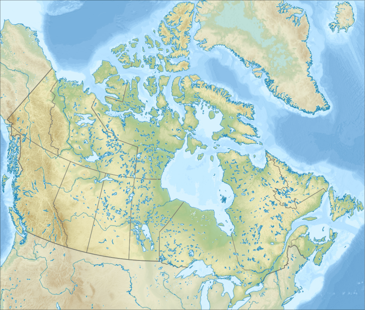 La Ronge Location of La Ronge in Saskatchewan/Canada | |
| Coordinates: 55°06′N 105°18′W / 55.100°N 105.300°WCoordinates: 55°06′N 105°18′W / 55.100°N 105.300°W | |
| Country | Canada |
| Province | Saskatchewan |
| Northern village[2] | 3 May 1905 |
| Industrial town[2] | 1965 |
| Town[2] | 1 November 1976 |
| Northern town[2] | 1 October 1983 |
| Government | |
| • Mayor | Thomas Sierzycki |
| • MLA Cumberland | Doyle Vermette |
| • MP Desnethé—Missinippi —Churchill River | Rob Clarke |
| Area[3] | |
| • Total | 11.86 km2 (4.58 sq mi) |
| Population (2011)[4] | |
| • Total | 2,743 |
| • Density | 231.3/km2 (599/sq mi) |
| Time zone | Central Standard Time (UTC−6) |
| Postal code | S0J 1L0 |
| Highways | Highway 2, Highway 102 |
| Post office established | 1911 |
| Climate | Dfc |
| Website | Official website |
| [5][6][7] | |
La Ronge is a northern town of 2,743 people (2011 census)[4] in the boreal forest of central Saskatchewan, Canada. Its location is approximately 250 km (160 mi) north of Prince Albert where Highway 2 becomes Highway 102. La Ronge lies on the western shore of Lac la Ronge, is adjacent to Lac La Ronge Provincial Park, and is on the edge of the Canadian Shield.
This town is also the namesake of the larger La Ronge population centre[8] comprising the community, the Northern Village of Air Ronge and the Kitsakie 156B and Lac La Ronge 156 reserves of the Lac La Ronge First Nation.[9]
History
The name of La Ronge comes from the lake. The origin of the name is uncertain; the most likely explanation is that early French fur traders named it "la ronge" (literally "the chewed") because of the large amount of beaver activity along the shoreline—many of the trees would have been chewed down for beaver dam construction.
In 1782,[10] the Swiss born fur trader Jean-Étienne Waddens had a fur trade post on Lac La Ronge.[11] In March 1782, Waddens was fatally wounded in a quarrel with his associate Peter Pond.
La Ronge began in 1904 as a fur trading post and meeting place, but with the decline of hunting and the fur market, La Ronge has diversified into other areas. Many of the Dene, Cree, and white trappers used La Ronge as their central service point. It incorporated as a northern village on 3 May 1905.[2]
With the extension of Highway 2 from Prince Albert in 1947, La Ronge became a major tourist fishing area. The highway between La Ronge and Prince Albert expanded the community further in the 1970s after it was paved.
In the early 1950s and 1960s, the mineral resources in the La Ronge area began to be explored and developed.
La Ronge's status changed from northern village to industrial town in 1965 and then to town on 1 November 1976 before finally becoming a northern town on 1 October 1983.[2]
In July 2015, La Ronge was threatened by a dangerous forest fire, caused by low precipitation and high temperatures.[12]
Geography

La Ronge is surrounded by several First Nations reserves, with the Northern Village of Air Ronge located just south of the community on Highway 2. With access to all other points north, east and west, and transportation linkage to the south, La Ronge is also the northern hub for the Saskatchewan provincial government.
Climate
La Ronge experiences a borderline subarctic climate (Köppen Dfc), slightly below the threshold of a humid continental climate. Winters are long, dry and very cold while summer is short, warm and wetter. Precipitation is low, with an annual average of 486.2 mm. The highest temperature ever recorded in La Ronge was 37.2 °C (99 °F) on 23 August 1929.[13] The coldest temperature ever recorded was −52.2 °C (−62 °F) on 15 February 1936.[14]
| Climate data for La Ronge Airport, 1981–2010 normals, extremes 1923–present | |||||||||||||
|---|---|---|---|---|---|---|---|---|---|---|---|---|---|
| Month | Jan | Feb | Mar | Apr | May | Jun | Jul | Aug | Sep | Oct | Nov | Dec | Year |
| Record high °C (°F) | 12.5 (54.5) |
14.0 (57.2) |
15.8 (60.4) |
28.0 (82.4) |
33.2 (91.8) |
36.1 (97) |
35.6 (96.1) |
37.2 (99) |
34.4 (93.9) |
27.4 (81.3) |
18.0 (64.4) |
10.6 (51.1) |
37.2 (99) |
| Average high °C (°F) | −13.4 (7.9) |
−9.2 (15.4) |
−1.5 (29.3) |
7.8 (46) |
15.0 (59) |
20.6 (69.1) |
23.5 (74.3) |
22.1 (71.8) |
15.2 (59.4) |
6.8 (44.2) |
−4.3 (24.3) |
−11.4 (11.5) |
5.9 (42.6) |
| Daily mean °C (°F) | −18.8 (−1.8) |
−15.4 (4.3) |
−8.1 (17.4) |
1.4 (34.5) |
8.4 (47.1) |
14.5 (58.1) |
17.5 (63.5) |
16.1 (61) |
9.7 (49.5) |
2.3 (36.1) |
−8.3 (17.1) |
−16.4 (2.5) |
0.2 (32.4) |
| Average low °C (°F) | −24.2 (−11.6) |
−21.5 (−6.7) |
−14.6 (5.7) |
−5.0 (23) |
1.8 (35.2) |
8.3 (46.9) |
11.5 (52.7) |
9.9 (49.8) |
4.2 (39.6) |
−2.3 (27.9) |
−12.3 (9.9) |
−21.2 (−6.2) |
−5.5 (22.1) |
| Record low °C (°F) | −48.3 (−54.9) |
−52.2 (−62) |
−41.8 (−43.2) |
−33.9 (−29) |
−17.6 (0.3) |
−3.3 (26.1) |
0.0 (32) |
−3.4 (25.9) |
−9.4 (15.1) |
−20.9 (−5.6) |
−37.6 (−35.7) |
−48.9 (−56) |
−52.2 (−62) |
| Average precipitation mm (inches) | 18.7 (0.736) |
15.3 (0.602) |
21.2 (0.835) |
35.8 (1.409) |
43.6 (1.717) |
66.5 (2.618) |
80.5 (3.169) |
60.6 (2.386) |
56.1 (2.209) |
36.6 (1.441) |
28.3 (1.114) |
22.8 (0.898) |
486.2 (19.142) |
| Average rainfall mm (inches) | 0.2 (0.008) |
0.3 (0.012) |
1.6 (0.063) |
16.9 (0.665) |
38.6 (1.52) |
66.5 (2.618) |
80.5 (3.169) |
60.6 (2.386) |
55.1 (2.169) |
20.7 (0.815) |
2.4 (0.094) |
0.3 (0.012) |
343.6 (13.528) |
| Average snowfall cm (inches) | 20.4 (8.03) |
17.3 (6.81) |
21.0 (8.27) |
19.2 (7.56) |
5.2 (2.05) |
0.1 (0.04) |
0.0 (0) |
0.0 (0) |
0.9 (0.35) |
16.7 (6.57) |
28.3 (11.14) |
25.0 (9.84) |
154.1 (60.67) |
| Source: Environment Canada[15][16][17] | |||||||||||||
Demographics
| Canada census – La Ronge community profile | |||
|---|---|---|---|
| 2011 | 2006 | ||
| Population: | 2,743[4] (0.7% from 2006) | 2,725 (-0.1% from 2001) | |
| Land area: | 11.86 km2 (4.58 sq mi) | 11.86 km2 (4.58 sq mi) | |
| Population density: | 231.3/km2 (599/sq mi) | 229.8/km2 (595/sq mi) | |
| Median age: | 30.2 (M: 30.1, F: 30.3) | 28.9 (M: 28.1, F: 29.5) | |
| Total private dwellings: | 1,170[4] | 1318 | |
| Median household income: | $56,118 | ||
| References: 2011[18] 2006[19] | |||
In the 2011 Census, Statistics Canada originally reported that the Northern Town of La Ronge had a population of 2,304 living in 841 of its 960 total dwellings, a -15.4% change from its 2006 population of 2,725.[20] To refute the results, the Northern Town of La Ronge conducted its own municipal census which counted 3,053 residents, which led to an appeal of the 2011 census results.[21] Statistics Canada subsequently amended the 2011 census results to a population of 2,743 living in 1,005 of its 1,170 total dwellings, a 0.7% change from 2006.[4] With a land area of 11.86 km2 (4.58 sq mi), it had a population density of 231.28/km2 (599.0/sq mi) in 2011.[4][20]
Population centre
The La Ronge population centre, the thirteenth largest population centre in the province,[22] comprises four adjoining census subdivisions including the Northern Town of La Ronge, the Northern Village of Air Ronge and the Kitsakie 156B and Lac La Ronge 156 Indian reserves of the Lac La Ronge First Nation.[9]
In the 2011 Census, Statistics Canada reported that the La Ronge population centre had a population of 5,905 living in 1,751 of its 1,922 total dwellings, a -1.0% change from its 2006 population of 5,962.[8] With a land area of 28.02 km2 (10.82 sq mi), it had a population density of 210.74/km2 (545.82/sq mi) in 2011.[4][20]
The following is a population breakdown of the La Ronge population centre by census subdivision.
| Census subdivision[9] | 2011 population[20] |
2006 population[20] |
|---|---|---|
| Air Ronge | 1,043 | 1,032 |
| Kitsakie 156B | 644 | 671 |
| La Ronge | 2,304 | 2,725 |
| Lac La Ronge 156 | 1,914 | 1,534 |
| Total La Ronge population centre | 5,905 | 5,962 |
Economy
Several mining companies, government agencies, and airlines now keep offices in La Ronge, and the local Chamber of Commerce has many other retail and service businesses amongst its members.
Sports

The community is also home to the La Ronge Ice Wolves ice hockey team of the Saskatchewan Junior Hockey League, the JHL (JRMCC Hockey League) and the La Ronge Crushers men's hockey league and the La Ronge women's hockey league.
La Ronge is home to an 8 team Ladies Slopitch League - JRMCC Ladies Slopitch (slow-pitch softball). There are many other sports available in the community including volleyball, broomball, curling and a newly formed women's hockey program.
Government
In 2009, La Ronge elected 21-year-old councillor Thomas Sierzycki as its mayor. This established La Ronge as having one of the youngest mayors in Canada.
Education
There are 2 high schools and 3 elementary schools in La Ronge and Air Ronge. High schools include Churchill Composite High School and Senator Myles Venne High School. Elementary schools in La Ronge and Air Ronge include Pre-cam Community School, Gordon Denny Community School, and Bells Point Elementary School.
Northlands College maintains its main campus in La Ronge.
Transportation
_Airport.JPG)
La Ronge is connected to southern Saskatchewan by Highway 2, which continues north as Highway 102. The community is also the terminus for the Prince Albert-La Ronge bus line operated by the provincially owned Saskatchewan Transportation Company, which runs one bus a day to and from the community.[23] La Ronge is served by the La Ronge (Barber Field) Airport and the La Ronge Water Aerodrome.
See also
References
- ↑ "Search for Municipal Information". Government of Saskatchewan. Retrieved 7 April 2014.
- 1 2 3 4 5 6 Northern Communities Incorporation Dates
- ↑ "2011 Community Profiles". Statistics Canada. Government of Canada. Retrieved 30 May 2012.
- 1 2 3 4 5 6 7 "Corrections and updates". Statistics Canada. 19 September 2012. Retrieved 13 October 2012.
- ↑ National Archives, Archivia Net. "Post Offices and Postmasters". Retrieved 6 November 2012.
- ↑ Government of Saskatchewan, MRD Home. "Municipal Directory System". Retrieved 6 November 2012.
- ↑ Commissioner of Canada Elections, Chief Electoral Officer of Canada (2005). "Elections Canada On-line". Retrieved 6 November 2012.
- 1 2 "Census Profile: La Ronge, Saskatchewan (Population centre)". Statistics Canada. 7 September 2012. Retrieved 14 October 2012.
- 1 2 3 "GeoSearch 2011 - Population Centres (POPCTR)". Statistics Canada. Retrieved 14 October 2012.
- ↑ "ENCYCLOPEDIA OF SASKATCHEWAN (list of forts in Northern Saskatchewan)". Retrieved 12 October 2012.
- ↑ "Dictionary of Canadian Biography Online (Jean-Étienne Waddens)". Retrieved 12 October 2012.
- ↑ "'Unprecedented' wildfires force out 13,000 Sask. evacuees". CBC. Retrieved 12 May 2016.
- ↑ "August 1929". Canadian Climate Data. Environment Canada. Retrieved 10 May 2016.
- ↑ "February 1936". Canadian Climate Data. Environment Canada. Retrieved 10 May 2016.
- ↑ "La Ronge A". Canadian Climate Normals 1981−2010. Environment Canada. Retrieved 10 May 2016.
- ↑ "Lac La Ronge". Canadian Climate Data. Environment Canada. Retrieved 10 May 2016.
- ↑ "La Ronge RCS". Canadian Climate Data. Environment Canada. Retrieved 10 May 2016.
- ↑ "2011 Community Profiles". Canada 2011 Census. Statistics Canada. July 5, 2013. Retrieved 11 June 2012.
- ↑ "2006 Community Profiles". Canada 2006 Census. Statistics Canada. March 30, 2011. Retrieved 24 February 2009.
- 1 2 3 4 5 "Population and dwelling counts, for Canada, provinces and territories, and census subdivisions (municipalities), 2011 and 2006 censuses (Saskatchewan)". Statistics Canada. 8 February 2012. Retrieved 13 October 2012.
- ↑ Ragnar Haagen (5 July 2012). "La Ronge grows larger". paNOW. paNOW.com. Retrieved 14 October 2012.
- ↑ "Population and dwelling counts, for Canada, provinces and territories, and population centres, 2011 and 2006 censuses (Saskatchewan)". Statistics Canada. 11 April 2012. Retrieved 14 October 2012.
- ↑ Saskatchewan Transportation Company. "Route Map" (PDF). Retrieved 3 February 2014.
External links
 |
Missinipe | | ||
| Beauval | |
Flin Flon | ||
| ||||
| | ||||
| Air Ronge, Prince Albert National Park |