Bredenbury, Saskatchewan
| Bredenbury | |
|---|---|
| Town | |
|
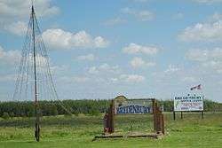
Signs and Christmas tree at the eastern entrance to Bredenbury, SK off Highway 16. | |
 Bredenbury | |
| Coordinates: 50°56′29″N 102°2′39″W / 50.94139°N 102.04417°W | |
| Country | Canada |
| Province | Saskatchewan |
| Rural Municipality | 213 , Saskatchewan |
| Government | |
| • Mayor | Fred Nicholson |
| • Governing Body |
Bredenbury Town Council
|
| • Federal Electoral District M.P. | Gary Breitkreuz |
| • Provincial Constituency M.L.A. | Bob Bjornerud |
| Time zone | CST |
| Website | Town of Bredenbury |
Bredenbury is a town, in the rural municipality of Saltcoats, No. 213, in the Canadian province of Saskatchewan. Bredenbury is located on Highway 16 in eastern Saskatchewan. The population of Bredenbury is 329. The main industries in the area are farming as well as potash mining near Esterhazy. The community is known in the area for its enthusiastic Christmas light displays which have won national awards.
History
Bredenbury was incorporated in 1913. There are conflicting stories about the origin of the town's name. One version is that the town was named after A.E. Bredin, a railway land inspector.[1] Another says that it was named after "Lord Brendenbury", who was a stockholder in the Manitoba Northwest Railway Company. It may be of relevance that there is a small parish and village called Bredenbury in the English county of Herefordshire. Bredenbury is often referred to by the locals as "God's Garden".
Geography
Bredenbury is located on the Yellowhead Highway (#16). It is 41 kilometres southeast of Yorkton and 50 km west of the Manitoba border. Bredenbury is approximately 2.5 hours from Regina and four hours from Winnipeg. The surrounding land is mainly used for agriculture and ranching.
Economy
Bredenbury has an economy based largely on agriculture, potash mining and the railway, along with their supporting businesses. A CPR main line runs through the town. There are railway car cleaning and fertilizer plants in Bredenbury as well.
Demographics
| Canada census – Bredenbury, Saskatchewan community profile | |||
|---|---|---|---|
| 2006 | |||
| Population: | 329 (-7.1% from 2001) | ||
| Land area: | 4.80 km2 (1.85 sq mi) | ||
| Population density: | 68.5/km2 (177/sq mi) | ||
| Median age: | 42.6 (M: 40.8, F: 46.0) | ||
| Total private dwellings: | 159 | ||
| Median household income: | $43,056 | ||
| References: 2006[2] | |||
Education
There are no public schools in Bredenbury itself. Students are bussed to Saltcoats for elementary school and to Yorkton for high school. Bredenbury Elementary School closed in 2001. The school building in the town is currently empty. The Mennonites operate a private parochial school: the Countryside School.
Christmas lights
Christmas in Bredenbury started out relatively small with a single street that dubbed itself 'Candy Cane Lane' and sported matching red and white candy canes down the length of the entire street. In subsequent years, the rest of the town has caught that same spirit, and the town is home to a special 'Light Up' ceremony at the beginning of December each year, along with elaborate displays at private homes, businesses and empty lots throughout the town.
Bredenbury has won the national WinterLights competition for communities with populations under 1,000 in 2001, 2002 and 2005. As a result of the community involvement with the Christmas celebrations, Bredenbury has hosted the CPR Holiday Train, with performers such as Tom Jackson. Bredenbury hosted the Holiday Train again in 2007, when the featured performers were Wide Mouth Mason and Melanie Doane.[3]
Sports teams and other athletic attractions
- Bredenbury Cougars - Triangle Hockey League (Senior Men's)
- Bredenbury Golf Course - a nine-hole golf course with artificial greens, maintained by local volunteers.
 |
Stornoway | | ||
| Saltcoats | |
Churchbridge | ||
| ||||
| | ||||
| Esterhazy |
Notes and sources
- ↑ Barry, Bill (1998) People Places: The Dictionary of Saskatchewan Place Names, p. 50, Regina, Sask: People Places Publishing Ltd., ISBN 1-894022-19-X
- ↑ "2006 Community Profiles". Canada 2006 Census. Statistics Canada. March 30, 2011. Retrieved 2009-02-24.
- ↑ Canadian Pacific Railway, Saskatchewan and Manitoba Holiday Train Schedule, archived from the original on 2007-11-10, retrieved 2007-11-14
- ↑ Becquet's Custom Programming (August 17, 2005), Saskatchewan City & Town Maps - Directory, retrieved 2007-10-03
- Government of Saskatchewan, Municipal Directory System (– Scholar search), retrieved 2007-11-04
- Government of Canada, 2006 Census Community Profiles, retrieved 2007-11-04
- Saskatchewan Learning, Saltcoats School Profile (PDF), archived from the original (PDF) on 2009-07-04, retrieved 2007-11-04
- Sask Biz, Bredenbury Community Profile, archived from the original on 2007-10-16, retrieved 2007-11-04
Published works
- Bredenbury Senior Citizens (1978), Memory Lane: A Local History of Bredenbury and Districts, Bredenbury, Sask: Bredenbury History Book Committee, p. 164, ISBN 0-88925-028-6
See also
Coordinates: 50°56′30″N 102°03′1″W / 50.94167°N 102.05028°W