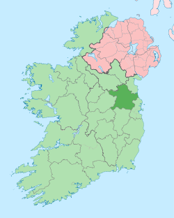
Clonard, County Meath
| Clonard Cluain Ioraird | |
|---|---|
| Town | |
 | |
 Clonard Location in Ireland | |
| Coordinates: 53°27′07″N 7°01′19″W / 53.451820°N 7.021877°WCoordinates: 53°27′07″N 7°01′19″W / 53.451820°N 7.021877°W | |
| Country | Ireland |
| Province | Leinster |
| County | County Meath |
| Population (2006) | |
| • Urban | 347 |
| Time zone | WET (UTC+0) |
| • Summer (DST) | IST (WEST) (UTC-1) |
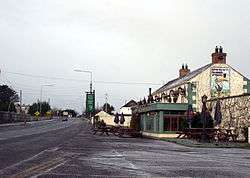
Clonard (Irish: Cluain Ioraird, meaning "Iorard's pasture"[1]) is a small village in County Meath, Ireland. It lies on the R148 regional road between the towns of Kinnegad and Enfield. This road was the main road between Dublin and Galway until the construction of the M4 motorway - it is still used by traffic avoiding the toll on the M4.
It is notable for being one of the earliest Christian sites in Ireland, being linked with the first Irish bishop Palladius c. 450 and as the location of a major early medieval monastery, founded in the 6th century by St. Finnian.
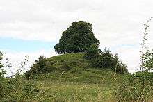
c. 1177, Hugh de Lacy, Lord of Meath, built a motte-and-bailey fortification at Clonard. It is a well-known landmark in the village.
There village contains a Catholic Church, graveyard and a primary school.
It is served by Bus Éireann services to Dublin and West of Ireland.
See also
References
- ↑ A. D. Mills, 2003, A Dictionary of British Place-Names, Oxford University Press
External links
| Wikimedia Commons has media related to Clonard. |