Mulhussey
| Mulhussey Maol Hosae | |
|---|---|
| Town | |
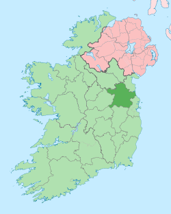
 Mulhussey Location in Ireland | |
| Coordinates: 53°26′14″N 6°37′21″W / 53.4371483°N 6.6225206°WCoordinates: 53°26′14″N 6°37′21″W / 53.4371483°N 6.6225206°W | |
| Country | Ireland |
| Province | Leinster |
| County | County Meath |
| Elevation[1] | 80 m (260 ft) |
| Population (2006) | |
| • Urban | 281 |
| (Kilcloon) | |
| Time zone | WET (UTC+0) |
| • Summer (DST) | IST (WEST) (UTC-1) |
| Irish Grid Reference | N944425 |
Mulhussey (Irish: Maol Hosae, meaning "Hussey's Summit") is a village in County Meath, Ireland. It has a school, a castle with accompanying cemetery, a nearby church (or the 'Little Chapel', as it is commonly known) at the edge of the Kilcloon parish in Kilcock, and a religious antiquity, St Bridgid's Well, located in Calgath, a townland of Mulhussey.
History
Mulhussey's first inhabitants were the Husseys, a noble Norman family in the 13th century AD. The Lord of Trim at the time sent the Husseys to an area outside Maynooth, which at the time was very important, because of the large Norman castle, owned by the Fitzgeralds of County Kildare.
A tower house and manor was to be built and lived in by the Husseys to look after the land and protect it for the DeLacy family of Trim. Legend has it that toward the end of the 16th century AD, the last inhabitant of the tower house and manor or Mulhussey Castle as it is known today, was a bald lady. The literal translation for Maol Hosae is 'Hussey's Summit', but folklore provides a second translation. Combining the Irish word for bald, and the Irish name for Hussey (Maol and Hosae) the land protected by the Hussey family was named Maol Hosae, which was anglicised to Mulhussey.
Geography
Mulhussey is located at the very south of County Meath in the parish of Kilcloon, along with neighbouring townlands Jenkinstown, Longtown, Kimmins Mill, Pagestown, Kilclone, Collistown and Rodanstown. An Post deliver mail to people in Mulhussey from Kilcock post office in Kildare, which leads some people to believe Mulhussey is in Kildare county, but this is for postage convenience only. Mulhussey's closest towns and villages are Kilcock and Maynooth, 6 and 8 kilometres to the south respectively, Dunboyne 16 kilometres to the east, Sumerhill 8 kilometres to the north along with Dunshaughlin 18 kilometres to the north. A tributary of the River Tolka flows through Muhussey and Kilclone townlands.
Sport
GAA is popular in Mulhussey; with inhabitants eligible to join the local club, Blackhall Gaels GAA. Training grounds are located in Pagestown and Batterstown - both with modernized club houses and gym facilities. The club boasts Gaelic football teams for both gentlemen and ladies, which prove to be more popular among locals - with smaller teams for hurling and camogie also.
Modern Mulhussey
Mulhussey has experienced an ongoing decline in population since 1991. The Central Statistics Office online records state that in 1991, Kilcloon census town had a population of 341, which in 2002 fell to 309 and in 2006 fell again to 281. St Joseph's National School in Mulhussey, (located on the Summerhill road) which was established in 1964, has experienced a decline in student numbers. The school website records 58 pupils attend the school at present with 8 staff members.
Mulhussey Castle, or tower house, still stands today on the road from Kilcock.
The Mulhussey Graveyard Restoration Society are currently working on restoring the Mulhussey cemetery beside the castle, which holds the remains of the Hussey family and a ruined church.
See also
References
- Gerard Rice's book 'Kilcloon'
- Maynooth Library
- http://www.cso.ie
- Mulhussey National School