Carnaross
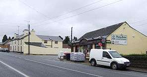
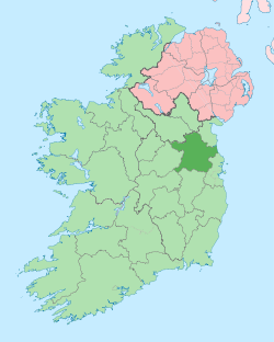
Carnaross or Carnaros (Irish: Carn na Ros) is a small town in County Meath, Ireland, some 4 km northwest of Kells on the R147 road between Kells and Virginia.[1]
Etymology
Carnaross was anciently called Bealaigh-duin, " the Road or Pass of the Fort"
Arriving at the exact derivation of a placename is often not possible. Where cairn appears in a place name the reference is to an ancient pagan burial site. It was customary to put a cairn or heap of stones over a grave. The custom was mostly abandoned with the arrival of Christianity. A cairn was still raised over suicides, the unbaptised and victims of war or fever who, for practical reasons, could not be brought to the churchyard. No passers-by would dare touch the cairn, and in some places a tree was planted instead of, or in addition to, the heap of stones. Evidence for just such a pagan burial site may exist nearby in a farmers field. Known as Keim the churchyard, it contains an ogham stone discovered in 2006 [2] by someone digging a grave.[3]
Carnaross, (detail from Larkin's Grand Jury Map, 1812)
In county Meath some of the places with cairn in their names are Rathcairn, Kilcairn, Cairnstown and Carnaross, to name but a few. Carnaross may have got its name from the Irish cairn. In P.W. Joyce's Irish Names of Places, (1913) vol. III, we find a reference to Carnaross which states that "the old people there say it is shortened from 'Carraig-na-ros', 'the rock of the woods', perhaps an ancient reference to this ogham stone just recently discovered.
There is evidence that Carnaross might be cathru na ros, Cathru could be translated as the quarter of the hills and not the quarter of the cairn. In ancient Ireland ceathru signified a quarter of a townland. The Normans introduced a similar-sounding word, cartron, (in French quarteron), for the same kind of division of land which was, according to Joyce, from 60 to 160 acres (0.65 km2). Cartronganny, near Mullingar, is the sandy cartron or the sandy quarter.
Ros is more difficult to interpret. It would not have been applied to any kind of hill, but rather to a promontory covered with trees or brushwood. In parts of Ireland the word is synonymous with wood, and a perfect example of the meaning of ros can be seen on the Donore road from Navan to Drogheda at Rosnaree. There is evidence that the valley of the Blackwater was thickly wooded in ancient times, and to the north of Castle Kieran is a locality named Cloghanrush, the stony place of the wood.
History
The parish of Carnaross is composed of the three mediaeval parishes of Castle Kieran, Loughan and Dulane. Carnaross is not even mentioned as a townland earlier than 1837, and even then John O'Donovan in the Ordnance Survey Field Name Books, refers to it as "a group of houses (two of them public houses) called Carnaross." It was, however, the site of a thatched chapel, (on the same site as the present church), and afterwards, when stage coaches came, it grew in importance and, because it was situated on the main Dublin-Enniskillen route, it soon boasted two inns. The townland of Loughan belonged to the Mapes of Maperath before the Cromwellian plantation; afterwards it was one of the many grants allotted to an officer named James Stopford. Dean Cogan mentions the holy well dedicated to Saint Anne.[4] In describing Castle Kieran he notes: "Convenient to the termon cross, on the south side, there is a green grave marking the resting place of a priest, name now unknown, on which, at interments, the coffin is deposited, while the De Profundis is being intoned." In the Deanery of Kells Carnaross we can read : " In the Termann of Cenannas, in Meath, as the Oidheadh Breasail (the Massacre of Breasal, a tale so called) states (he was killed by) Diarmait, his father, and he was resuscitated by Becan. "
The three mediaeval parishes of Castle Kieran, Loughan and Dulane [5]
The parishes of Loghan, Castle-Kieran, and Dulane were once separate and distinct. Latterly the union has been called the parish of Carnaross. Dulane was under the patronage of St. Cairneck, and Castle-Kiernan under that of St. Kieran.
Loghan or Loughan
Loghan, or Loughan, a parish, partly in the barony of CASTLERAHAN, county of CAVAN, and province of ULSTER, but chiefly in the barony of UPPER KELLS, county of MEATH, and province of LEINSTER, 4 miles (N. W.) from Kells, on the road from Dublin by Kells to Enniskillen; containing 3795 inhabitants, of which number, 339 are in the village of Loghan. This parish, which is also called Castlekeiran and Tristelkerin, contains also the villages of Rathendrick, Derver, and Castlekeiran, and is situated on the river Blackwater, near its source in Lough Ramor.
It is a rectory, in the diocese of Meath, entirely impropriate in the Marquess of Headfort: the tithes amount to £250. The impropriator allows £10 per annum to the curate of Mounter-Connaught parish for performing the occasional duties of that part of Loghan which lies in the county of Cavan, and of which the Protestant inhabitants attend Virginia church: those of the Meath portion attend the church of Kells. In the R. C. divisions Loghan forms part of the union or district of Carnaross, or Dulane. At Carnaross is a private school of about 60 children.
On the banks of the river are the remains of a small church, dedicated to Saint Kieran, with a large and richly sculptured stone cross in the cemetery; here is also a holy well, much resorted to by the peasantry on the first Sunday in August.
The old church has been torn down and up- rooted. There was a holy well here dedicated to Saint Anne. The ruins of the abbey-church of Castle-Kieran are also situated in the parish of Loghan. (See vol. i. pp. 124, 125). Convenient to the termon-cross, on the south-side, there is a green grave, marking the resting-place of a priest, name now unknown, on which, at interments, the coffin is deposited, while the De Profundis is being entoned.
Dulane
DULEEN, or DULANE, a parish, in the barony of UPPER KELLS, county of MEATH, and province of LEINSTER, 2 1/4 miles (N.) from Kells, on the road to Moynalty; containing 1503 inhabitants. It comprises 4150 statute acres, as applotted under the tithe act: the land is generally of good quality; and the system of agriculture is improved. There is a sufficient quantity of bog for fuel, and there are quarries of limestone and freestone. The gentlemen's seats are Maprath, that of T. Taylor Rowley, Esq.; Williamston, of the Rev. G. Garnett; Willmount, of J. Radcliff, Esq.; and Oakley Park, of Capt. Graham.
It is a chapelry, in the diocese of Meath, forming part of the union of Kells and corps of the archdeaconry of Meath : the tithes amount to £200; the glebe comprises 2a. 3r. 17p. In the R. C. divisions it is the head of a union or district called Carnaross, comprising also the parish of Loghan, in each of which is a chapel; the chapel of Duleen is a neat edifice. There is a private school, in which are about 50 children. There are some ancient crosses in Kiern churchyard, said to have been placed there by a saint of that name, which are held in great veneration by the peasantry.
This old church presents every appearance of antiquity. The chancel has been torn down. The nave measures thirty feet by twenty-one. There is a plain doorway on the west end, surmounted by an immense block of stone ; another entrance on the south side seems to have been more modern.
The baptismal font lies to the north of the church. It is a large stone with sides inclining, about three feet in height, and measures inter- nally one foot ten inches by ten inches. Here stood the ancient abbey of Tuilen, or Tulan, founded by St. Cairnigh in the sixth century. The grey walls of the venerable sanctuary, in the last stage of desolation, encompassed by a rich and beautiful country, cannot fail to speak to the heart of the pilgrim, and remind him of the once happy days of Ireland.
1170. Dulane was plundered by Dermod Mac Murchadh, King of Leinster, and the foreigners.
After the Anglo-Norman invasion, the abbey of Dulane pined away, ana henceforth we find it a parish church. To the south of the old church, in the cemetery, is a horizontal tomb, considerably sunk in the clay, with the following inscription: ABBEY OF CASTLEKIERAN.
Castlekeiran
Castlekeiran, a village, in the parish of LOGHAN, barony of UPPER KELLS, county of MEATH, and province of LEINSTER, 2 ½ miles (W. N. W.) from Kells; containing 24 houses and 162 inhabitants.
CASTLEKIERAN is called sometimes hter-Chiarain. This place was anciently called Bealaigh-duin, " the Road or Pass of the Fort". A monastery was founded here on the southern bank of the Abhainn-Sele, or Blackwater, by Saint Ciaran, which was called Diseart Chiarain-Bealaigh-duin.
The Annals of the Four Masters
The Annals of the Four Masters have the following notices:
770. Ciaran,* the Pious, of Bealach-dain, died on 14 June.
855. Siadhal, Abbot of Disert-Chiarain (Castlekieran), died.
868. Comsudh, Abbot of Disert-Chiarain, of Bealach-duin, died.
949. Castlekieran was plundered by the Danes.
961. Dubhthach, Abbot of Castlekieran, died.
1170. Castlekieran was burned by Dermod Mac Murcha, king of Leinster, and the foreigners.
The old church is quadrangular, measuring forty-five feet six inches by twenty feet. Most of the stones have been carried away, and the whole presents a melancholy picture of desolation. There are interesting remains of five Termon crosses, J between four of which the church is situated ; and one of those on the north side is placed in the Blackwater.
Ogam stone
This ogham stone is found in 2006. The inscription reads “COVAGNI MAQI MUCOI LUGUNI” which translates as: Cuana son of the people of Lugh. The tribes of the Gaileanga and Luighne occupied these territories anciently, with Cuana, Maelan, Mac Maelan and Leochain or Loughan cited as a chiefly names amongst notices for these Luighne and Gaileanga. Cuana is linked with the ancient battle of Belach-Duinn (Castlekeiran).[6]
The Iron Church
The old Anglican Church, unusually made out of tin or iron remains there to this day. It is however currently used as an Independent Evangelical place of worship under the name "The Iron Church" One interesting feature is the old Anglican Church. Unusually this is made out of tin. Sold in the early 1980s to people [details required] from Collon, Louth, it is currently used as a Baptist/Independent Evangelical church. The minister is Pastor Tom Wallace
Sports
Carnaross has a Gaelic Football Club.[7]
Notes
[8] [9] [10] [11] [12] [13] [14] [15] [16] [17] [18] [19]
References
- ↑ Ordnance Survey of Ireland map ref. N 698
- ↑ http://www.megalithicireland.com/Castlekeeran.htm
- ↑ "'Cairn' & 'ros': Carnaross". Askaboutireland.ie. Retrieved 2013-12-10.
- ↑ Ciaran's Well in Kells Co. Meath". Homepage.eircom.net. Retrieved 2013-12-10.
- ↑ Deanery of Kells Carnaross, Dean Cogan
- ↑ "Castlekeeran Ogham Stone". Megalithicireland.com. Retrieved 2013-12-10.
- ↑ http://www.carnarossgfc.ie/ Carnaross Gaelic Football Club
- ↑ http://www.carnarossgfc.ie/ Carnaross Gaelic Football Club
- ↑ "Keenahene & Loughan". Askaboutireland.ie. Retrieved 2013-12-10.
- ↑ "Ciaran's Well in Kells Co. Meath". Homepage.eircom.net. Retrieved 2013-12-10.
- ↑ "Pilgrims Way to St. Patrick's Purgatory | Eileen Gardiner | Lough Derg | Italica Press | Chapter 4 monuments". Italica Press.
- ↑ "Ireland Resources Page listing Irish holiday services and guides". Goireland.com. Archived from the original on 27 September 2011. Retrieved 2013-12-10.
- ↑ "The diocese of Meath : ancient and modern". Archive.org. Retrieved 2013-12-10.
- ↑ Denis Larionov & Alexander Zhulin. "Read the eBook The diocese of Meath : ancient and modern (Volume 2) by Anthony Cogan online for free (page 25 of 48)". Ebooksread.com. Retrieved 2013-12-10.
- ↑ "CASTLEKEIRAN, a village". Libraryireland.com. Retrieved 2013-12-10.
- ↑ "LISGRIFFIN to LYONS index". Libraryireland.com. Retrieved 2013-12-10.
- ↑ "DULEEK to DYSERTMORE index". Libraryireland.com. Retrieved 2013-12-10.
- ↑ "The diocese of Meath : ancient and modern". Archive.org. Retrieved 2013-12-10.
- ↑ http://ia340913.us.archive.org/3/items/dioceseofmeathan01cogaiala/dioceseofmeathan01cogaiala.pdf
Coordinates: 53°45′N 6°57′W / 53.750°N 6.950°W