Regional road


A regional road (Irish: bóthar réigiúnach) in Ireland is a class of road not forming a major route (such as a national primary road or national secondary road), but nevertheless forming a link in the national route network. There are over 11,600 kilometres of regional roads.[1] Regional roads are numbered with three-digit route numbers, prefixed by "R" (e.g. R105).
History
Until 1977, classified roads in Ireland were designated with one of two prefixes: "T" for Trunk Roads and "L" for Link Roads. The Local Government (Roads and Motorways) Act authorised the designation of roads as National roads: in 1977, twenty-five National Primary roads (N1-N25) and thirty-three National Secondary roads (N51-N83) were initially designated under Statutory Instrument S.I. No. 164/1977.
Many of the remaining classified roads became Regional roads (formally authorised under the Roads Act 1993, having been indicated as such on road signs on a non-statutory basis for some years previously) and their routes were designated under a Statutory Instrument ('SI') in 1994. The latest SI designating the routes of Regional roads was published in 2012: the Roads Act 1993 (Classification of Regional Roads) Order 2012.
Other roads formerly classified as Trunk or Link roads eventually became Local roads.
Older signs showing the former Trunk and Link road designations are still to be seen in some locations. The L (for Link Road) prefix on these signs is not connected to the network of Local roads currently in place.
Features
Unlike national roads, regional roads are maintained by local county or city councils rather than the National Roads Authority. The vast majority of the regional road network is made up of single-carriageway roads although some roads are dual-carriageway (see: High-capacity regional roads below). Until the late 1990s, such roads were often in a very poor condition, although increased road maintenance funding to local councils has resulted in more frequent resurfacing of regional roads, as well as relaying and realignment on some routes.
Regional roads are generally subject to a speed limit of 80 km/h (imperial equivalent 50 mph), rather than the 100 km/h (imperial equivalent 62.5 mph) for national roads. Prior to 20 January 2005, when Ireland adopted metric speed limits, national and regional roads had identical speed limits of 60 mph. Regional roads, however, pass through towns, villages and built-up areas frequently, so even lower local speed restrictions are often in place. However, certain regional roads, often sections of former national roads which have been bypassed by motorways or other road improvements, have speed limits of 100 km/h. The R132 (former N1) is an example of a Regional road with a 100 km/h speed limit.


As of 2009, directional signposting on some regional roads in Ireland remains poor, with even modern signage usually relying on fingerpost signposts located directly at junctions. However, work on improving signposting on regional roads has been continuing since 2003; routes which previously had the most deficient signposting were selected for upgrading first. In 2007, a total of "€7 million to continue progress on the regional roads signposting programme, which commenced in 2003" was granted to local authorities.[2]
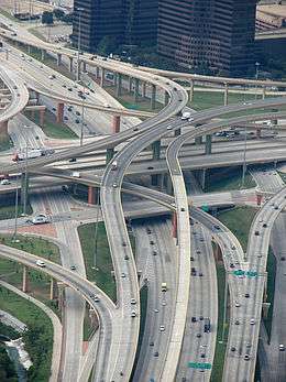
High-capacity regional roads
There are some higher-capacity (i.e. not just single-carriageway) sections of regional road, most notably the R113 (Belgard Road) and R445 (Old Naas Road), R132 Swords Inner By-pass and R136 Dublin Outer Ring Road which have sections of dual carriageway.
In some cases, important high-capacity urban routes are built or designated as regional roads, such as the mostly dual-carriageway R710 Waterford Outer Ring Road, or the R774 Greystones to the N11 link, which is dual-carriageway for its full length.
In many other cases, upgraded regional roads (for example, wide two-lane roads) were previously part of a national primary road, prior to the construction of a motorway or other bypass. In most cases, when a national primary road is changed by the creation of a bypass (motorway or other), the road previously forming part of the route is reclassified as a regional road rather than as a local road.
Route definitions
The current routes of all regional roads in Ireland – as defined by Statutory Instrument (S.I.) No 54/2012 (Classification of Regional Roads) Order 2012 under the Roads Act 1993 – are listed below. The S.I. specifies the start and end points of each route and the names of those townlands, villages, towns, and other settlements through which the route passes, as well as individual road names where necessary to establish the exact routing.
R101—R199
 North Circular Road, Dublin
 Blanchardstown – Malahide Road, Dublin
 Finglas – Killester, Dublin
 Finglas – Kilbarrack, Dublin
 Dublin – Howth, Co. Dublin
 Sutton – Malahide – Swords, Co. Dublin
 Dublin – Malahide, Co. Dublin
 Dublin – Naul, Co. Dublin – Drogheda. Co. Louth
 Chapelizod – Wolf Tone Quay, Dublin
 St Stephen's Green – Red Cow, Dublin
 Conyngham Road – Beach Road, Sandymount, Dublin
 Chapelizod – Churchtown – Mount Merrion, Co. Dublin
 Fonthill – Blackrock, Co. Dublin
 Dublin – Rathfarnham – Brittas, Co. Dublin
 Rathfarnham, Co. Dublin – Laragh, Co. Wicklow
 Ballyboden – Loughlinstown, Co. Dublin
 Dublin – Enniskerry – Kilcroney, Co. Wicklow
 Dublin – Blackrock, Co. Dublin and Dún Laoghaire – Lahaunstown, County Dublin
 Blackrock – Dún Laoghaire, Co. Dublin – Bray, Co. Wicklow
 Lucan – Rathcoole – Corbally, Co. Dublin
 Lucan – Blanchardstown – Skephubble, Co. Dublin
 Finglas – Balbriggan, Co. Dublin
 Maynetown – Balgriffin, Co. Dublin
 Snugborough – Malahide, Co. Dublin
 Swords, Co. Dublin – Dunshaughlin, Co. Meath – Kilcock, Co. Kildare
 Lissenhall – Portrane, Co. Dublin
 Blakes Cross – Skerries – Balbriggan, Co. Dublin
 Lusk – Rush – Skerries, Co. Dublin
 Coldwinters – Wyanstown, Co. Dublin
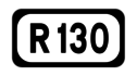 Coolquoy Common – Grallagh, Co. Dublin
 Drumcondra Road – East Link Bridge – Merrion Gates, Dublin
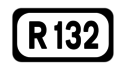 Dublin – Dundalk, Co. Louth (part of old National Route 1)
 Drummartin Link Road, Sandyford, Co. Dublin
 Nangor Road, Clondalkin, Co. Dublin
 Dublin – Ashbourne, Co. Meath (part of old National Route 2)
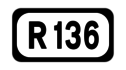 Lucan – Tallaght, Co. Dublin (Outer Ring Road)
 Dame Street – Tallaght, Co. Dublin (part of old National Route 81)
 O'Connell Bridge – Mount Merrion Avenue, Co. Dublin (part of old National Route 11)
 Clonshaugh – Baldoyle, Dublin (part of old National Route 32)
 Dublin – Clonee – Kells – Navan – Derver, Co. Meath (part of old National Route 3)
 Dublin – Kinnegad, Co. Westmeath (part of old National Route 4)
 Leixlip, Co. Kildare – Clonee, Co. Meath
 Drogheda, Co. Louth – Bettystown – Julianstown – Kentstown, Co. Meath
 Bettystown – Mornington, Co. Meath
 Drogheda, Co. Louth – Cushinstown, Co. Meath
 Navan – Balrath, Co. Meath
 Black Bull – Trim – Athboy, Co. Meath – Crossdoney, Co. Cavan
 Piercetown – Primatestown, Co. Meath
 Dunboyne – Summerhill, County Meath – The Downs, Co. Westmeath
 Dunboyne, Co. Meath – Maynooth, Co. Kildare
 Trim – Summerhill, County Meath – Kilcock, Co. Kildare
 Innfield – Laracor, Co. Meath
 Ballynadrumny, Co. Kildare – Trim, County Meath
 Navan, Co. Meath – Kinnegad, Co. Westmeath
 Navan, Co. Meath – Kingscourt, Co. Cavan – Monaghan
 Ballinlough Big – Kells – Slane, Co. Meath
 Ballyboy – Kells – Moynalty, Co. Meath – Kingscourt, Co. Cavan
 Blakestown, Co. Louth – Kingscourt – Knockanoark – Rakenny, Co. Cavan
 Mell, Co. Louth – Drogheda – Clogherhead – Castlebellingham – Tallanstown, Co. Louth
 Drogheda – Termonfeckin, Co. Louth
 Drogheda – Collon, Co. Louth
 Dunleer – Collon, Co. Louth
 Ardee – Dunleer – Murrays Cross, Co. Louth
 Ardee – Louth – Dundalk, Co. Louth
 Green Gates – Blackrock – Dundalk, Co. Louth
 Dundalk – Carlingford – County Bridge, Co. Louth
 Feede – Rockmarshall, Co. Louth
 The Bush – Greenore, Co. Louth
 Carlingford – Saint James Well, Co. Louth
 Dundalk – Drumbilla, Co. Louth
 Dundalk, Co. Louth – Carrickmacross, Co. Monaghan – Bailieborough – Virginia, Co. Cavan
 Kingscourt, Co. Cavan – Carrickmacross – Corcullioncrew, Co. Monaghan
 Carrickmacross – Ballybay, Co. Monaghan
 Shercock, Co. Cavan – Castleblayney – Tullynagrow, Co. Monaghan
 Castleblayney – Lurganearly, Co. Monaghan
 Castleblayney – Ballybay – Clones, Co. Monaghan
 Clontibret – Ballybay, Co. Monaghan
 Cavanreagh – Glasslough – Kiltybeggs, Co. Monaghan
 Monaghan – Drumfurrer, Co. Monaghan
 Annaghervy – Inishammon, Co. Monaghan
 Monaghan – Cootehill, Co. Cavan – Cavan
 Monaghan – Newbliss – Dyan, Co. Monaghan
 Ballybay, Co. Monaghan – Cootehill, Co. Cavan
 Mullagh – Bailieborough – Cootehill, Co. Cavan
 Shercock – Cootehill, Co. Cavan
 Rockcorry – Anny, Co. Monaghan
 Moynalty, Co. Meath – Virginia, Co. Cavan – Longford
 Virginia, Co. Cavan – Castlepollard, Co. Westmeath
 New Inn – Ballyjamesduff, Co. Cavan
 Belturbet – Corrarod, Co. Cavan
 Cavan – Arvagh, Co. Cavan – Longford
 Crossdoney, Co. Cavan – Ballinamore, Co. Leitrim
R200—R299
 Derrynacreeve, Co. Cavan – Drumkeeran, Co. Leitrim
 Belturbet – Killeshandra, Co. Cavan – Drumsna, Co. Leitrim
 Dromod, Co. Leitrim – Derrynacreeve, Co. Cavan
 Arvagh, County Cavan – Carrigallen, Co. Leitrim
 Carigallen – Ballinamore, Co. Leitrim
 Garadice, Co. Leitrim – Gortawee, Co. Cavan
 Glangevlin – Blacklion, Co. Cavan
 Drumshanbo, Co. Leitrim – Dowra, Mullaghahy, Co. Cavan
 Drumshanbo – Ballinamore, Co. Leitrim
 Drumheckil – Fenagh, Co. Leitrim
 Drumaleague – Drumcong, Co. Leitrim
 Cappoge – Mooremount, Co. Louth
 Clones, Co. Monaghan – Ballyhaise, Co. Cavan – Cavan
 Tyholland – Castleshane, Co. Monaghan
 Castleshane – Drumbeo, Co. Monaghan
 De Valera Road and Port Road, Letterkenny, Co. Donegal
 Glencolmbkille – Ardara. Co. Donegal
 Ballyshannon – Ballintra, Co. Donegal
 Eaghy – Pettigoe, Co. Donegal
 Pettigoe – Lough Derg, Co. Donegal
 Pettigoe – Letter Bridge, Co. Donegal
 Castlefinn – Alt Upper, Co. Donegal
 Stranorlar – Dunmore, Co. Donegal
 Newtowncunningham – Athaghaderry, Co. Donegal
 Ring of Inishowen, Co. Donegal
 Muff – Burnfoot – Carrownamaddy, Co. Donegal
 Quigleys Point – Carndonagh, Co. Donegal
 Moville – Portsallagh, Co. Donegal
 Doon Bridge – Malin – Slievebane, Co. Donegal
 Malin – Templemoyle Cross, Co. Donegal
 Drumfree – Gleneely, Co. Donegal
 Letterkenny – Rathmelton – Creeslough, Co. Donegal
 Kilmacrennan – Millford – Portsalon, Co. Donegal
 Rathmelton – Carrowkeel – Cionn Fhanáda, Co. Donegal
 Carrigart – Na Dúnaibh, Co. Donegal
 Kilmacrenan – Rathmelton, Co. Donegal
 Letterkenny – Glenties, Co. Donegal
 Doon Glebe – Gaoth Dobhair, Co. Donegal
 Ballybofey – An Clochán Liath, Co. Donegal
 Ballybofey – Glenties, Co. Donegal
 Carrickyscanlan – An Dúchoraidh, Co. Donegal
 An Tearmann – Drumfin, Co. Donegal
 Glenveagh – An Fál Carrach, Co. Donegal
 Gort an Choirce – Doirí Beaga – Croithlí, Co. Donegal
 Acomhal Ghaoth Dobhair – Cé an Bhuna Bhig, Co. Donegal
 Croithlí – Ailt an Choráin – An Clochán Liath, Co. Donegal
 Ailt an Choráin – Cé Ailt an Choráin, Co. Donegal
 Maas – Ardara, Co. Donegal
 Glenties – Mountcharles, Co. Donegal
 Aghayeevoge – Killybegs – Málainn Bhig, Co. Donegal
 Raphoe – Lifford, Co. Donegal
 Rossgeir – Saint Johnstown – Newtowncunningham, Co. Donegal
 Mín Doire Abhainn – Aerfort na Carraige Finne, Co. Donegal
 The Diamond, Donegal and Ballyshannon – Bundoran, Co. Donegal (part of old National Route 15)
 Portsalon Coast Road, Co. Donegal
 Sligo Airport Road, Strandhill, Co. Donegal
 Sligo – Cornalaghta, Co. Leitrim
 Cliffoney – Mullaghmore, Co. Sligo
 Bundoran, Co. Donegal Manorhamilton – Carrick-on-Shannon, Co. Leitrim
 Kinlough – Conray – Glenfarne, Co. Leitrim
 Manorhamilton – Dooard, Co. Leitrim
 Manorhamilton – Kiltyclogher, Co. Leitrim
 Carrowroe, Co. Sligo – Leitrim
 Ardcarn – Keadew – Mountallen, Co. Roscommon
 Sligo – Pollboy, Co. Leitrim
 Sligo – Killarga, Co. Leitrim
 Dromahair – Sriff, Co. Leitrim
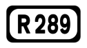 Dromahair – Corderry, Co. Leitrim
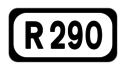 Gortlownan – Ballisadare, Co. Sligo
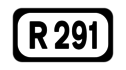 Sligo – Rosses Point, Co. Sligo
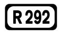 Sligo – Strandhill – Ballisadare, Co. Sligo
 Ballynaboll, Co. Sligo – Ballaghaderreen, Co. Roscommon – Ballyhaunis, Co. Mayo
 Boyle, Co. Roscommon – Tobercurry, Co. Sligo – Ballina, Co. Mayo
 Ballymote, Co. Sligo – Boyle, Co. Roscommon
 Ballymote – Quarryfield, Co. Sligo
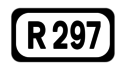 Dromore West, Co. Sligo – Dooyeaghvy, Co. Mayo
 Inishcrone – Carrownurlar, Co. Sligo
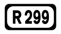 Drumsna – Drumheckil, Co. Leitrim
R300—R399
 Partry, Co. Mayo – An Fhairche, Co. Galway
 Castlebar – Rahans, Co. Mayo
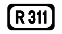 Castlebar – Newport, Co. Mayo
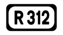 Castlebar – Bellacorick, Co. Mayo
 Bangor – An Fod Dubh, Co. Mayo
 Béal an Mhuirthead – Ballycastle – Ballina, Co. Mayo
 Pontoon – Crossmolina – Ballycastle, Co. Mayo
 Bogadoon – Crossmolina, Co. Mayo
 Newport – Boggy, Co. Mayo
 Foxford – Pontoon, Co. Mayo
 Mallaranny – Keem, Co. Mayo
 Swinford – Claremorris, Co. Mayo
 Ballylahan – Bohola – Kiltimagh, Co. Mayo
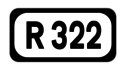 Kiltimagh – Kilkelly, Co. Mayo
 Kiltimagh – Knock – Ballyhaunis, Co. Mayo
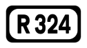 Balla - Kiltimagh, Co. Mayo
 Glentavraun, Co. Mayo – Cloonarragh, Co. Roscommon
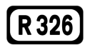 Loughglinn - Meelick, Co. Roscommon
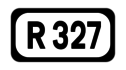 Cuilmore, Co. Mayo – Pollremon, Co. Galway
 Ballindine, Co. Mayo – Moylough, Co. Galway
 Knock, Co. Mayo (part of old National Route 17)
 Westport – Partry, Co. Mayo
 Claremorris – Ballinrobe, Co. Mayo
 Moylough – Tuam, Co. Galway – Kilmaine, Co. Mayo
 Tuam – Headford, Co. Galway
 Ballinrobe – Neale, Co. Mayo – Headford, Co. Galway
 Westport – Louisburgh – Leenane, Co. Mayo
 Leenaun – An Teach Dóite – An Spidéal, Co. Galway – Galway
 Taylors Hill, Galway
 Salthill – Newcastle – Oranmore, Co. Galway
 Galway – Caltra, Co. Galway
 Scrib – Sraith Salach, Co. Galway
 Ballinafad – Roundstone – Clifden, Co. Galway
 Lettershinna – Doire Fhada Thiar, Co. Galway
 Casla – An Cheathrú Rua, Co. Galway
 Sraith Salach – Kylemore, Co. Galway
 An Mám, Co. Galway – Neale, Co. Mayo
 Cong – Cross, Co. Mayo
 Kinvarra – Craughwell – Tuam, Co. Galway
 Derrydonnell – Athenry – Ballinasloe, Co. Galway
 Loughrea – Tallyho Cross, Co. Galway
 Loughrea – Bellafa, Co. Galway
 Loughrea – Woodford, Co. Galway
 Portumna, Co. Galway – Ennis, Co. Clare
 Portumna – Ballinasloe, Co. Galway
 Portumna – Ballinasloe, Co. Galway
 Killimor, Co. Galway – Cloghan, Co. Offaly
 Athleague, Co. Roscommon – Ballinasloe, Co. Galway – Blue Ball, Co. Offaly
 Ballinasloe – Mount Bellew Bridge, Co. Galway
 Mount Bellew Bridge – New Inn, Co. Galway
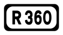 Dunmore – Ballymoe, Co. Galway
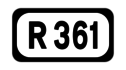 Williamstown, Co. Galway – Castlerea, Co. Roscommon – Boyle, Co. Roscommon
 Dunmore, Co. Galway – Athleague, Co. Roscommon – Athlone, Co. Westmeath
 Newsbridge, Co. Galway – Bellanamullia, Co. Roscommon
 Moylough – Ballymoe, Co. Galway
 Marlay – Ballynahowna, Co. Galway
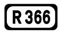 Roscommon – Aghagower, Co. Roscommon
 Ballymoe, Co. Galway – Tulsk, Co. Roscommon
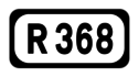 Four Mile House – Strokestown, Co. Roscommon – Carrick-on-Shannon, Co. Leitrim
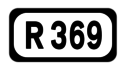 Elphin – Gortnagoyne, Co. Roscommon
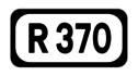 Frenchpark, Co. Roscommon – Carrick-on-Shannon, Co. Leitrim
 Roosky, Co. Leitrim – Ballyleague, Co. Roscommon
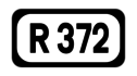 Na Doiriú Theas – Cé Nua Ros an Mhíl, Co. Galway
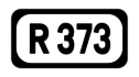 Breaffy – Castlebar, Co. Mayo
 Casla – Leitir Mealláin, Co. Galway
 Swinford – Kilkelly, Co. Mayo
 Lurga Upper – Knock Airport
 Castleplunket – Castlerea, Co. Roscommon
 Louisburgh – Roonagh Pier, Co. Mayo
 Streamstown – Cleggan, Co. Galway
 Kilbeggan – Skeagh, Co. Westmeath
 Mullingar – Ballymore – Athlone, Co. Westmeath
 Mullingar – Horseleap, Co. Westmeath – Clara, Co. Offaly
 Mullingar, Co. Westmeath – Ballymahon – Lanesborough, Co. Longford
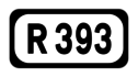 Mullingar – Ballinacarrigy, Co. Westmeath – Longford
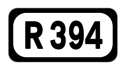 Tullanisky, Co. Westmeath – Kilcogy, County Cavan
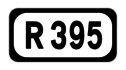 Delvin – Castlepollard, Co. Westmeath – Edgeworthstown, Co. Longford
 Coole, Co. Westmeath – Granard, Co. Longford
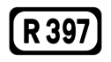 Longford – Ballymahon, Co. Longford
 Derraghan More – Brickeens, Co. Longford
 Kilcurry – Ratharney, Co. Longford
R400—R499
 Mullingar, Co. Westmeath – Cushina, Co. Offaly
 Kinnegad, Co. Westmeath – Edenderry, County Offaly – Kildare
 Innfield, Co. Meath – Ballina Cross, Co. Offaly
 Lucan, Co. Dublin – Clane – Carbury, Co. Kildare
 Leixlip – Saint Wolstans, Co. Kildare
 Maynooth, Co. Kildare – Newcastle, Co. Dublin
 Maynooth – Barberstown Cross, Co. Kildare
 Kilcock – Naas, Co. Kildare
 Maynooth – Prosperous, Co. Kildare
 Blackwood Cross – Naas, Co. Kildare
 Naas, Co. Kildare – Blessington, Co. Wicklow
 Naas, Co. Kildare – Hollywood, Co. Wicklow
 Stephenstown South, Co. Kildare – Whitestown, Co. Wicklow
 Kildare – Kilcullen – Ballymore Eustace, Co. Kildare
 Shee Bridge – Monasterevin, Co. Kildare
 Allenwood Cross – Kildare – Crookstown Upper, Co. Kildare
 Milltown – Droichead Nua – Kinnegad Cross, Co. Kildare
 Monasterevin, Co. Kildare – Carlow
 Athy – Castledermot, Co. Kildare – Tullow, Co. Carlow
 Greatheath – Portarlington, Co. Laois – Bracknagh, Co. Offaly – Rathangan, Co. Kildare
 Killinure, Co. Laois – Bawnoges, Co. Westmeath
 Tullamore, Co. Offaly – Roscrea, Co. Tipperary
 Cappakeel – New Inn – Mountmellick – Coolagh Cross, Co. Laois
 Portarlington, Co. Offaly – Mountmellick – Mountrath, Co. Laois
 Lea Cross, Co. Laois – Monasterevin, Co. Kildare
 Rathbrennan – Abbeyleix, Co. Laois
 Portlaoise – Castlecomer, Co. Kilkenny
 Cashel – Stradbally, Co. Laois – Cloney, Co. Kildare
 Stradbally, Co. Laois – Athy, Co. Kildare
 Ballickmoyler, Co. Laois – Maganey Cross, Co. Kildare
 Carlow – Mountrath, Co. Laois
 Crettyard – Molloys Cross, Co. Laois
 Abbeyleix, Co. Laois – Ballyragget, Co. Kilkenny
 Abbeyleix, Co. Laois – Templemore, Co. Tipperary
 Borris-in-Ossory – Durrow, Co. Laois
 Borris-in-Ossory – Rathdowney, Co. Laois – Balief Cross, Co. Kilkenny
 Kilbeggan, Co. Westmeath – Ferbane, Co. Offaly
 Ferbane – Kilcormac, Co. Offaly
 Borrisokane, Co. Tipperary – Cloghan, Co. Offaly
 Birr – Banagher, Co. Offaly
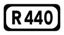 Birr – Kinnity, Co. Offaly – Mountrath, Co. Laois
 Rhode – Edenderry, Co. Offaly
 Clonbullogue – Bracknagh, Co. Offaly
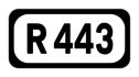 Ring Road, Tullamore, Co. Offaly
 Shannonbridge – Clonmacnoise, Co. Offaly – Farnagh, Co. Westmeath
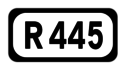 Naas, Co. Kildare – Portlaoise, Co. Laois – Roscrea – Nenagh, Co. Tipperary – Limerick – Crathloemoyle, Co. Clare (part of old National Routes 7 and 18)
 Kinnegad, Co. Westmeath – Galway (old National Route 6)
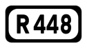 Naas, Co. Kildare – Waterford (old National Route 9)
 Collinstown – Celbridge, Co. Kildare
 Gort, Co. Galway – Smithstown, Co. Clare (part of old National Route 18)
 Doolin – Doolin Pier, Co. Clare
 Gort, Co. Galway – Corofin – Milltown Malbay, Co. Clare
 Gort, Co. Galway – Scarriff, Co. Clare
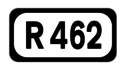 Gort, Co. Galway – Cratloe, Co. Clare
 Limerick – Killaloe – Scarriff, Co. Clare
 Limerick – Parteen, Co. Clare
 Parkroe – Bodyke, Co. Clare
 Cloughan – Broadford, Co. Clare – Birdhill, Co. Tipperary
 Clogher – Rosneillan, Co. Clare
 Ballynahinch – Feakle, Co. Clare
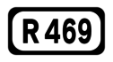 Kilmurry – Ennis, Co. Clare
 Newmarket-on-Fergus – Sixmilebridge, Co. Clare
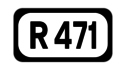 Shannon Town – Cloonlara, Co. Clare
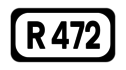 Newmarket-on-Fergus – Shannon, Co. Clare
 Ennis – Killadysert – Kilrush Pier, Co. Clare
 Ennis – Milltown Malbay, Co. Clare
 College Green, Ennis, Co. Clare
 Ennis – Lisdoonvarna, Co. Clare
 Ballvaughan – Black Head – Lisdoonvarna, Co. Clare
 Lisdoonvarna – Cliffs of Moher – Lehinch, Co. Clare
 Ballynalackan – Coogyulla, Co. Clare
 Ballyvaughan – Leamaneh Cross, Co. Clare
 Kilfenora – Ennistimon, Co. Clare
 Spanish Point Road, Co. Clare
 Cloonadrum – Kilrush, Co. Clare
 Doonbegh – Creegh – Knockalough, Co. Clare
 Derrycrossaun Cross – Corrowniska, Co. Clare
 Carrowbane – Killimer Ferry, Co. Clare
 Kilkee – Loop Head, Co. Clare
 Breaghva – Carrigaholt, Co. Clare
 Portumna, Co. Galway – Birr, Co. Offaly
 Borrisokane, Co. Tipperary - Moneygall, Co. Offaly
 Nenagh – Cloughjordan, Co. Tipperary – Shinrone, Co. Offaly – Roscrea, Co. Tipperary
 Sharavogue – Shinrone, Co. Offaly
 Nenagh – Coolbaun – Carrigahorrig, Co. Tipperary
 Nenagh – Ballina - Birdhill, Co. Tipperary
 Nenagh – Dromineer, Co. Tipperary
 Kilmastulla, Co. Tipperary – Killaloe, Co. Clare
 Nenagh – Dolla – Tipperary, Co. Tipperary
 Nenagh – Thurles, Co. Tipperary
 Toomyvara – Dolla – Boher, Co. Tipperary
R500—R599
 Nenagh – Silvermines, Co. Tipperary
 Templemore – Borrisoleigh, Co. Tipperary
 Templemore, Co. Tipperary – Johnstown, Co. Kilkenny
 Limerick – Milestone – Thurles, Co. Tipperary
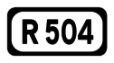 Birdhill – Newport, Co. Tipperary
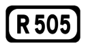 Grange East, Co. Limerick – Dundrum – Cashel, Co. Tipperary
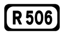 Annacotty - Cappamore, Co. Limerick
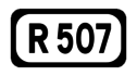 Cluggin Cross - Doon, Co. Limerick
 Childers Road, Limerick
 Dock Road - Ballycummin, Limerick
 Limerick - Crean, Co. Limerick
 Limerick – Kilmallock, Co. Limerick - Fermoy, Co. Cork
 Bearys Cross, Co. Limerick - Mitchelstown, Co. Cork
 Rockstown - Herbertstown, Co. Limerick
 Tipperary - Charleville, Co. Cork - Abbeyfeale, Co. Limerick
 Emly, Co. Tipperary - Bruff - Croom, Co. Limerick
 Kilmallock, Co. Limerick - Mitchelstown, Co. Cork
 Kilmallock - Rathkeale - Askeaton, Co. Limerick (part of old National Route 69)
 Adare - Drumcolliher, Co. Limerick
 Ballynaskig - Ballykevan - Newcastle West, Co. Limerick
 Newcastle West - Foynes, Co. Limerick
 Newcastle West, Co. Limerick - Kildorrery, Co. Cork
 Rathkeale, Co. Limerick - Listowel, Co. Kerry (part of old National Route 21)
 Glin - Athea - Abbeyfeale, Co. Limerick
 Dalys Cross - Montpelier, Co. Limerick
 Patrickswell, Co. Limerick - Limerick (part of old National Route 20)
 Caherdavin - Ballysimon Road, Limerick (part of old National Routes 18 and 24)
 Doirín Dún Aodha - Guagán Barra, Co. Cork
 An Mhuiríoch - An Fheothanach - Dingle, Co. Kerry
 Crosaire na Coille Móire - Srón Bhroin, Co. Kerry
 Tarbert - Ballybunion - Tralee, Co. Kerry
 Ballylongford - Listowel, Co. Kerry
 Listowel - Ballybunion, Co. Kerry
 Ballyconry - Lisselton, Co. Kerry
 Listowel, Co. Kerry - Abbeyfeale, Co. Limerick
 Ballyduff – Tralee, Co. Kerry
 Abbeydorney – Listowel, Co. Kerry
 Tralee – Fenit, Co. Kerry
 Dingle – Ceann Sléibhe – Baile an Fheirtéaraigh, Co. Kerry
 Camp – An Conair, Dingle, Co. Kerry
 Farranfore – Castlemaine – Anascaul, Co. Kerry
 Milltown – Fossa, Co. Kerry
 Glenbeigh – Rossbeigh, Co. Kerry
 Caherciveen – Portmagee – Knightstown, Co. Kerry
 Kilcoman – Baile an Sceilg – Portmagee, Co. Kerry
 Kineigh Cross – Emlaghmore, Co. Kerry
 Sneem – Molls Gap, Co. Kerry
 Kenmare – Poulgorm, Co. Kerry
 Glenflesk – Barraduff, Co. Kerry
 Kenmare, Co. Kerry – Castletownbere, Co. Cork
 Glengarriff – Dursey Sound, Co. Cork
 Tuosist – Lauragh, Co. Kerry
 Derreen, Co. Kerry – Healy Pass – Adrigole, Co. Cork
 Barnes Gap – Eyeries, Co. Cork
 Wellesley Bridge, Co. Kerry – Kippagh Junction, Co. Cork
 Castleisland, Co. Kerry – Clonbannin, Co. Cork
 Ballydesmond – Newmarket - Charleville, Co. Cork
 Broadford, Co. Limerick – Kanturk, Co. Cork – Cork
 Kanturk – Buttevant, Co. Cork
 Twopothouse – Doneraile, Co. Cork
 Ballydesmond, Co. Cork – Rathmore, Co. Kerry – Macroom, Co. Cork
 Millstreet – Sandpit Cross, Co. Cork
 Macroom – Ballylickey, Co. Cork
 Crookstown – Kealkill, Co. Cork
 Bandon – Bantry, Co. Cork
 Macroom – Dunmanway, Co. Cork
 Capeen – Clonakilty, Co. Cork
 Bandon – Ballyheedy, Co. Cork
 Crookstown – Bandon, Co. Cork
 Bantry – Crookhaven, Co. Cork
 Ballydehob – Toormore, Co. Cork
 Skibereen – Drimoleague, Co. Cork
 Aghaville – Derreeny, Co. Cork
 Skibbereen – Baltimore, Co. Cork
 Skibbereen – Castletownshend, Co. Cork
 Leap – Glandore – Rosscarbery, Co. Cork
 Burgatia Cross – Owenahincha – Tulligee, Co. Cork
 Dunmanway – Clonakilty, Co. Cork
R600—R699
 Cork Airport – Kinsale – Clonakilty, Co. Cork
 Timoleague – Courtmacsherry, Co. Cork
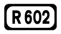 Bandon – Timoleague, Co. Cork
 Bandon – Garranereagh, Co. Cork
 Ballinspittle – Old Head of Kinsale – Barrell Cross, Co. Cork
 Innishannon – Kinsale, Co. Cork
 Ballythomas Cross – Archdeacon Duggan Bridge, Co. Cork
 Halfway – Kinsale, Co. Cork
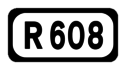 Cork – Ballincollig, Co. Cork
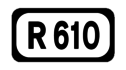 Cork – Passage West – Raffeen, Co. Cork
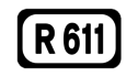 Shannonpark – Belgooly, Co. Cork
 Carrigaline – Crosshaven, Co. Cork
 Ringaskiddy – Ballinhassig, Co. Cork
 Cork – Rathcormack, Co. Cork
 Cork – Riverstown, Co. Cork
 White's Cross – Annacarton Bridge, Co. Cork
 Blarney – Cloghroe, Co. Cork
 Cork – Coachford – Macroom, Co. Cork
 Farnanes – Mallow, Co. Cork
 Dromahane – Mallow, Co. Cork
 Gortnagross – Newberry Cross, Co. Cork
 Cloghroe – Cannon's Cross, Co. Cork
 Little Island Loop Road, Co. Cork
 Tullagreen – Cobh, Co. Cork
 Midleton – Rathcormack, Co. Cork
 Midleton, Co. Cork – Tallow, Co. Waterford
 Rathcormack, Co. Cork – Tallow, Co. Waterford
 Midleton – Ballycotton, Co. Cork
 Ballynacorra – Whitegate, Co. Cork
 Cloyne – Rostellan, Co. Cork
 Castlemartyr – Shangarry, Co. Cork
 Kelly – Ladysbridge, Co. Cork
 Youghal, Co. Cork – Tallow Bridge, Co. Waterford
 Northern Ring Road, Cork
 Manch West – Drinagh – Skibbereen, Co. Cork
 Robb's Bridge – Clyda Bridge Lower, Mallow, Co. Cork
 Durrow, Co. Laois – Cashel – Caher, Co. Tipperary – Mitchelstown – Fermoy – Dunkettle, Co. Cork (part of old National Route 8)
 Knockagh – Caher. Co. Tipperary
 Victoria Cross – Doocloyne, Cork
 Thurles – Suir Bridge, Co. Tipperary
 Thurles – Holycross – Cashel, Co. Tipperary
 Holycross – Tipperary, Co. Tipperary
 Tipperary – Ballyfauskeen Cross, Co. Limerick
 Bansha, Co. Tipperary – Galbally – Newtown, Co. Limerick
 Tipperary – Newtown, Co. Limerick
 Mitchelstown, Co. Cork – Clonmel, Co. Tipperary
 Fermoy, Co. Cork – Lismore, Co. Waterford
 Molly Barrys Cross – Ballyderown Cross, Co. Cork
 Caher – Clogheen, Co. Tipperary – Lismore, Co. Waterford
 Glentanagree Bridge – Cappoquin, Co. Waterford
 Caher – Ardfinnan, Co. Tipperary
 Clonmel, Co. Tipperary – Kilcloher – Piltown Cross, Co. Waterford
 Knockaraha Bridge – Ballymacmague – Dungarvan, Co. Waterford
 Kielys Cross – Ardmore – Clearys Cross, Co. Waterford
 Killongford – Ceann Heilbhic, Co. Waterford
 Dungarvan – Tramore – Waterford, Co. Waterford
 Lemybrien, Co. Waterford – Carrick-on-Suir, Co. Tipperary
 Carrick-on-Suir, Co. Tipperary – Seafield, Co. Waterford
 Clonmel, Co. Tipperary – Lowrys Bridge, Co. Waterford
 Kilmacthomas, Co. Waterford
 Clonmel - Carrick-on-Suir, Co. Tipperary – Ballyduff, Co. Waterford – Waterford
 The Sweep - Knockmahon, Co. Waterford
 Bawnfune - Tramore, Co. Waterford
 Waterford – Passage East, Co. Waterford
 Blenheim Cross, Waterford – Dunmore East, Co. Waterford
 Kilmacomb – Tramore, Co. Waterford
 Morissons Road, Waterford
 New Inn – Clonmel, Co. Tipperary
 Cashel – Clonmel, Co. Tipperary
 Urlingford, Co. Kilkenny – Clonmel, Co. Tipperary
 Tranagh – Ninemilehouse, Co. Tipperary
 Cashel – Killenaule, Co. Tipperary – Ballymack, Co. Kilkenny
 Cashel – Fethard, Co. Tipperary – Mullinahone – Callan, Co. Kilkenny
 Urlingford, Co. Kilkenny – Kilkenny
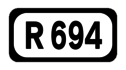 Freshford – Ballyragget – Castlecomer, Co. Kilkenny
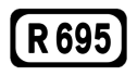 Kilkenny – Kilmanagh – Callan, Co. Kilkenny
 Carrick-on-Suir – Glenbower, Co. Kilkenny
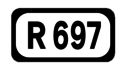 Carrick-on-Suir, Co. Tipperary – Kilkenny
 Callan – Baunreagh – Pilltown, Co. Kilkenny – Mountbelton, Co. Waterford
 Callan – Knocktopher, Co. Kilkenny
R700—R774
 Kilkenny – Thomastown, Co. Kilkenny – New Ross, Co. Wexford
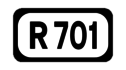 Kilmaganny – Sheepstown, Co. Kilkenny
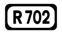 Coolgrange – Gowran, Co. Kilkenny – Enniscorthy, Co. Wexford
 Thomastown, Co. Kilkenny – Ballymurphy Co. Carlow
 Mullinavat, Co. Kilkenny – New Ross, Co. Wexford
 Leighlinbridge – Borris, Co. Carlow – Stripes, Co. Kilkenny
 Fethard – Kilsheelan, Co. Tipperary
 Ballingarrane – Moangarriff – Clonmel, Co. Tipperary
 Waterford – Waterford Airport – Kilmacleague, Co. Waterford
 Inner Ring Road, Waterford
 Outer Ring Road, Waterford
 Waterford – Slieveroe, Co. Kilkenny
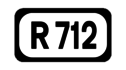 Kilkenny – Paulstown, Co. Kilkenny (part of old National Route 10)
 Danesfort – Ballyhale, Co. Kilkenny (part of old National Route 10)
 Royaloak – Bagenalstown – Kildavin, Co. Carlow
 Carlow – Tullow, Co. Carlow – Gorey, Co. Wexford
 Rathvilly – Carlow, Co. Carlow
 Straboe – Hacketstown, Co. Carlow
 Borris, Co. Carlow - New Ross, Co. Wexford
 Kiltealy, Co. Wexford – Wexford
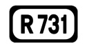 Ballynabanoge – Ballinlug East, Co. Wexford
 Coolnaveagh – Raheenagurren East, Co. Wexford
 New Ross – Arthurstown – Wellingtonbridge, Co. Wexford – Wexford
 Slaght – Hook Head, Co. Wexford
 Dunmain – Ballymackesy, Co. Wexford
 Ballynabola – Wellingtonbridge – Rosslare, Co. Wexford
 Haggard – Duncannon, Co. Wexford
 Ballyhit – Waddingtown – Baldwinstown, Co. Wexford
 Ballykilliane – Kilmore Quay, Co. Wexford
 Ballybrennan Big – Rosslare, Co. Wexford
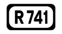 Wexford – Castlebridge – Gorey, Co. Wexford
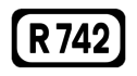 Faheys Cross – Courtown – Gorey, Co. Wexford
 Curracloe – White Gap, Co. Wexford
 Enniscorthy – Blackwater, Co. Wexford
 Wheelagower – Ferns, Co. Wexford
 Wheelagower – Bunclody, Co. Wexford – Croneyhorn, Co. Wicklow
 Mullmast, Co. Kildare – Hacketstown, Co. Carlow – Arklow, Co. Wicklow
 Carnew – Tinahely, Co. Wicklow
 Shillelagh – Tinahely, Co. Wicklow
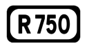 Arklow – Wicklow – Rathnew, Co. Wicklow
 Wicklow – The Beehive, Co. Wicklow
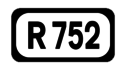 Rathnew – Woodenbridge, Co. Wicklow
 Aughrim – Ballinacarrig, Co. Wicklow
 Avoca – Ballinacor, Co. Wicklow
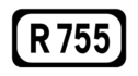 Rathdrum – Laragh – Kilmacanogue, Co. Wicklow
 Laragh – Wicklow Gap – Dunlavin, Co. Wicklow
 Laragh – Glendalough, Co. Wicklow
 Lockstown – Burgage Moyle, Co. Wicklow
 Tinode – Sally Gap – Draghmore, Co. Wicklow
 Enniskerry – Killough, Co. Wicklow
 Rathnew – Kilcoole – Bray, Co. Wicklow
 Greystones – Glen of the Downs, Co. Wicklow
 Ashford – Annamoe, Co. Wicklow
 Ashford – Roundwood, Co. Wicklow
 Newtownmountkennedy – Roundwood, Co. Wicklow
 The Strand, Bray, Co. Wicklow
 Bray – Hollybrook, Co. Wicklow
 Southern Ring Road, Bray, Co. Wicklow
 Ballindinas, Co. Wexford – Wexford
 Arthurstown v Ballyhack, Co. Wexford
 Newtownmountkennedy – Ashford – Rathnew – Arklow, Co. Wicklow – Gorey, Co. Wexford (part of old National Route 11)
 Jack White's Cross – Brittas, Co. Wicklow
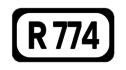 Willow Grove – Charlesland, Co. Wicklow
R801—R899
 North Wall, Dublin
 Dorset Street – Bath Road, Dublin
 Summerhill – Parnell Street, Dublin
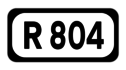 Granvy Row – Cork Street, Dublin
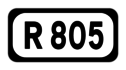 Ellis Quay – Finglas, Dublin
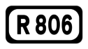 Blanchardstown – Manor Street, Dublin
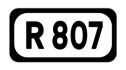 Clontarf Road, Dublin
 Artane – Clontarf, Dublin
 Raheny – Baldoyle, Co. Dublin
 Cornmarket – Inchicore, Dublin
 South Circular Road, Dublin
 Davitt Road, Dublin
 City Quay, Dublin
 Lombard Street East, Dublin
 Westland Row – Donnybrook, Dublin
 Baggot Street, Dublin
 Harolds Cross – Ballyboden, Co. Dublin
 Terenure – Walkinstown Roundabout, Co. Dublin
 Long Mile Road – Tallaght, Co. Dublin
 Rathmines – Milltown, Dublin
 Rathfarnham – Churchtown, Dublin
 Grange Road, Rathfarnham, Co. Dublin
 Ailesbury Road, Dublin
 Milltown – Blackrock, Co. Dublin
 Wyckham Way, Dundrum, Co. Dublin
 Blackrock – Cornelscourt, Co. Dublin
 Stradbrook Road, Killiney, Co. Dublin
 Monkstown – Dalkey, Co. Dublin
 Foxrock – Dún Laoghaire, Co. Dublin
 Sandycove Seafront, Co. Dublin
 Ballyfermot Road, Dublin
 Embankment Road, Clontarf, Dublin
 Woodville – Cooldrinagh, Co. Dublin
 Loughlinstown – Shankill, Co. Dublin
 Walkinstown Embankment Road, Co. Dublin
 Inchicore – Kilmainham, Dublin
 Earlsfort Terrace, Dublin
 Golden Ball – Cornellscourt, Co. Dublin
 Snugborough Road, Blanchardstown, Co. Dublin
 Sundays Well Road, Cork
 Christy Ring Bridge – Washington Street, Cork
 Grand Parade, Cork
 Glasheen Road and Bishopstown Road, Cork
 South Douglas Road and Grange Road, Cork
 Boreenmanagh Road and Skehard Road, Cork
 Well Road and Blackroad Road, Cork
 Saint Patricks Quay, Cork
 Carr's Hill, Douglas, Co. Cork
 Ennis Road, Limerick
 Lord Edward Street and New Road, Limerick
 Mungret – Quinns Cross, Limerick
 Saint Johns Street, Waterford
 Grannagh – Newrath, Co. Kilkenny
 Eglinton Street and University Road, Galway
 Salthill Road and Newcastle Road, Galway
 Ballypaan Road, Galway
 Headford Road, Galway
 Church Square, Monaghan
 Fermanagh Street, Clones, Co. Monaghan
 Pearse Road and Markievicz Road, Sligo
 Clon Road and Gort Road, Ennis, Co. Clare
 Mitchell Street, Nenagh, Co. Tipperary
 North Circular Road, Tralee, Co. Kerry
 Castle Street, Tralee, Co. Kerry
 Park Road and High Street, Killarney, Co. Kerry
 Port Road, Killarney, Co. Kerry
 Oakpark Road Tralee Co. Kerry replacing portion of N69 in Tralee
 Facksbridge – Miles, Clonakilty, Co. Cork
 Main Street, Mallow, Co. Cork
 Irishtown, Clonmel, Co. Tipperary
 Main Street, Carrick-on-Suir, Co. Tipperary
 New Road, Kilkenny
 Wolfe Tone Street and John Street, Kilkenny
 Dublin Road, Carlow
 John Street, Wexford
- R890 road : Blackstoops – Saint Johns Road, Enniscorthy, Co. Wexford
- R895 road : Cannon Row, Navan, Co. Meath
- R899 road : Greenhills Road, Drogheda, Co. Louth
R900—R941
- R900 road : West Street, Drogheda, Co. Louth
- R901 road : Main Street, Cavan
- R903 road : Main Street, Carrick-on-Shannon, Co. Leitrim
- R904 road : Dunloe street, Ballinasloe, Co. Galway
- R906 road : Link Road, Tipperary, Co. Tipperary
- R907 road : Main Street, Midleton, Co. Cork
- R908 road : The Front Strand, Youghal, Co. Cork
- R909 road : College Road, Kilkenny
- R910 road : Waterford Road, Kilkenny
- R911 road : Clogherane – Abbeyside, Dungarvan, Co. Waterford
- R912 road : Jordanstown – Paulstown, Co. Kilkenny
- R913 road : Mitchelstown Road – The Square, Caher, Co. Tipperary
- R914 road : Roscommon Road, Athlone, Co. Westmeath
- R915 road : Ballymahon Road, Athlone, Co. Westmeath
- R916 road : Waterhouse Road, Athlone, Co. Westmeath
- R917 road : Spencer Street, Castlebar, Co. Mayo
- R918 road : Little Bray – Fassaroe, Bray, Co. Wicklow
- R919 road : Killerisk Road, Tralee, Co. Kerry
- R920 road : Cloghore – Belleek Bridge, Co. Donegal
- R921 road : Merlin Park – Droughiska, Galway
- R923 road : Bishop Street, Tuam, Co. Galway
- R924 road : Church Street, Carlow, Co. Carlow
- R925 road : Killybegs Road, Donegal, Co. Donegal
- R926 road : Dooradoyle, Co. Limerick
- R927 road : Main Street, Carrickmacross, Co. Monaghan
- R928 road : Pearse Street, Ballina, Co. Mayo
- R929 road : Main Street, Ballyhaunis, Co. Mayo
- R930 road : Shortcastle Street, Mallow, Co. Cork
- R931 road : Bridge Street, Skibbereen, Co. Cork
- R932 road : Golden Road, Cashel, Co. Tipperary
- R933 road : Castle Street and Haggard Street, Trim, Co. Meath
- R934 road : Castletown Road, Dundalk, Co. Louth
- R935 road : Bellananagh Road, Cavan
- R936 road : Allingham Road, Ballyshannon, Co. Donegal
- R937 road : Dublin Road, Monaghan
- R938 road : Dublin Road, Castleblaney, Co. Monaghan
- R940 road : Ramelton Road, Letterkenny, Co. Donegal
- R941 road : Kells, Co. Meath
See also
- History of Roads in Ireland
- List of Ireland-related topics
- Local roads in Ireland
- Motorways in the Republic of Ireland
- National primary road
- National Roads Authority
- National secondary road
- Roads in Ireland
- Road signs in the Republic of Ireland
- Road speed limits in the Republic of Ireland
- Transport in Ireland
- Trunk Roads in Ireland
References
- Local Government (Roads and Motorways) Act, 1974
- S.I. No. 164/1977 — Local Government (Roads and Motorways) Act, 1974 (Declaration of National Roads) Order, 1977
- Roads Act, 1993
- S.I. No. 400/1994: Roads Act, 1993 (Declaration of Regional Roads) Order, 1994
- Roads Act 1993 (Classification of Regional Roads) Order 2006 – Department of Transport