Clackamas, Oregon
| Clackamas, Oregon | |
|---|---|
| Former Census-designated place (CDP) | |
|
Route 212 and SE 82nd Dr. in Clackamas, Oregon | |
 Location of Clackamas, Oregon | |
| Coordinates: 45°24′36″N 122°33′37″W / 45.41000°N 122.56028°WCoordinates: 45°24′36″N 122°33′37″W / 45.41000°N 122.56028°W | |
| Country | United States |
| State | Oregon |
| County | Clackamas |
| Area | |
| • Total | 2.18 sq mi (5.65 km2) |
| • Land | 2.18 sq mi (5.65 km2) |
| • Water | 0.0 sq mi (0.0 km2) |
| Elevation | 164 ft (50 m) |
| Population (2010) | |
| • Total | 6,965 |
| • Density | 3,195.0/sq mi (1,232.7/km2) |
| Time zone | Pacific (PST) (UTC-8) |
| • Summer (DST) | PDT (UTC-7) |
| ZIP code | 97015 |
| Area code(s) | 503 |
| FIPS code | 41-13450[1] |
| GNIS feature ID | 1166631[2] |

Clackamas is an unincorporated community and former census-designated place (CDP) in Clackamas County, Oregon, United States.[3] The population was 6,965 at the 2010 census. It is a suburb of Portland.
Clackamas has Camp Withycombe, a military base, and a branch of the Kaiser Permanente Hospital.
Geography
According to the United States Census Bureau, the CDP has a total area of 2.1 square miles (5.4 km2), all of it land.[4]
Demographics
As of the census[1] of 2000, there were 5,177 people, 2,000 households, and 1,336 families residing in the CDP. The population density was 2,425.3 people per square mile (938.4/km²). There were 2,133 housing units at an average density of 999.3 per square mile (386.6/km²). The racial makeup of the CDP was 85.28% White, 1.08% African American, 0.66% Native American, 6.32% Asian, 0.33% Pacific Islander, 2.70% from other races, and 3.63% from two or more races. Hispanic or Latino of any race were 5.95% of the population. 22.1% were of German, 10.8% English, 9.4% Irish and 6.3% American ancestry according to Census 2000.
There were 2,000 households out of which 36.2% had children under the age of 18 living with them, 49.9% were married couples living together, 11.5% had a female householder with no husband present, and 33.2% were non-families. 25.5% of all households were made up of individuals and 5.1% had someone living alone who was 65 years of age or older. The average household size was 2.58 and the average family size was 3.12.
In the CDP the population was spread out with 27.0% under the age of 18, 9.9% from 18 to 24, 34.1% from 25 to 44, 22.5% from 45 to 64, and 6.5% who were 65 years of age or older. The median age was 33 years. For every 100 females there were 96.5 males. For every 100 females age 18 and over, there were 96.3 males.
The median income for a household in the CDP was $44,478, and the median income for a family was $50,607. Males had a median income of $40,614 versus $26,863 for females. The per capita income for the CDP was $21,672. About 8.2% of families and 9.4% of the population were below the poverty line, including 12.1% of those under age 18 and 8.6% of those age 65 or over.
Education
Clackamas is served by Clackamas High School, one of three high schools in the North Clackamas School District.
Transportation
Highways
Oregon Route 212 and Interstate 205 pass through Clackamas.
Public transportation
Clackamas is served by a number of TriMet bus lines and the MAX Light Rail Green Line.
Aerial transportation
Clackamas does not have a public airport, however Portland International Airport (PDX) is approximately 15 miles north.
External links
![]() Media related to Clackamas, Oregon at Wikimedia Commons
Media related to Clackamas, Oregon at Wikimedia Commons
References
- 1 2 "American FactFinder". United States Census Bureau. Archived from the original on 2013-09-11. Retrieved 2008-01-31.
- ↑ "US Board on Geographic Names". United States Geological Survey. 2007-10-25. Retrieved 2008-01-31.
- ↑ http://www2.census.gov/geo/pvs/bas/bas11/st41_or/cou/c41005_clackamas/BAS11C24100500000_000.pdf
- ↑ "US Gazetteer files: 2010, 2000, and 1990". United States Census Bureau. 2011-02-12. Retrieved 2011-04-23.
Municipalities and communities of Clackamas County, Oregon, United States | ||
|---|---|---|
| Cities | 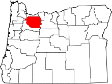 | |
| Hamlets | ||
| CDPs | ||
| Other unincorporated communities |
| |
| Footnotes | ‡This populated place also has portions in an adjacent county or counties | |