Zigzag, Oregon
| Zigzag | |
|---|---|
| Unincorporated community | |
 Zigzag  Zigzag Location within the state of Oregon | |
| Coordinates: 45°20′38″N 121°56′35″W / 45.34389°N 121.94306°WCoordinates: 45°20′38″N 121°56′35″W / 45.34389°N 121.94306°W | |
| Country | United States |
| State | Oregon |
| County | Clackamas |
| Elevation | 1,414 ft (431 m) |
| Time zone | Pacific (PST) (UTC-8) |
| • Summer (DST) | PDT (UTC-7) |
| ZIP code | 97049 |
| Area code(s) | 503 and 971 |
| GNIS feature ID | 1152771[1] |
Zigzag is an unincorporated community in Clackamas County, Oregon, United States. It is located within the Mount Hood Corridor, between Rhododendron and Welches on U.S. Route 26. The community is part of a local type of government called a village as one of the communities making up the Villages at Mount Hood, which stretches from the border of Sandy to Government Camp.
The community is named after the nearby Zigzag River, a tributary of the Sandy River, which is in turn a tributary of the Columbia River.[2] The place was also known as "Zig Zag".[1] Zigzag's elevation is 1,414 feet (431 m).[1]
History
Pioneer Joel Palmer crossed the deep ravine of Zigzag Canyon near the timberline on Mount Hood on October 11, 1845.[3] He described the crossing in his journal:
The manner of descending is to turn directly to the right, go zigzag for about one hundred yards, then turn short round, and go zigzag until you come under the place where you started from; then to the right, and so on, until you reach the base.
The Zigzag River is no more crooked than adjoining streams, therefore the stream was most likely identified to fellow travelers on what was to become the Barlow Road by the manner of crossing and not for an especially irregular alignment.[3]
Zigzag post office was established in 1917; it ran intermittently until 1974.[3] For a time the Zigzag post office was located in present-day Rhododendron.[3]
Historic structures
The 1935 Zigzag Ranger Station is listed on the National Register of Historic Places (NRHP). St. John the Evangelist Roman Catholic Church, another NRHP property, was formerly in the Zigzag area.[4] The ZigZag Inn—which, like the ranger station and church, is a rustic-style log structure—was built by William John "Bill" Lenz, son of the founder of Lenz in Hood River County.[5][6] Lenz built many other notable structures in the area.[5]
References
- 1 2 3 "Zigzag". Geographic Names Information System. United States Geological Survey. November 28, 1980. Retrieved 2009-12-29.
- ↑ Friedman, Ralph (1990). In Search of Western Oregon. Caldwell, Idaho: The Caxton Printers, Ltd. p. 622. ISBN 0-87004-332-3.
- 1 2 3 4 McArthur, Lewis A.; Lewis L. McArthur (2003) [1928]. Oregon Geographic Names (7th ed.). Portland, Oregon: Oregon Historical Society Press. ISBN 0-87595-277-1.
- ↑ "St. John the Evangelist Roman Catholic Church". Oregon Historic Sites Database: Oregon Department of Parks and Recreation. Retrieved 2009-12-29.
- 1 2 "History". ZigZag Inn. Retrieved 2009-12-29.
- ↑ Lenz, Jake (November 3, 1937). "Pioneers of the Hood River Valley". The Hood River County Sun. Retrieved 2009-12-29.
External links
- Historic image near Zigzag from Salem Public Library
- Historic images of Saint John the Evangelist Roman Catholic Church from the University of Oregon digital archives
Municipalities and communities of Clackamas County, Oregon, United States | ||
|---|---|---|
| Cities | 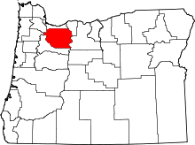 | |
| Hamlets | ||
| CDPs | ||
| Other unincorporated communities |
| |
| Footnotes | ‡This populated place also has portions in an adjacent county or counties | |