Cherryville, Oregon
Cherryville is an unincorporated community in Clackamas County, Oregon, United States.[1] It is about six miles east of Sandy on U.S. Route 26,[2] near the route of the Barlow Road.[3]
The name of the community is said to have come from the wild cherries that grew in the area.[4] Cherryville post office was established in 1884 and closed in 1958.[4] In 1915 Cherryville had a population of 50, a public school, and a church.[5] The church building is now gone, but the church cemetery still exists.[3]
References
- ↑ "Cherryville". Geographic Names Information System. United States Geological Survey. November 28, 1980. Retrieved 2010-12-30.
- ↑ Oregon Atlas & Gazetteer (7th ed.). Yarmouth, Maine: DeLorme. 2008. p. 29. ISBN 0-89933-347-8.
- 1 2 "Clackamas County, Oregon". Pioneer History to about 1900: Churches of Christ & Christian Churches in the Pacific Northwest. Northwest College of the Bible. Retrieved 2010-12-30.
- 1 2 McArthur, Lewis A.; McArthur, Lewis L. (2003) [1928]. Oregon Geographic Names (7th ed.). Portland, Oregon: Oregon Historical Society Press. p. 195. ISBN 978-0875952772.
- ↑ Friedman, Ralph (1990). In Search of Western Oregon (2nd ed.). Caldwell, Idaho: The Caxton Printers, Ltd. p. 621. ISBN 0-87004-332-3.
Municipalities and communities of Clackamas County, Oregon, United States | ||
|---|---|---|
| Cities | 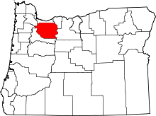 | |
| Hamlets | ||
| CDPs | ||
| Other unincorporated communities |
| |
| Footnotes | ‡This populated place also has portions in an adjacent county or counties | |
Coordinates: 45°22′01″N 122°09′18″W / 45.367064°N 122.155084°W
This article is issued from Wikipedia - version of the 9/27/2016. The text is available under the Creative Commons Attribution/Share Alike but additional terms may apply for the media files.