Camp Edwards Heliport
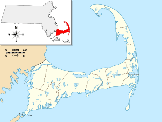
Camp Edwards Heliport (FAA LID: MA29) is a private use heliport located at Camp Edwards, a U.S. Army facility in Barnstable County, Massachusetts, United States. The airport is located three nautical miles (6 km) north of the central business district of Bourne, Massachusetts. It is owned by the Massachusetts Army National Guard.[1]
Facilities and aircraft
Camp Edwards Heliport has one helipad designated H1 with a concrete surface measuring 117 by 40 feet (36 x 12 m). There are 17 helicopters based at this facility.[1]
References
External links
Airports in the Cape and Islands Area |
|---|
|
| Primary | |
|---|
|
| Military | |
|---|
|
| General aviation | |
|---|
|
| Private | |
|---|
|
| Heliports |
- Brant Point
- Camp Edwards
- Cape Cod Canal
- Cotuit
- David Libby
- Falmouth Hospital
- Fuller House
- Marstons Mills
- North Bay
- North Chatham
- Seapuit
- Wayne
|
|---|
|
| Seaplane bases |
- Cuttyhunk Harbor
- Long Pond
- Marstons Mills
- Woods Hole
|
|---|
|
| Closed | |
|---|
|
|---|
|
| Primary | |
|---|
|
| Reliever | |
|---|
|
| General | |
|---|
|
| Public use | |
|---|
|
| Private use | |
|---|
|
| Military | |
|---|
|
| Defunct | |
|---|
|
|---|
|
| Active | | |
|---|
|
| Inactive | | Army | | Airfields | |
|---|
| | Armories | |
|---|
| | Arsenals | |
|---|
| | Bases | |
|---|
| | Camps | |
|---|
| | Centers | |
|---|
| | Firing Ranges | |
|---|
| | Forts | |
|---|
| | Heliports | |
|---|
| | Hospitals | |
|---|
| | Labs | |
|---|
| | Nike Sites |
- B-03C
- B-03L
- B-05C
- B-05L
- B-15C
- B-15L
- B-17C
- B-17H
- B-17L
- B-18
- B-21DC
- B-21HA
- B-36C
- B-36L
- B-37C
- B-37L
- B-38C
- B-38L
- B-40H
- B-55C
- B-55L
- B-63C
- B-63L
- B-73L
- B-84L
- B-85C
- B-85L
- PR-19C
- PR-19H
- PR-19L
- PR-29A
- PR-29C
- PR-29L
|
|---|
| | Plants | |
|---|
| | Proving grounds | |
|---|
| | Reservations | |
|---|
| | Training | |
|---|
|
|---|
| | Navy | | Air Stations | |
|---|
| | Airfields | |
|---|
| | Ammunition Depots | |
|---|
| | Areas | |
|---|
| | Auxiliary Air Facilities | |
|---|
| | Camps | |
|---|
| | Facilities | |
|---|
| | Hospitals | |
|---|
| | Plants | |
|---|
| | Outlying Landing Fields | |
|---|
| | Reserve Centers | |
|---|
| | Ranges | |
|---|
| | Test Stations | |
|---|
| | Yards | |
|---|
|
|---|
| Air
Force | | Bases | |
|---|
| | Centers | |
|---|
| | Facilities | |
|---|
| | Hospitals | |
|---|
| | Laboratories | |
|---|
| | Plants | |
|---|
| | Ranges | |
|---|
| | Stations | |
|---|
| | Texas Towers | |
|---|
|
|---|
| Coast
Guard | |
|---|
|
|---|