Barnstable County, Massachusetts
| Barnstable County, Massachusetts | ||
|---|---|---|
 Barnstable County Courthouse | ||
| ||
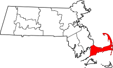 Location in the U.S. state of Massachusetts | ||
 Massachusetts's location in the U.S. | ||
| Founded | 1685 | |
| Seat | Barnstable | |
| Largest city | Barnstable | |
| Area | ||
| • Total | 1,306 sq mi (3,383 km2) | |
| • Land | 394 sq mi (1,020 km2) | |
| • Water | 912 sq mi (2,362 km2), 70% | |
| Population (est.) | ||
| • (2015) | 214,333 | |
| • Density | 544/sq mi (210/km²) | |
| Congressional district | 9th | |
| Time zone | Eastern: UTC-5/-4 | |
| Website |
www | |

Barnstable County is a county located in the U.S. state of Massachusetts. As of the 2010 census, the population was 215,888.[1] Its county seat is Barnstable.[2] The county consists of Cape Cod and associated islands (some adjacent islands are in Dukes County and Nantucket County).
Barnstable County comprises the Barnstable Town, MA Metropolitan Statistical Area, which is also included in the Boston-Worcester-Providence, MA-RI-NH-CT Combined Statistical Area.
Barnstable County was formed as part of the Plymouth Colony on 2 June 1685, including the towns of Falmouth, Sandwich and others lying to the east and north on Cape Cod. Plymouth Colony was merged into the Province of Massachusetts Bay in 1691.
History
Giovanni da Verrazzano
Cape Cod is described in a letter from the Italian explorer Giovanni da Verrazzano to Francis I of France, relating the details of a voyage to the New World made on behalf of the French crown in the ship Dauphine, the only surviving of a fleet of four.[3] Sailing from Madeira in 1524, the Dauphine made land in North Carolina in March. It sailed north to Newfoundland, mapping the coast and interviewing the natives, whom he found friendly south of the cape, but unfriendly north of it. To the north of an island that reminded Verrazzano of Rhodes, the Dauphine made its way with difficulty over shoals "never less than three feet deep" extending "from the continent fifty leagues out to sea," which Brevoort, based on their extent, has identified as Nantucket Shoals.[4] Verrazzano called them Armellini. On the other side was a promontory, Pallavisino, which is probably the cape,[4] as they sailed along it for "fifty leagues." Details of the north end are not given, but subsequently they came to a "high country, full of very dense forests, composed of pines," which, according to Brevoort and others, resembles the coast of Maine.[4]
Bartholomew Gosnold
After Verrazzano, what is now the eastern United States acquired the map label of New France, but France had no way to develop it. Scattered colonies in the wilderness of a few dozen men could not be supported until the foundation of Quebec in 1608. Meanwhile, the paper claim did not deter entrepreneurs. In March, 1602, Bartholomew Gosnold set sail from Falmouth, Cornwall, in the ship, Concord, transporting a crew of 8, an exploration party of 12, and 20 colonists, with the intent of establishing a trading post in the New World. Intersecting the coast of Maine, they turned to the south, encountered what appeared to be an island, and dropped anchor in Provincetown Harbor. Gosnold at first called the land Shoal Hope, but after discovering it was a cape, and acquiring a hold full of cod from the abundant schools in Cape Cod Bay, he changed the name to Cape Cod.[5]
Gosnold explored the cape, establishing good relations with the natives there, approximately 1500 members of the Nauset Tribe, closely related in language and custom to the Wampanoag people of the mainland, and under their sovereignty. John Brereton, chaplain of the expedition, reported that they were dark-skinned, customarily nude except for deerskins over the shoulders and sealskins around the waist, and wore their long, black hair up in a knot. They painted their bodies. Some knew a few English words, which is something of a historical problem, as Gosnold and his companions are believed to have been the first English to land in America.[6] Gosnold made a point of describing how healthy the people appeared.
Subsequently, Gosnold sailed around the cape to discover an island, "full of wood, vines, gooseberry bushes, whortleberries, raspberries, eglantines, etc.," as well as large numbers of shore birds. He named it Martha's Vineyard after his daughter. Another island nearby, Cuttyhunk Island, he named Elizabeth Island, in honor of Elizabeth I of England, from which the Elizabeth Islands take their name. He intended to place a trading post there, but when the time came for the return voyage, the colonists decided not to remain. Gosnold ventured a second time to the New World in 1608 as Captain John Smith's second in command of the Jamestown expedition. After three months there he died of malaria.[5]
Martin Pring
In 1603 another mercantile expedition set sail from Bristol, England, in two ships, the Speedwell and the Discoverer, commanded by a 23-year-old captain, Martin Pring. Elizabeth I had died two weeks earlier, but Pring had secured permission from Sir Walter Raleigh, who held from the queen exploration rights to all of North America.
Geography
According to the U.S. Census Bureau, the county has a total area of 1,306 square miles (3,380 km2), of which 394 square miles (1,020 km2) is land and 912 square miles (2,360 km2) (70%) is water.[7] It is the second-largest county in Massachusetts by total area. It has approximately 550 miles (890 km) of shoreline.
Barnstable County is not co-extensive with Cape Cod. The latter is a geophysical term defined by its insular or peninsular landmass. According to Freeman, it is a "long, irregular peninsula" between 65 mi (105 km) and 75 mi (121 km), measured along the north or the south shores respectively, and between 5 mi (8.0 km) and 20 mi (32 km) wide. Originally, he points out, only the tip was considered the cape, but as it was settled the name extended from its tip to the shortest line across the isthmus.[8] Barnstable County, on the other hand, is a geopolitical and legal term. It is the area contained within the borders of all cities and towns defined to be in the county by the Massachusetts General Court. These borders were located in multiple episodes of disputed legislation during the centuries since the foundation of Plymouth Colony.[9]
The main difference between Cape Cod and Barnstable County is the band of water up to several miles wide extending from the shoreline to the outermost county border. The offshore area contains significant maritime life, as well as being a recreational and transportational medium, and containing historical material lost with sunken ships.[10]
The highest elevation in the county is 306 feet (93 m) on the summit of Pine Hill, located on Joint Base Cape Cod in Bourne. The lowest point is sea level.
Adjacent counties
Barnstable County borders Plymouth County to the northwest; off Barnstable County's southern shore are Dukes County and Nantucket County.
National protected areas
Demographics
| Historical population | |||
|---|---|---|---|
| Census | Pop. | %± | |
| 1790 | 17,342 | — | |
| 1800 | 19,293 | 11.3% | |
| 1810 | 22,211 | 15.1% | |
| 1820 | 24,026 | 8.2% | |
| 1830 | 28,514 | 18.7% | |
| 1840 | 32,548 | 14.1% | |
| 1850 | 35,276 | 8.4% | |
| 1860 | 35,990 | 2.0% | |
| 1870 | 32,774 | −8.9% | |
| 1880 | 31,897 | −2.7% | |
| 1890 | 29,172 | −8.5% | |
| 1900 | 27,826 | −4.6% | |
| 1910 | 27,542 | −1.0% | |
| 1920 | 26,670 | −3.2% | |
| 1930 | 32,305 | 21.1% | |
| 1940 | 37,295 | 15.4% | |
| 1950 | 46,805 | 25.5% | |
| 1960 | 70,286 | 50.2% | |
| 1970 | 96,656 | 37.5% | |
| 1980 | 147,925 | 53.0% | |
| 1990 | 186,605 | 26.1% | |
| 2000 | 222,230 | 19.1% | |
| 2010 | 215,888 | −2.9% | |
| Est. 2015 | 214,333 | [11] | −0.7% |
| U.S. Decennial Census[12] 1790-1960[13] 1900-1990[14] 1990-2000[15] 2010-2015[1] | |||

2000 census
As of the census[16] of 2000, there were 222,230 people, 94,822 households, and 61,065 families residing in the county. The population density was 562 people per square mile (217/km²). There were 147,083 housing units at an average density of 372 per square mile (144/km²). The racial makeup of the county was 94.23% White, 1.79% Black or African American, 0.56% Native American, 0.63% Asian, 0.02% Pacific Islander, 1.11% from other races, and 1.66% from two or more races. 1.35% of the population were Hispanic or Latino of any race. 24.0% were of Irish, 15.6% English, 9.4% Italian, 5.9% German and 5.0% "American" ancestry according to Census 2000. 93.6% spoke English, 1.7% Portuguese, 1.4% Spanish and 1.0% French as their first language.
There were 94,822 households out of which 24.30% had children under the age of 18 living with them, 52.20% were married couples living together, 9.40% had a female householder with no husband present, and 35.60% were non-families. 29.50% of all households were made up of individuals and 14.40% had someone living alone who was 65 years of age or older. The average household size was 2.28 and the average family size was 2.82.
In the county the population was spread out with 20.40% under the age of 18, 5.20% from 18 to 24, 25.00% from 25 to 44, 26.20% from 45 to 64, and 23.10% who were 65 years of age or older. The median age was 45 years. For every 100 females there were 89.90 males. For every 100 females age 18 and over, there were 86.10 males.
The median income for a household in the county was $45,933, and the median income for a family was $54,728. Males had a median income of $41,033 versus $30,079 for females. The per capita income for the county was $25,318. About 4.60% of families and 6.90% of the population were below the poverty line, including 8.60% of those under age 18 and 5.00% of those age 65 or over.
2010 census
As of the 2010 United States Census, there were 215,888 people, 95,755 households, and 58,724 families residing in the county.[17] The population density was 548.3 inhabitants per square mile (211.7/km2). There were 160,281 housing units at an average density of 407.1 per square mile (157.2/km2).[18] The racial makeup of the county was 92.7% white, 1.9% black or African American, 1.1% Asian, 0.6% American Indian, 1.5% from other races, and 2.2% from two or more races. Those of Hispanic or Latino origin made up 2.2% of the population.[17] In terms of ancestry, 27.0% were Irish, 19.2% were English, 11.4% were Italian, 11.4% were American, and 9.1% were German.[19]
Of the 95,755 households, 22.2% had children under the age of 18 living with them, 48.3% were married couples living together, 9.6% had a female householder with no husband present, 38.7% were non-families, and 31.8% of all households were made up of individuals. The average household size was 2.21 and the average family size was 2.77. The median age was 49.9 years.[17]
The median income for a household in the county was $60,317 and the median income for a family was $75,056. Males had a median income of $53,480 versus $41,990 for females. The per capita income for the county was $35,246. About 5.0% of families and 7.2% of the population were below the poverty line, including 9.8% of those under age 18 and 5.6% of those age 65 or over.[20]
Demographic breakdown by town
Income
The ranking of unincorporated communities that are included on the list are reflective if the census designated locations and villages were included as cities or towns. Data is from the 2007-2011 American Community Survey 5-Year Estimates.[21][22][23]

historical map of 1890
| Rank | Town | Per capita income |
Median household income |
Median family income |
Population | Number of households | |
|---|---|---|---|---|---|---|---|
| Woods Hole | CDP | $123,954 | $125,156 | $136,731 | 725 | 368 | |
| New Seabury | CDP | $61,788 | $91,528 | $101,563 | 975 | 483 | |
| Chatham | CDP | $59,799 | $82,656 | $103,375 | 1,754 | 805 | |
| Popponesset | CDP | $59,468 | $250,000+ | $250,000+ | 158 | 96 | |
| 1 | Chatham | Town | $52,039 | $69,325 | $97,096 | 6,177 | 2,920 |
| Monomoscoy Island | CDP | $49,544 | $107,143 | $170,179 | 177 | 72 | |
| Mashpee Neck | CDP | $48,867 | $90,096 | $108,618 | 869 | 333 | |
| 2 | Wellfleet | Town | $47,428 | $59,234 | $93,107 | 2,858 | 1,621 |
| Falmouth | CDP | $44,413 | $34,018 | $75,590 | 3,595 | 2,116 | |
| Harwich Port | CDP | $42,832 | $49,925 | $79,205 | 1,909 | 1,021 | |
| Dennis | CDP | $42,820 | $52,727 | $68,750 | 2,330 | 1,220 | |
| Yarmouth Port | CDP | $42,334 | $63,177 | $82,159 | 4,908 | 2,593 | |
| 3 | Orleans | Town | $42,268 | $61,897 | $84,099 | 5,946 | 2,888 |
| North Falmouth | CDP | $41,985 | $75,408 | $84,444 | 2,849 | 1,343 | |
| Provincetown | CDP | $41,925 | $46,696 | $87,857 | 2,842 | 1,539 | |
| Teaticket | CDP | $41,595 | $46,469 | $67,171 | 1,625 | 901 | |
| 4 | Provincetown | Town | $41,488 | $46,547 | $87,228 | 2,994 | 1,645 |
| Seconsett Island | CDP | $41,384 | $60,625 | $115,250 | 32 | 22 | |
| Seabrook | CDP | $40,604 | $69,400 | $88,750 | 354 | 154 | |
| Sandwich | CDP | $40,209 | $82,989 | $86,875 | 2,699 | 1,265 | |
| 5 | Truro | Town | $39,856 | $71,964 | $85,909 | 1,903 | 873 |
| Monument Beach | CDP | $38,459 | $80,240 | $90,110 | 2,714 | 1,185 | |
| Bourne | CDP | $38,452 | $53,059 | $55,469 | 1,406 | 699 | |
| 6 | Falmouth | Town | $38,334 | $61,244 | $77,488 | 31,674 | 14,293 |
| West Chatham | CDP | $37,397 | $52,500 | $92,552 | 1,109 | 540 | |
| East Sandwich | CDP | $36,850 | $91,806 | $103,914 | 4,018 | 1,621 | |
| 7 | Barnstable | City | $36,121 | $62,191 | $75,620 | 45,486 | 20,119 |
| 8 | Sandwich | Town | $36,047 | $82,485 | $95,273 | 20,635 | 7,702 |
| Barnstable County | County | $36,000 | $60,525 | $76,708 | 216,639 | 96,775 | |
| East Dennis | CDP | $35,874 | $64,875 | $84,550 | 2,795 | 1,269 | |
| 9 | Eastham | Town | $35,352 | $56,029 | $75,803 | 5,011 | 2,404 |
| Massachusetts | State | $35,051 | $65,981 | $83,371 | 6,512,227 | 2,522,409 | |
| West Falmouth | CDP | $34,659 | $58,831 | $59,073 | 1,684 | 769 | |
| 10 | Brewster | Town | $34,380 | $59,321 | $77,463 | 9,853 | 4,354 |
| Northwest Harwich | CDP | $34,287 | $54,753 | $63,947 | 4,060 | 1,750 | |
| 11 | Harwich | Town | $34,087 | $57,455 | $69,811 | 12,259 | 5,537 |
| Brewster | CDP | $34,024 | $46,473 | $69,713 | 2,291 | 1,117 | |
| North Eastham | CDP | $33,833 | $50,214 | $68,693 | 1,792 | 938 | |
| 12 | Mashpee | Town | $33,492 | $62,763 | $73,560 | 13,900 | 5,753 |
| 13 | Yarmouth | Town | $33,251 | $50,228 | $63,975 | 23,919 | 11,825 |
| Popponesset Island | CDP | $32,909 | $39,712 | $62,639 | 152 | 54 | |
| 14 | Bourne | Town | $32,330 | $62,531 | $79,613 | 19,632 | 8,051 |
| 15 | Dennis | Town | $31,986 | $51,580 | $64,861 | 14,392 | 6,790 |
| East Harwich | CDP | $31,872 | $60,674 | $67,146 | 4,426 | 1,953 | |
| South Yarmouth | CDP | $31,498 | $46,505 | $60,015 | 11,463 | 5,732 | |
| Pocasset | CDP | $31,038 | $54,349 | $83,472 | 3,065 | 1,390 | |
| Orleans | CDP | $30,759 | $39,444 | $48,125 | 1,453 | 778 | |
| Sagamore | CDP | $30,655 | $70,554 | $76,523 | 3,728 | 1,379 | |
| East Falmouth | CDP | $30,575 | $55,967 | $66,141 | 5,926 | 2,689 | |
| West Falmouth | CDP | $30,553 | $45,529 | $53,027 | 6,097 | 2,948 | |
| West Dennis | CDP | $30,428 | $49,815 | $64,619 | 2,095 | 1,020 | |
| Forestdale | CDP | $30,139 | $84,981 | $88,274 | 4,047 | 1,313 | |
| Buzzards Bay | CDP | $30,074 | $51,341 | $79,145 | 3,120 | 1,218 | |
| Harwich Center | CDP | $29,955 | $58,729 | $80,278 | 1,864 | 813 | |
| Dennis Port | CDP | $28,071 | $45,375 | $65,313 | 3,686 | 1,633 | |
| United States | Country | $27,915 | $52,762 | $64,293 | 306,603,772 | 114,761,359 | |
| South Dennis | CDP | $26,704 | $49,123 | $58,027 | 3,486 | 1,648 | |
Politics
| Voter Registration and Party Enrollment as of October 13, 2010[24] | |||||
|---|---|---|---|---|---|
| Party | Number of Voters | Percentage | |||
| Democratic | 44,070 | 26.48% | |||
| Republican | 27,687 | 16.63% | |||
| Unenrolled | 93,815 | 56.36% | |||
| Minor Parties | 881 | 0.53% | |||
| Total | 166,453 | 100% | |||
| Year | Republican | Democratic |
|---|---|---|
| 2012 | 45.4% 60,446 | 53.2% 70,822 |
| 2008 | 42.1% 55,694 | 56.1% 74,264 |
| 2004 | 44.3% 58,527 | 54.6% 72,156 |
| 2000 | 41.0% 49,686 | 51.5% 62,363 |
| 1996 | 36.3% 40,144 | 53.5% 59,223 |
| 1992 | 31.1% 33,916 | 42.8% 46,641 |
| 1988 | 49.7% 49,676 | 48.8% 48,747 |
| 1984 | 57.0% 51,261 | 42.7% 38,369 |
| 1980 | 50.4% 41,493 | 29.1% 23,952 |
| 1976 | 53.7% 39,295 | 42.8% 31,268 |
| 1972 | 61.1% 36,340 | 38.1% 22,636 |
| 1968 | 57.6% 24,296 | 39.2% 16,546 |
| 1964 | 42.8% 15,133 | 56.9% 20,101 |
| 1960 | 62.6% 20,900 | 37.2% 12,423 |
Government
Barnstable County is one of the last functioning counties in Massachusetts. County government consists of a legislative branch (Cape Cod Assembly of Delegates) and an executive branch (Barnstable County Commissioners).
Cape Cod Assembly of Delegates
The Assembly of Delegates is the legislative branch of Barnstable County. There are fifteen towns located within Barnstable County, and each town is duly represented on the Assembly of Delegates. In 1989, by an Act of the Massachusetts General Court and confirmed by a majority of Barnstable County voters, the Barnstable County Home Rule Charter went into effect and the first session of the Assembly of Delegates convened. All legislative powers of the County are vested in the Assembly of Delegates which acts by ordinance and also adopts resolutions.
Membership
The Assembly of Delegates consists of fifteen Delegates representing each of the towns located in Barnstable County. A Delegate’s vote is weighted based on the 2010 U.S. Decennial Census. The town of Barnstable, for example, has the largest vote of 20.92% and Truro has the smallest vote of only 0.93%.
Barnstable County Commissioners
There are three Barnstable County Commissioners who together act as the Executive Branch of county government. Each commissioner is elected at large and serves a four-year staggered term. Duties of the commissioners include direction of county agencies, preparation of budgets for submission to the Assembly, care of county property and finances, proposing ordinances to the Assembly, and appointment of the County Administrator.
Membership
Mary Pat Flynn (Falmouth), Chair
- Term: 2013–2017
Sheila R. Lyons (Wellfleet), Vice-Chair
- Term: 2013–2017
William "Bill" Doherty (Harwich), Commissioner
- Term: 2010–2014
Cape Cod Commission
The planning agency of Barnstable County is the Cape Cod Commission.
Communities
Cities and towns have been legally incorporated as such under the laws of the State of Massachusetts. They include the entire territory of the state. A city may continue to name itself a town even though legally a city. Villages are subordinate to cities or towns. In addition to and not necessarily based on these legal municipalities are the arbitrary divisions of the United States Census Bureau. Villages are census divisions, but have no separate corporate existence from the towns they are in. Other arbitrary divisions may be in use. For example, the City of Barnstable has five fire districts that cover the seven villages - each village has its own fire department except that Centerville, Osterville and Marstons Mills have combined their efforts into the COMM Fire Department.
Upper Cape
| ||||||||||||
Mid-Cape
| ||||||||||||
Lower Cape
| ||||||||||||
Outer Cape (occasionally, Lower Cape)
| ||||||||||||

City
- Barnstable (county seat)
Towns
Villages
Census-designated places
- Bourne
- Brewster
- Buzzards Bay
- Chatham
- Dennis
- Dennis Port
- East Dennis
- East Falmouth
- East Harwich
- East Sandwich
- Falmouth
- Forestdale
- Harwich Center
- Harwich Port
- Mashpee Neck
- Monomoscoy Island
- Monument Beach
- North Eastham
- North Falmouth
- Northwest Harwich
- Orleans
- Pocasset
- Popponesset
- Popponesset Island
- Provincetown
- Sagamore
- Sandwich
- Seabrook
- Seconsett Island
- South Dennis
- South Yarmouth
- Teaticket
- West Dennis
- West Falmouth
- West Yarmouth
- Woods Hole
- Yarmouth Port
Unincorporated communities
- Bellingsgate
- Captains Hill
- Captains Village
- Ferris Fields
- Hatchville
- Long Point
- Monomoy Island
- South Brewster
- South Chatham
- South Sandwich
- Waquoit
- Wood End
See also
| Wikimedia Commons has media related to Barnstable County, Massachusetts. |
- Barnstable County Correctional Facility
- Barnstable County Courthouse
- Barnstable County Fairgrounds
- Barnstable County Hospital
- Barnstable Municipal Airport
- Cape Cod
- Cape Cod Commission
- Joint Base Cape Cod
- Nantucket Sound
- National Register of Historic Places listings in Barnstable County, Massachusetts
- Registry of Deeds (Massachusetts)
- Scusset Beach State Reservation
- Shawme-Crowell State Forest
- USS Barnstable County (LST-1197)
References
- 1 2 "State & County QuickFacts". United States Census Bureau. Retrieved August 26, 2013.
- ↑ "Find a County". National Association of Counties. Archived from the original on 2012-07-12. Retrieved 2011-06-07.
- ↑ Giovanni da Verrazzano (2006). "Letter to King Francis I of France, 8 July 1524: Excerpts" (PDF). National Humanities Center. p. 8. Text reproduced by permission from Wroth, Lawrence C., ed. (1970). The Voyages of Giovanni da Verrazzano, 1524-1528. New Haven: Yale University Press.
- 1 2 3 Brevoort, James Carson (1874). Verrazano the Navigator. New York: American Geographical Society of New York. pp. 135–136.
- 1 2 Conway 2008, pp. 31–32
- ↑ Conway 2008, pp. 33–35
- ↑ "2010 Census Gazetteer Files". United States Census Bureau. August 22, 2012. Retrieved September 15, 2014.
- ↑ Freeman 1860, p. 27
- ↑ A history of this extensive legislation through 1860 on a town-by-town basis can be found in Freeman 1862, passim
- ↑ In an effort to protect this area, Barnstable County created the Cape Cod Commission, giving it control over the oceanic waters within county jurisdiction, to exclude the bays and river mouths as well as the Cape Cod Canal. Its final plan, completed in 2011, includes maps showing the total extent of Barnstable County, most of which is oceanic, including most of Cape Cod Bay, half of upper Buzzard's Bay, and some of the waters to the south of the cape. "Cape Cod Ocean Management PLan" (pdf). Cape Cod Commission. 13 October 2011. p. 33.
- ↑ "County Totals Dataset: Population, Population Change and Estimated Components of Population Change: April 1, 2010 to July 1, 2015". Retrieved July 2, 2016.
- ↑ "U.S. Decennial Census". United States Census Bureau. Archived from the original on May 11, 2015. Retrieved September 15, 2014.
- ↑ "Historical Census Browser". University of Virginia Library. Retrieved September 15, 2014.
- ↑ "Population of Counties by Decennial Census: 1900 to 1990". United States Census Bureau. Retrieved September 15, 2014.
- ↑ "Census 2000 PHC-T-4. Ranking Tables for Counties: 1990 and 2000" (PDF). United States Census Bureau. Retrieved September 15, 2014.
- ↑ "American FactFinder". United States Census Bureau. Archived from the original on 2013-09-11. Retrieved 2008-01-31.
- 1 2 3 "DP-1 Profile of General Population and Housing Characteristics: 2010 Demographic Profile Data". United States Census Bureau. Retrieved 2016-01-12.
- ↑ "Population, Housing Units, Area, and Density: 2010 - County". United States Census Bureau. Retrieved 2016-01-12.
- ↑ "DP02 SELECTED SOCIAL CHARACTERISTICS IN THE UNITED STATES – 2006-2010 American Community Survey 5-Year Estimates". United States Census Bureau. Retrieved 2016-01-12.
- ↑ "DP03 SELECTED ECONOMIC CHARACTERISTICS – 2006-2010 American Community Survey 5-Year Estimates". United States Census Bureau. Retrieved 2016-01-12.
- ↑ "SELECTED ECONOMIC CHARACTERISTICS 2007-2011 American Community Survey 5-Year Estimates". U.S. Census Bureau. Retrieved 2013-01-26.
- ↑ "ACS DEMOGRAPHIC AND HOUSING ESTIMATES 2007-2011 American Community Survey 5-Year Estimates". U.S. Census Bureau. Retrieved 2013-01-26.
- ↑ "HOUSEHOLDS AND FAMILIES 2007-2011 American Community Survey 5-Year Estimates". U.S. Census Bureau. Retrieved 2013-01-26.
- ↑ "2010 State Primary Party Enrollment Statistics" (PDF). Massachusetts Elections Division. Retrieved 2011-01-31.
Bibliography
- Conway, Jack North (2008). The Cape Cod Canal. Charlestown, South Carolina: The History Press.
- Freeman, Frederick (1860). The History of Cape Cod: the Annals of Barnstable County and of its Several Towns, Including the District of Mashpee. Volume I. Boston: Geo. C Rand & Avery.
- Freeman, Frederick (1862). The History of Cape Cod: the Annals of the Thirteen Towns of Barnstable County. Volume II. Boston: Geo. C Rand & Avery.
- Whalen, Richard F. (2007). Truro. Charlestown, South Carolina: The History Press.
External links
 Geographic data related to Barnstable County, Massachusetts at OpenStreetMap
- Barnstable County Registry of Deeds
- Cape Cod Commission official site
- USGenWeb Genealogical Site for Barnstable County
- OASIS Online Archival Search Information System; Barnstable County
 |
Plymouth County | Cape Cod Bay | Gulf of Maine | |
| Buzzards Bay | |
Atlantic Ocean | ||
| ||||
| | ||||
| Dukes County | Nantucket County | Atlantic Ocean |
Boston (capital) | |
| Topics |
|
| Society | |
| Regions | |
| Counties | |
| Cities |
|
Coordinates: 41°43′N 70°15′W / 41.72°N 70.25°W