Falmouth Airpark
| Falmouth Airpark | |||||||||||
|---|---|---|---|---|---|---|---|---|---|---|---|
| IATA: none – ICAO: none – FAA LID: 5B6 | |||||||||||
| Summary | |||||||||||
| Airport type | Public | ||||||||||
| Owner | Falmouth Airpark Homeowners Assoc. | ||||||||||
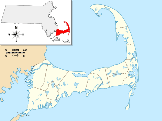
| Serves | Falmouth, Massachusetts | ||||||||||
| Elevation AMSL | 43 ft / 13 m | ||||||||||
| Coordinates | 41°35′08″N 070°32′25″W / 41.58556°N 70.54028°WCoordinates: 41°35′08″N 070°32′25″W / 41.58556°N 70.54028°W | ||||||||||
| Website | www.FalmouthAirpark.net | ||||||||||
| Map | |||||||||||
 5B6 | |||||||||||
| Runways | |||||||||||
| |||||||||||
| Statistics (2007) | |||||||||||
| |||||||||||
Falmouth Airpark (FAA LID: 5B6) is a public-use airport and residential airpark located four miles (6 km) northeast of the central business district of Falmouth, in Barnstable County, Massachusetts, United States. It is privately owned by Falmouth Airpark Homeowners Association.[1] The airport grew to superscede the Coonamessett_Airport which was located in close proximity to the Otis_Air_National_Guard_Base and closed in the 1960s. [2]
Facilities and aircraft
Falmouth Airpark covers an area of 110 acres (45 ha) which contains one runway designated 7/25 with a 2,298 x 40 ft (700 x 12 m) asphalt pavement. For the 12-month period ending March 1, 2007, the airport had 2,118 aircraft operations, an average of 5 per day: 99% general aviation and 1% air taxi. At that time there were 52 aircraft based at this airport: 96% single-engine and 4% multi-engine.[1]
References
- 1 2 3 FAA Airport Master Record for 5B6 (Form 5010 PDF), effective 2007-12-20
- ↑ "Abandoned & Little-Known Airfields: Southeastern Massachusetts". Abandoned & Little-Known Airfields. 29 March 2011. Retrieved 22 June 2013.
External links
- Falmouth Airpark, official web site
- Aerial photo of the airport in 1960 with a grass runway
- Aerial photo of the airport in 1968 with a paved runway
- Resources for this airport:
- FAA airport information for 5B6
- AirNav airport information for 5B6
- FlightAware airport information and live flight tracker
- SkyVector aeronautical chart for 5B6