Plymouth Municipal Airport (Massachusetts)
| Plymouth Municipal Airport | |||||||||||||||
|---|---|---|---|---|---|---|---|---|---|---|---|---|---|---|---|
 A private plane on the airport's main ramp | |||||||||||||||
| IATA: PYM – ICAO: KPYM – FAA LID: PYM | |||||||||||||||
| Summary | |||||||||||||||
| Airport type | Public | ||||||||||||||
| Owner | Town of Plymouth | ||||||||||||||
| Serves | Plymouth County, Massachusetts | ||||||||||||||
| Elevation AMSL | 148 ft / 45 m | ||||||||||||||
| Coordinates | 41°54′32″N 070°43′44″W / 41.90889°N 70.72889°W | ||||||||||||||
| Website | www.pymairport.org | ||||||||||||||
| Runways | |||||||||||||||
| |||||||||||||||
| Statistics (2009) | |||||||||||||||
| |||||||||||||||
Plymouth Municipal Airport (IATA: PYM, ICAO: KPYM, FAA LID: PYM) is a town-owned, public-use airport located four nautical miles (7 km) southwest of the central business district of Plymouth, a town in Plymouth County, Massachusetts, United States.[1] According to the FAA's National Plan of Integrated Airport Systems for 2009–2013, it is categorized as a general aviation airport.[2] Due to space issues, the airport has 2 gates in Carver, Massachusetts, for which, according to locals, Plymouth still owes money to Carver for buying their land, which could be due to the corrupt town government in Carver at the time the land was bought.
Facilities and aircraft
Plymouth Municipal Airport covers an area of 758 acres (307 ha) at an elevation of 148 feet (45 m) above mean sea level. It has two asphalt paved runways: 6/24 is 4,349 by 75 feet (1,326 x 23 m) and 15/33 is 3,351 by 75 feet (1,021 x 23 m).[1]
For the 12-month period ending April 1, 2009, the airport had 73,040 aircraft operations, an average of 200 per day: 96% general aviation, 4% air taxi, and <1% military. At that time there were 134 aircraft based at this airport: 75% single-engine, 12% multi-engine, 5% jet and 8% helicopter.[1]
The airport does not have a control tower, as it is has an airspace class of E. There is both an Automated Surface Observation System (ASOS) and Common Traffic Advisory Frequency (CTAF) available at Plymouth Airport.
Gallery
 General aviation terminal
 Charter plane at the airport
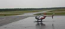 Helicopter on the airport ramp
References
- 1 2 3 4 FAA Airport Master Record for PYM (Form 5010 PDF). Federal Aviation Administration. Effective 8 April 2010.
- ↑ National Plan of Integrated Airport Systems for 2009–2013: Appendix A: Part 3 (PDF, 1.28 MB). Federal Aviation Administration. Updated 15 October 2008.
External links
- Aerial photo as of 10 March 1995 from USGS The National Map via MSR Maps
- FAA Terminal Procedures for PYM, effective December 8, 2016
- Resources for this airport:
- FAA airport information for PYM
- AirNav airport information for KPYM
- ASN accident history for PYM
- FlightAware airport information and live flight tracker
- NOAA/NWS latest weather observations
- SkyVector aeronautical chart, Terminal Procedures