Ben Chonzie
| Ben Chonzie | |
|---|---|
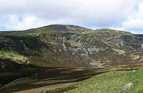 Ben Chonzie from the Glen Turret side of the hill | |
| Highest point | |
| Elevation | 931 m (3,054 ft) [1] |
| Prominence | 645 m (2,116 ft) |
| Parent peak | Ben More |
| Listing | Munro, Marilyn |
| Naming | |
| Translation | "mossy hill" (Gaelic) |
| Pronunciation | Gaelic [ˈpeiɲ ə ˈxɔːɲɪç] |
| Geography | |
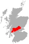
| Location | Perth and Kinross, Scotland |
| OS grid | NN773308 |
| Topo map |
OS Landranger 51 and 52 OS Explorer 379 |
Ben Chonzie, also known as Ben-y Hone,[2] (Gaelic Beinn a' Chòinnich, meaning "mossy mountain"[3]) is a Scottish mountain situated eleven kilometres northwest of Crieff. It stands at 931 m (3054 ft) and is therefore listed as a Munro.[4] It is the highest point of a large area of moorland and rounded hills between Loch Earn and Loch Tay, and with a broad, flat summit and relatively few distinguishing features, it is often regarded as one of Scotland's least interesting Munros.[5] It is most often climbed from Invergeldie (Comrie) to the southwest; however it can also be climbed from the southeast by way of Glen Turret. The latter is longer but presents walkers with a more interesting and scenic ascent, having an array of buttresses and cliffs which can be tackled by those who feel brave, or passed by on either side.[6] Mountain hares (Lepus timidus, sub species Lepus timidus scoticus) can be seen around the plateau area if walkers are quiet and observant. There are also many other animals on the approaches to the Ben, including Buzzards, other birds of prey, and frogs and newts in the pools alongside the landrover track that runs up the eastern aspect of the loch. Deer may be seen on the slopes to the north of the Ben.
References
- ↑ "walkhighlands Ben Chonzie". walkhighlands.co.uk. 2013. Retrieved 15 October 2013.
- ↑ On Ben Chonzie, real hillwalkers don't picnic, Robin Howie, The Scotsman, 19 November 2005
- ↑ Scottish Hill and Mountain Names, Peter Drummond, ISBN 0-907521-30-4
- ↑ The Munros (SMC Guide), Donald Bennett et al, ISBN 0-907521-13-4
- ↑ "...having a reputation of being one of the dullest Munros in the land" The Munros: Scotland's Highest Mountains, Cameron McNeish, ISBN 0-947782-50-8
- ↑ The Southern Highlands (SMC Guide), Donald Bennett et al, ISBN 0-907521-34-7
 |  | ||
| Northern Highlands |   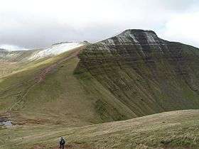 | |
|---|---|---|
| Western Highlands | ||
| Central and Eastern Highlands | ||
| Southern Highlands | ||
| Islands | ||
| Scottish Lowlands, England and Wales | ||
56.45332892
Coordinates: 56°27′14″N 3°59′31″W / 56.453857°N 3.992062°W