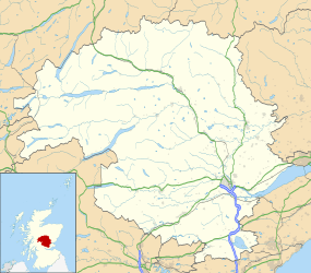
Comrie
| Comrie | |
| Scottish Gaelic: Cuimrigh | |
 Comrie |
|
 Comrie |
|
| Population | 1,839 [1] (2001 census) est. 2,010[2] (2006) |
|---|---|
| OS grid reference | NN773219GB |
| Council area | Perth and Kinross |
| Lieutenancy area | Perth and Kinross |
| Country | Scotland |
| Sovereign state | United Kingdom |
| Post town | Crieff |
| Postcode district | PH6 |
| Dialling code | 01764 |
| Police | Scottish |
| Fire | Scottish |
| Ambulance | Scottish |
| EU Parliament | Scotland |
| UK Parliament | Ochil and South Perthshire |
| Scottish Parliament | Perthshire South and Kinross-shire |
| Website | /www.comrie.org.uk |
Coordinates: 56°22′30″N 3°59′18″W / 56.374929°N 3.988251°W
Comrie(/ˈkʌmri/;[3] Gaelic: Cuimridh; Pictish: Aberlednock; Roman: Victoria) is an affluent village and parish in the southern highlands of Scotland, towards the western end of the Strathearn district of Perth and Kinross, seven miles (11 km) west of Crieff. Comrie is a historic conservation village, recognised for its outstanding beauty (for which it has received many awards) and history and is also situated in a National Scenic Area around the river Earn. In addition Comrie is a thriving local community with over 50 local groups covering all ages and many interests. Situated on the Highland Boundary Fault, the village experiences more earth tremors than anywhere else in Britain. The town is twinned with Carleton Place, Ontario, Canada.
Location & Etymology
Comrie sits within the registration county of Perthshire (Gaelic: Siorrachd Pheairt) and the Perth and Kinross local council area. The name Comrie is derived from the original Gaelic name con-ruith or comh-ruith (from con/comh 'together', and ruith 'to run', 'running') translating literally as 'running together', but more accurately as 'together flowing' or 'the place where rivers meet'. In modern Gaelic the name is more often transcribed as 'Comraidh', 'Cuimridh' or 'Cuimrigh'. This is an apt toponym as the village sits at the confluence of three rivers. The River Ruchill (Gaelic: An Ruadh Thuill, The Red Flood) and The River Lednock (Scots Gaelic: An Leathad Cnoc, The Wooded Knoll) are both tributaries of the Earn (Gaelic: Uisge Dubh-Èireann) at Comrie,[4] which itself eventually feeds into the Tay (Gaelic: Uisge Tatha).
Due to its position astride the Highland Boundary Fault it experiences frequent earth tremors and Comrie has an old nickname of the 'Shaky Toun/Toon' (Scots) or 'Am Baile Critheanach' (Gaelic). In the 1830s around 7,300 tremors were recorded and today Comrie records earth tremors more often, and to a higher intensity, than anywhere else in the United Kingdom.[5] Comrie became the site of one of the world's first seismometers in 1840, and a functional replica is still housed in the 'Earthquake House' in The Ross in Comrie.[6]
The village's position on the Highland Boundary Fault is unique, and gives Comrie a claim to the highly contested title of Gateway to the Highlands. To the north of the village, Ben Chonzie and the Grampian Mountains rise majestically, while to the south of the village wide and open moorland is joined by lesser (though still impressive) mountains and glens which provide a unique range of terrain and ecology.
History
There is significant evidence of prehistoric habitation of the area, characterised by numerous standing stones and archeological remains, which give some insight into the original pre-historic, Pictish and later Celtic societies that once lived here.
In 79AD the Roman General Agricola chose what are now the outskirts of Comrie as the site to build a fort and temporary marching camp, because of the area's strategic position on the southern fringe of the Highlands. The fort is one of the line of so-called "Glen blocking" forts which runs from Drumquhassle to Stracathro and includes the legionary fortress of Inchtuthil. The temporary camp was c. 22 acre (c. 9 ha) in size. An infamous battle between the Celts and Romans is known to have taken place on the unidentified mountain called Mons Graupius, and the area surrounding Comrie, Strathearn, is one of several proposed battle sites.
Comrie's early prosperity derived from weaving. This was mostly done as piecework in people's own homes. Comrie was also important as a droving town. Cattle destined for the markets of the Scottish Lowlands and ultimately England would be driven south from their grazing areas in the Highlands. River crossings, such as at Comrie, were important staging posts on the way south. Much of the land around Comrie was owned by the Drummond family, Earls of Perth, latterly Earls of Ancaster, whose main seat was Drummond Castle, south of Crieff. Another branch of the Drummonds owned Drummondernoch (Gaelic: Drumainn Èireannach - Drummond of Ireland), to the west of the town. Aberuchill Castle, however, just outside Comrie was originally a Campbell seat.
Over the years the village has grown to incorporate many of its smaller satellite settlements, including The Ross (Gaelic: An Ros) a small settlement to the west of the village contained within a river peninsula (An Ros literally translates as peninsula) which became more accessible when 'The Ross Bridge' was constructed in 1792. Prior to this the peninsula was only accessible via a river ford. Similarly, the once isolated communities in the glens and mountains around the village, such as Invergeldie in Glen Lednock and Dalchruin in Glen Artney have generally come to be considered part of Comrie village. Previously, these communities existed as small isolated settlements - for instance, Glen Lednock contained 21 different settlements of 350 individual structures and 25 corn-drying kilns. However, these exclusively Gaelic-speaking hamlets were largely eviscerated by The Highland Clearances during the 18th and 19th centuries.
Comrie underwent something of a renaissance in the early 19th century and Victorian periods as an attractive location for wealthy residents and visitors, an image which has been maintained to the present day. A result of this popularity was the coming of the railway in 1893, when the Caledonian Railway completed a branch line from Crieff. This line was later extended to meet the Callander and Oban Railway at Lochearnhead. The line from Comrie to Lochearnhead was closed in 1951 and the Comrie to Crieff line closed in 1964, due largely to the improved road network in the area.
Comrie's mountainous location with an abundance of streams and lochs meant that the early 20th century saw the development of a number of hydro-electric power schemes in the area. A dam was built in Glen Lednock and water was piped from Loch Earn in the west to another power station.
Today Comrie is an attractive retirement village, recording the largest proportion of over-65s in Scotland in the 1991 census. The village's economy is supplemented by adventure and wildlife tourism.
Sights and culture
Architecture
The White Church, the former parish kirk, is Comrie's most striking building, with its prominent tower and spire situated on the roadside of the ancient churchyard at the heart of the village. This is an early Christian site, dedicated to the obscure early saint Kessog (or Mokessog), who may have flourished in the 8th century. The Comrie Parish Church is of a grand Gothic style, disproportionate to anything else in the village dominates the distant skyline. It was designed and built in 1881 by George T Ewing. Comrie is also graced by a little-known Charles Rennie Mackintosh building, a shop in the main street with a first floor corner turret built in a version of the Scottish vernacular style (not visible in the above illustration). Some of the buildings and homes in the village date back hundreds of years with many traditional highland cottages built in dry-stone and/or clay which all would have originally been endowed with thatched roofs. In the higher mountain glens surrounding the village traditional highland blackhouses, most now in ruins, are also to be found. There are also a number of grand estate homes and historic castles in the local area. For the most part however, in the main quadrants of the village are to be found Victorian and Edwardian buildings, including many large detached villas and small terraces. In the newer parts of the village more modern properties from the 1950s onwards dominate, including extremely modern properties of varying character.
Awards
The village has won the Royal Horticultural Society "Large Village Britain in Bloom Winner" in 2007 and 2010. Comrie also won a number of awards in the 2009 Beautiful Scotland Campaign, including Best Village[7] and a special award for Continuous Community Involvement. In 2013 Comrie won gold in the village category of the Beautiful Scotland Awards, as well as a special Community Horticulture Award.
Glen Lednock, The Monument and the Deil's Cauldron

A granite obelisk atop Dùn Mòr (English: The great hill) to the north commemorates Henry Dundas, 1st Viscount Melville. It was designed by James Gillespie Graham in 1812.[9] This monument is reached via a woodland trail through wooded Glen Lednock (Scots Gaelic: Gleann Leathad Cnoc) in which is to be found the Slocha'n Donish or De'ils Caldron (also known as the Falls of Lednock). The trail begins in the village, at Laggan Park (Gaelic: An Làgan Mòr - The Great Basin) and ascends through a native forest of pines, oak, elm, ash rowan, alder and beech to Glen Lednock. Via The Shaky Bridge (although the original shaky bridge was replaced with a decidedly less shaky successor) the hiker is greeted with a splendid view of the glen, a truly highland landscape where a single lane road leads higher to Glen Lednock Reservoir and the Munro, Ben Chonzie. From here Dùn Mòr and the Monument are easily reached, offering unparalleled views across Strathearn and further west to the central highlands. A swift descent (or ascent depending on route chosen) leads through a long, steep, wooded gorge which contains the impressive Deil's Cauldron. Here the river has cut a high, cascading waterfall in the surrounding rock, with pools below resembling a boiling cauldron. It is said that a water-elf, Uris-chidh resides here and attempts to lure victims into the treacherous waters. Following the path down a lesser companion to the great falls, The Wee Cauldron, which offers a calmer view of the river. Following the path through the forest eventually returns the walker to the village.
Cultybraggan Camp
To the south of the village is a military camp at Cultybraggan. During World War II this was POW Camp 21[10] and housed Italian and later German prisoners of war. This was a 'black' camp (i.e. most of its inmates were ardent Nazis), which became infamous after anti-Nazi German POW Wolfgang Rosterg was lynched there by fellow inmates (who were hanged after the war for the act). Rudolf Hess was imprisoned within the camp overnight. Many of the more difficult Nazis were moved to POW Camp 165 at Watten in Caithness.
Within the grounds of the former POW camp there is a two story nuclear bunker (Cultybraggan RGHQ), which was the proposed emergency location of the provincial Scottish government in case of nuclear attack. As late as the 1990s the bunker had its own accommodation, telephone exchange, sewage plant and even a BBC studio.[11] More recently, in 2007 the local community trust bought the camp, and the surrounding 90 acres (360,000 m2) of land, under Land Reform legislation for the sum of £350,000.
In December 2016 Heinrich Steinmeyer, a former Waffen-SS prisoner of the camp, left Comrie £384,000 in his will, as an expression of "my gratitude to the people of Scotland for the kindness and generosity that I have experienced in Scotland during my imprisonment of war and hereafter." A local trust manages the legacy.[12]
A List of Notable Sights in and around Comrie
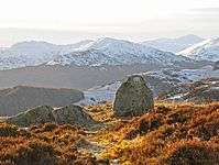
- Ben Chonzie (Gaelic: Beinn a' Chòinnich) - A mountain and Munro which overlooks the village, famous for its many mountain hares.
 Hogmanay flambeaux fire festival with the white church visible in background
 - Cultybraggan (Gaelic: Possibly Cul taigh bracan) - An ancient farming site, and site of the once-secret underground nuclear bunker.
- Linn a' chullaich (English:Pool of the Boar) - A deep freshwater pool, still commonly used for wild swimming in the summer months. Known locally as 'The Lynn'.
- The Deil's Cauldron (Gaelic: Slocha'n Donish, English: The Devil's Kettle) - A deep rock waterfall where legend has it there resides a water-elf called Uris-chidh who lures victims to a watery death.
- The earthquake house (Gaelic: An taigh crith-fuinn) - A small research station housing one of the world's first seismometers, still active today.
- Tullichettle (Gaelic: Tulach a' chadal) (English: The knoll/mound of sleep - An ancient churchyard.
- Auchingarrich (Gaelic: Achadh an gàradh)(English: Field of the garden)- An ancient farming site. Now home to a wildlife centre.
- Loch Earn (Gaelic: Loch Éireann) - A beautiful freshwater loch surrounded by mountains.
- Ben Vorlich (Loch Earn) (Gaelic: Beinn Mhùrlaig) - A nearby mountain and Munro.
- Fort Victoria (Gaelic: An Gearasdan Borgach))- The remains of a Roman 'glen blocking' fort. This site is considered by some the farthest north that the Romans were able to invade Scotland.
 Lord Melville's monument
 - Standing stones (Gaelic: Na tursachan) - A number of standing stones are relics of the pre-Christian Celtic and Pictish societies which once inhabited the area.
- Melville Monument (Gaelic: Carragh Melville) - A 72-foot granite obelisk which sits on a high, steep, craggy hillside overlooking the village. Built to commemorate First Lord Melville Henry Dundas.
- Dundas Monument (Gaelic: Carragh Dhùn Deas)- A similar, but smaller obelisk to the east of the village.
- Glen Artney (Gaelic: Gleann Artanaig) (English: This may be Artanag's glen, a name based on old Gaelic art, meaning bear)- A beautiful glen and ancient royal deer forest immortalised in Sir Walter Scott's The Lady in the Lake, it supplied venison to the Sovereigns of Scotland at Holyrood, Dunfermline and Falkland.
- Glen Lednock (Gaelic: Gleann Leathad Cnoc) (English: The Glen of the wooden knoll) - A beautiful highland glen in the mountains above the village, once home to a smaller community prior to the Highland Clearances. The glen is home to a great stock of wildlife including elusive Scottish wildcat and capercaillie, golden eagle, buzzard, mountain hare, grouse and number of deer species.
- Sput Rolla (English: The spout of the scroll)- A waterfall which breaks the River Lednock as it flows down from the mountains in Glen Lednock to the village.
- Lawers House (Gaelic: Taigh Labhar) - A grand estate home to the east of the village.
 Old image of Comrie from the south
 - St Kessog's Free Church of Scotland (Gaelic: An t-eaglais Naomh Cais-Òg)) - A grand church built in 1879 which replaced the smaller Free Church (White Church)
- The White Church (Scottish Gaelic: An t-Eaglais gheal) - Built in 1805 on the site of another ancient churchyard. The centrepiece of the village and a category A listed building. Now a community centre.
- Brough and Macpherson shop - A building re-designed by Charles Rennie Mackintosh in 1903 following a fire.
- The House of Ross (Gaelic: An Taigh Ros)- A grand estate home constructed in 1908 in the 18th-century Scots vernacular style. The home is now subdivided into a number of separate dwellings. The estate grounds contain an extensive miniature railway which is opened to the public several times a year.
- Aberuchill Castle (Gaelic: Caisteal Obar Ruadh thuill) (English: The castle at the mouth of the red flood) - A grand castle and estate home initially constructed in 1602 at the foot of the hills of Ruchill. The castle is now owned by Vladimir Lisin, a Russian industrialist and billionaire and according to Forbes magazine the richest man in Russia. The castle has played host to many infamous characters of Scottish and world fame historically and to the present day.
- Dunira (Gaelic: Dùn Iar-a))Castle and estates - A grand estate and home west of the village.
Amenities
Comrie has a number of local amenities which include a primary school, a post office, two hotels ('The Comrie Hotel' and 'The Royal Hotel', both of which contain their own restaurant and bar), 5 churches of various denominations, two small cafés (one of which is also the local fish and chip shop), a restaurant ('The Deil's Cauldron'), and an independent petrol station.
The Flambeaux Parade and Hogmanay Celebrations
Comrie has a unique and somewhat curious Hogmanay ritual. Each Hogmanay, on the stroke of midnight, a torchlight procession marches through the village. Traditionally the procession involves the twelve strongest men of the village carrying long, thick birch poles, to which burning tarred rags are attached, to each of the four corners of the village. The procession is usually accompanied by the village pipe band and villagers with floats and dressed in costume. After the procession the torches are thrown from the Dalginross Bridge into the River Earn. The precise origins of the ceremony are unclear. It is generally assumed to have pre-Christian Celtic or possibly Pictish roots and to be intended to cleanse the village of evil spirits in advance of the new year (albeit the new year's commencing in January is a relatively modern convention). The use of the birch tree specifically may have significance as the first letter of the Celtic Ogham alphabet, and a symbol of new beginning.
The spectacle attracts thousands of visitors from all around the world to the small highland village each Hogmanay. A countdown to midnight is usually held at Melville Square and after the processions people gather here again for traditional Scottish music and dancing. Drinking alcohol in the street is commonplace and tolerated. Parties in village homes are common and other Scottish Hogmanay traditions like first footing are also observed.
Comrie Fortnight
An annual two-week festival, called the Comrie Fortnight, is held in the village during July and August. The Comrie Fortnight started in the late 1960s and has evolved over the years, now consisting of a wide range of activities including competitions, outings, dances and a float parade. Profits from the Comrie Fortnight are used to support events and groups in the local community.
Language
Today the principal languages of Comrie are English, Gaelic and Scots.
Historically, Comrie and the surrounding area has been part of the Gàidhealtachd. A statistical account of the Comrie Parish from 1799 recites that "The common language of the people is Gaelic and all the natives understand it; but many, especially the old, do not understand English". Gaelic appears to have remained the primary language during the early part of the 19th century, as the following passage written in 1828 from Mr.Mushet, local minister at the time, describing the annual celebration of the sacrament of the lord's supper testifies "The Lord favoured us (blessed be His name) with fair and seasonable weather. We had near eleven tables in Irish (Gaelic). Each table contained forty-eight persons or thereabout, and we had only two tables and some few persons at the third in English". As with the rest of Scotland however, the process of language shift away from Gaelic and towards English, facilitated by the Highland Clearances and the Education (Scotland) Act of 1872, was apparently well established by the late 19th century. Indeed, by 1891 census estimates suggested that only 17.9% of the population of Comrie were native Gaelic speakers.[13] In 1901 only 8.3% of the population were native Gaelic speakers, while only 4.5% of the population had Gaelic as their sole language.[13] The most recent census data for 2002 shows that less than 5% of the population are Gaelic speakers.
The decline of Gaelic speakers in the area can be largely attributed to The Highland Clearances (Scottish Gaelic: Fuadach nan Gàidheal) in the 18th and 19th centuries, which saw people in the smaller satellite settlements of the village (located in the surrounding mountains and glens) forcibly displaced from their homes, and many forced to emigrate to Canada, Australasia and North America. In addition, the Education (Scotland) Act of 1872 led to generations of Gaels forbidden from speaking their native language in the classroom, and punished for doing so. As with the rest of Scotland (excluding the North-west), Gaelic speakers have struggled to retain their language through the generations, though Comrie retains a larger than average number of speakers.[13]
Notable people
- John Craig, recipient of the Victoria Cross
- Vladimir Lisin, the richest living Russian according to Forbes magazine, owns and lives in Aberuchill Castle in Comrie. His internationally important guests have included the King of Spain.
- Robert the Bruce, king of Scotland, the outlaw Rob Roy McGregor and Scotland's internationally renowned national poet Robert Burns all mentioned their stays in the village in their writing, including in Burns' case time spent at Aberuchill Castle.
- Mary Queen of Scots held Comrie and the surrounding woodlands as one of her favourite hunting grounds.
- Queen Victoria stayed in the Royal Hotel in Comrie.
- Queen Wilhelmina of the Netherlands visited the village between the two world wars and stayed at The Royal Hotel. Her signed portrait now hangs in The Principal Suite.
- Dr James MacGregor was from Comrie and became the first Gaelic-speaking Presbyterian minister in Nova Scotia in 1786.
Comrie Golf Club
Comrie Golf Club was founded in 1891 and is situated on the outskirts of the village of Comrie.[14]
Image Gallery


References
- ↑ "Comparative Population Profile: Comrie Locality". Scotland's Census Results Online. 2001-04-29. Retrieved 2008-09-01.
- ↑ Gro-scotland.gov.uk Archived September 16, 2009, at the Wayback Machine.
- ↑ Comrie. Retrieved 2013-12-01.
- ↑ "Gaelic Place-Names of Scotland database". Ainmean-Àite na h-Alba. Retrieved 4 November 2012.
- ↑ Moorlandschool.co.uk
- ↑ Comrie Earthquake House
- ↑ Beautiful Scotland Winner 2009
- ↑ Ordnance Survey 1:25,000 scale Explorer map series, sheets 309-470
- ↑ http://www.scottisharchitects.org.uk/architect_full.php?id=200250
- ↑ PRISONER OF WAR CAMPS (1939 – 1948), English Heritage 2003
- ↑ Subterranea Britannica Cultybraggan RGHQ
- ↑ "Nazi PoW leaves £384,000 to Perthshire village". BBC News. 2 December 2016. Retrieved 2 December 2016.
- 1 2 3 Linguae-celticae.org
- ↑ Comriegolf.co.uk
External links
| Wikimedia Commons has media related to Comrie. |
- Comrie at www.scottish-towns.co.uk
- Tourist Attractions in Comrie
- Comrie Community Website
- The Roman Gask Project
- History of Strathearn