Beinn Bhuidhe (Glen Fyne)
| Beinn Bhuidhe | |
|---|---|
| Highest point | |
| Elevation | 948 m (3,110 ft) [1] |
| Prominence | 592 m (1,942 ft) [2] |
| Parent peak | Ben Lui |
| Listing | Munro |
| Naming | |
| Translation | Yellow hill [3] (Gaelic) |
| Pronunciation | Gaelic [ə ˈveiɲ ˈvujə] |
| Geography | |
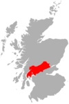
| Location | Argyll and Bute, Scotland |
| OS grid | NN20361871 |
| Topo map | OS Landranger 50, 56. |
| Climbing | |
| Easiest route | Hike |
Ben Bhuidhe (Gaelic: A' Bheinn Bhuidhe) is a Scottish mountain at the head of Loch Fyne.
Overview
Beinn Bhuidhe is a 948 metres (3,110 ft) Munro that lies separately from the main body of the Arrochar Alps. It is an isolated mountain which, particularly when climbed in winter conditions, has a "real feeling of expedition about it". It is a remote and unfrequented hill, situated to the north of the head of Loch Fyne between the upper reaches of Glen Fyne and Glen Shira. It is the only high hill in an extensive tract of featureless moorland between the head of Loch Lomond and Loch Awe. Its long summit ridge has three tops, the summit being the south-western one. Beinn Bhuidhe is much quieter than the Arrochar Alps proper, due in part to the 7.3 kilometres (4.5 mi) walk-in along a private road before starting the climb.
Geography
Beinn Bhuidhe is large mountain with three ridges shaped like the prongs of a trident. The longest ridge is the most southerly of the three and extends to Clachan Hill (658 metres (2,159 ft)). The shortest is the most northerly and runs to Beinn an t-Sidhein (694 metres (2,277 ft)). Between them lies the main ridge upon which the summit is located, which runs for 6 kilometres (4 mi) from Tom a’ Phiobaire in the south-west to Ceann Garbh (803 metres (2,635 ft)) in the north-east. The summit (948 metres (3,110 ft)) is located approximately midway along this ridge.
Ascents
There are roads in both Glen Fyne and Glen Shira but Beinn Bhuidhe is mostly accessed from the former. There are good tracks giving access to the long south-west ridges, but the short and steep route running west-north-west from Inverchorachan House is the most popular.
References
Footnotes
- ↑ "walkhighlands Beinn Bhuidhe". walkhighlands.co.uk. 2013. Retrieved 16 October 2013.
- ↑ "Beinn Bhuidhe, Scotland". Peakbagger.com.
- ↑ Beinn Bhuidhe [Glen Fyne] (Munro) - MunroMagic.com
Bibliography
- Bennet, Donald, ed. (1999). The Munros: Scottish Mountaineering Club Hillwalkers Guide. Edinburgh: Scottish Mountaineering Trust. ISBN 0-907521-57-6.
 |  | ||
Coordinates: 56°19′36″N 4°54′25″W / 56.32661°N 4.90687°W