Snaefell
| Snaefell | |
|---|---|
 | |
| Highest point | |
| Elevation | 2,037 ft (621 m) |
| Prominence | 2,037 ft (621 m) |
| Parent peak | none - HP Isle of Man |
| Listing | Marilyn, Hardy |
| Coordinates | 54°15′46.8″N 4°27′43.2″W / 54.263000°N 4.462000°WCoordinates: 54°15′46.8″N 4°27′43.2″W / 54.263000°N 4.462000°W |
| Naming | |
| Translation | snow fell (Norse) |
| Pronunciation | /ˈsneɪfɛl/ |
| Geography | |
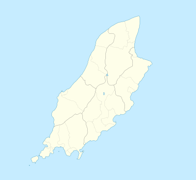 Snaefell Location of Snaefell in the Isle of Man | |
| Location | Isle of Man |
| OS grid | SC397881 |
| Topo map | OS Landranger 95 |
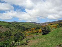
Snaefell (Manx: Sniaull) is the highest mountain and the only summit higher than 2,000 feet (610 m) on the Isle of Man, at 2,037 feet (620.9 m) above sea level.[1][2] The summit is crowned by a railway station, cafe and several communications masts.
Views
It is a well-known saying in the Isle of Man that on a clear day six kingdoms can be seen from the top: the Isle of Man, England, Ireland, Scotland, Wales and Heaven.[3] Some versions add a seventh kingdom, that of Manannán (or the sea).[4]
The plaque at the summit indicates the directions of five points from Snaefell as well as their distances:
- 31 miles (50 km) to the Mull of Galloway (Scotland)
- 51 miles (82 km) to Scafell (England)
- 66 miles (106 km) to the Mountains of Mourne (Northern Ireland)
- 85 miles (137 km) to Liverpool (England)
- 97 miles (156 km) to Dublin (Ireland)
Climbing Snaefell
The Snaefell Mountain Railway has a seasonal electric tram service, typically from April to October, which climbs the 4 miles (6.4 km) from Laxey to the summit.
The A18 Snaefell Mountain Road passes over the slopes of Snaefell, and is the highest section of the Snaefell Mountain Course over which the Isle of Man TT Races are held. Walkers often use the car park on this road near the Bungalow railway station (last railway stop before the summit) from which there is a rough path to the peak. The trail has sections of gravel, slate stones, grass and rock. While the angle of ascent steepens significantly closer to the summit, special climbing equipment is not required. However, caution is required in steep areas as the grass, earth and rocks are often slippery. Average climb time on foot on a dry footpath is about 45 minutes.
A geodetic marker embedded in the small, concrete obelisk indicates the true mountain summit. The rock cairn standing nearby has an information plaque on top.
Gallery
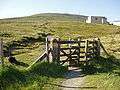 Footpath entry near Bungalow railway station typically used to climb Snaefell
 The Snaefell Mountain Railway on the ascent of Snaefell
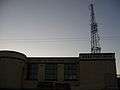 Defunct hotel (now concession stand) near the summit
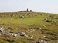 Top of Snaefell with geodetic marker and nearby cairn with plaque
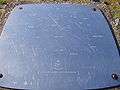 Plaque pointing out the directions of landmarks and their distances from the summit
References
- ↑ "Ordnance Survey Triangulation stations trig archive". Retrieved 17 October 2016.
- ↑ "Ordnance Survey mapping". Retrieved 17 October 2016.
- ↑ Isle of Man guide website
- ↑ Manx Notebook website
External links
- Computer generated summit panoramas North South Index
- Snaefell Mountain Railway
- Cold War RADAR Site
- Snaefell Fell Race
| Northern Highlands |   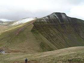 | |
|---|---|---|
| Western Highlands | ||
| Central and Eastern Highlands | ||
| Southern Highlands | ||
| Islands | ||
| Scottish Lowlands, England and Wales | ||