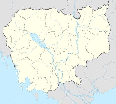
Batheay District
| Batheay ស្រុកបាធាយ | |
|---|---|
| District (srok) | |
 Batheay | |
| Coordinates: 11°59′46″N 104°56′40″E / 11.99611°N 104.94444°E | |
| Country |
|
| Province | Kampong Cham |
| Communes | 12 |
| Villages | 80 |
| Government | |
| • Governor | Mr. Yin Kim Horn |
| Population (1998)[1] | |
| • Total | 90,920 |
| Time zone | +7 |
| Geocode | 0301 |
Batheay District (Khmer: ស្រុកបាធាយ) is a district (srok) of Kampong Cham Province, Cambodia. The district capital is Ph'av town. The town is located on National Highway 6 around 64 kilometres east of the provincial capital at Kampong Cham city and 60 kilometres north of the Cambodian capital Phnom Penh. The district lies at the junction between two major waterways, the Mekong River and the Tonle Sap.[2]
In August 2006, Batheay district was the site of an outbreak of the deadly H5N1 virus commonly known as "avian influenza" or "bird flu".[3] The outbreak was detected in live and dead ducks taken from a farm in the district and the Ministry of Agriculture culled 700 birds to prevent further outbreaks. Authorities suspect that ducks smuggled from Prey Veng Province where an earlier outbreak was confirmed, to nearby Tbong Khmum District, were responsible for this the new outbreak. Overall, more than 3000 ducks were slaughtered in Kampong Cham to prevent further infections. No human infections were reported.[4]
Location
Batheay district is the easternmost district of Kampong Cham Province and borders on two other provinces. Reading from the north clockwise, Batheay shares a border with Kampong Thom Province to the north and the districts of Cheung Prey and Kang Meas to the east. To the south of Batheay are Ksach Kandal, Mukh Kampuol and Ponhea Leu districts of Kandal Province. Batheay shares its western border with Kampong Tralach and Chol Kiri districts of Kampong Chhnang province.[5]
Administration
Mr. Yin Kim Horn is the Batheay district governor and reports to H.E. Hun Neng the Governor of Kampong Cham.[6] The following table shows the villages of Batheay district by commune.
| Khum (Communes) | Phum (Villages) |
|---|---|
| Batheay | Svay Pok, Batheay, Srah Pring, Chreaek, Tuol, Ou Mal |
| Chbar Ampov | Chbar Ampov, Tuol Chan, Anlong Chrey, Stueng Chveng |
| Chealea | Chea Lea, Ta Ngil, Tang Krang, Baek Peang, Phnum Thum |
| Cheung Prey | Cheung Prey, Andoung Snay, Prasoutr Ka, Prasoutr Kha, Trabaek, Trayang Pong |
| Me Pring | Me Pring, Tang Thlaeung, Tang Srei, Tang Roleang, Prey Kaor |
| Ph'av | Ph'av, Samraong, Tang Boeng, Ba Kal, Prey Nha, Kandaol |
| Sambour | Sambour, Balang, Veal, Sangkaeub, Ta Poy, Chong, Tao Baek |
| Sandaek | Kampal, Pou Steang, Svay Prey, Tang Chrey, Sroengk |
| Tang Krang | Phnum Del, Cheung Chhnok, Tboung Phnum, Popit, Ak Tieng, Kampong Preah, Tang Kouk, Prasat |
| Tang Krasang | Boeng Veaeng, Kradas Ka, Kradas Kha, Sdok Thum, Trav Phni, Khvet, Boeng, Khtum, Chan, Chi Neang |
| Trab | Roung Damrei, Kampout, Phnum Touch, Tum Prong, Thmei, Pou Ruessei, Trab, Chan Kong, Thkov, Thma Kaev, Routh |
| Tumnob | Tumnob Leu, Prayuk, Doun Paen, Rung, Prasam, Sroeng, Trapeang Snao |
Demographics
The district is subdivided into 12 communes (khum) and 80 villages (phum).[7] According to the 1998 Census, the population of the district was 90,920 persons in 17,541 households in 1998. With a population of over 90,000 people, Batheay is one of the less populous districts in Kampong Cham province. The average household size in Batheay is 5.1 persons per household, the same as the rural average for Cambodia. The sex ratio in the district is 91.3%, with more females than males.[8]
References
- ↑ General Population Census of Cambodia, 1998: Village Gazetteer. National Institute of Statistics. February 2000. pp. 32–33.
- ↑ Total Road Atlas of Cambodia 2006 (3rd ed.). Total Cambodge. 2006. pp. 44–45.
- ↑ "Cambodia hit by two new bird flu outbreaks". Med India. August 21, 2006. Retrieved 2009-01-26.
- ↑ "New bird flu outbreak hits Cambodian ducks". Reuters. September 5, 2006. Retrieved 2009-01-26.
- ↑ "Kampong Cham Provincial Resources". Ministry of Commerce. Archived from the original on 5 January 2009. Retrieved 2009-01-25.
- ↑ "Flood Control Project in Batheay District Established". Rasmei Kampuchea Daily. July 18, 2008. pp. B 6. Retrieved 2009-01-26.
- ↑ "Kampong Cham Administration". Royal Government of Cambodia. Retrieved 2009-01-20.
- ↑ General Population Census of Cambodia, 1998: Village Gazetteer. National Institute of Statistics. February 2000. pp. 32–73.
External links
Coordinates: 11°59′46″N 104°56′40″E / 11.99611°N 104.94444°E
