Kampong Cham (city)
| Kampong Cham ក្រុងកំពង់ចាម | |
|---|---|
| City | |
|
| |
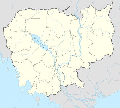 Kampong Cham Location of Kampong Cham, Cambodia | |
| Coordinates: 11°59′13.3″N 105°27′43.3″E / 11.987028°N 105.462028°ECoordinates: 11°59′13.3″N 105°27′43.3″E / 11.987028°N 105.462028°E | |
| Country |
|
| Province | Kampong Cham |
| District | Kampong Cham District |
| Government | |
| • Type | City municipality |
| Elevation | 20 m (70 ft) |
| Population (2008)[1] | |
| • Total | 118,242 |
| • Rank | Ranked 6th |
| Time zone | Cambodia (UTC+7) |

Kampong Cham (Khmer: ក្រុងកំពង់ចាម) is the capital city of Kampong Cham Province in eastern Cambodia. It is the sixth largest city in Cambodia[2] with a population of 63,771 people (2006)[3] and is located on the Mekong River. Kampong Cham is 124 kilometers northeast from Phnom Penh and can be reached by either boat or by asphalt road. It takes about 2.5 hours by vehicle or 2.5 hours by boat from Phnom Penh to the city of Kampong Cham. Its geographic location is 12.00°N, 105.46°E.
The city is connected to the district of Tbong khmum by the Kizuna bridge, the first in Cambodia to span the Mekong.
The city is subdivided into four khums and 31 phums.
Climate
| Climate data for Kampong Cham, Cambodia | |||||||||||||
|---|---|---|---|---|---|---|---|---|---|---|---|---|---|
| Month | Jan | Feb | Mar | Apr | May | Jun | Jul | Aug | Sep | Oct | Nov | Dec | Year |
| Record high °C (°F) | 35 (95) |
37 (99) |
38 (100) |
39 (102) |
37 (99) |
36 (97) |
37 (99) |
35 (95) |
34 (93) |
34 (93) |
33 (91) |
35 (95) |
39 (102) |
| Average high °C (°F) | 31.5 (88.7) |
32.9 (91.2) |
34.1 (93.4) |
34.7 (94.5) |
33.5 (92.3) |
32.2 (90) |
31.4 (88.5) |
31.5 (88.7) |
31.1 (88) |
30.8 (87.4) |
30.8 (87.4) |
30.7 (87.3) |
32.1 (89.78) |
| Daily mean °C (°F) | 26.1 (79) |
27.4 (81.3) |
29.5 (85.1) |
29.7 (85.5) |
29.1 (84.4) |
28.1 (82.6) |
27.6 (81.7) |
27.7 (81.9) |
27.4 (81.3) |
27.1 (80.8) |
26.7 (80.1) |
26.1 (79) |
27.71 (81.89) |
| Average low °C (°F) | 20.8 (69.4) |
21.9 (71.4) |
25.0 (77) |
24.8 (76.6) |
24.7 (76.5) |
24.1 (75.4) |
23.9 (75) |
24.0 (75.2) |
23.8 (74.8) |
23.5 (74.3) |
22.7 (72.9) |
21.5 (70.7) |
23.39 (74.1) |
| Record low °C (°F) | 10 (50) |
10 (50) |
18 (64) |
20 (68) |
20 (68) |
21 (70) |
20 (68) |
21 (70) |
21 (70) |
18 (64) |
16 (61) |
11 (52) |
10 (50) |
| Average precipitation mm (inches) | 4 (0.16) |
5 (0.2) |
33 (1.3) |
86 (3.39) |
242 (9.53) |
228 (8.98) |
224 (8.82) |
271 (10.67) |
263 (10.35) |
247 (9.72) |
106 (4.17) |
12 (0.47) |
1,721 (67.76) |
| Average relative humidity (%) | 67 | 66 | 66 | 68 | 76 | 79 | 79 | 81 | 83 | 81 | 76 | 72 | 74.5 |
| Source #1: Climate-Data.org (temp & precip)[4] | |||||||||||||
| Source #2: Weatherbase (humidity)[5] | |||||||||||||
See also
References
- ↑ "2008 Census". Archived from the original on 2013-01-11.
- ↑ Tourism Cambodia
- ↑ travelsradiate.com, stats implemented from Geonames
- ↑ "Climate: Kampong Cham". Climate-Data.org. Retrieved 19 May 2016.
- ↑ "KAMPONG CHAM, CAMBODIA". Weatherbase. Retrieved 19 May 2016.
External links
 Kampong Cham travel guide from Wikivoyage
| Capital city |  | |
|---|---|---|
| Districts | ||
| Provincial capitals | ||
|---|---|---|
| Municipal cities | ||
| Other cities | ||
This article is issued from Wikipedia - version of the 10/3/2016. The text is available under the Creative Commons Attribution/Share Alike but additional terms may apply for the media files.