Kampong Speu Province
| Kampong Speu ខេត្តកំពង់ស្ពឺ | |
|---|---|
| Province | |
|
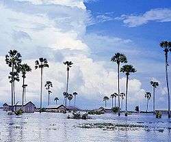
A flooded field in Kampong Speu | |
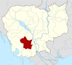 Map of Cambodia highlighting Kampong Speu | |
| Coordinates: 11°27′N 104°30′E / 11.450°N 104.500°ECoordinates: 11°27′N 104°30′E / 11.450°N 104.500°E | |
| Country |
|
| Provincial status | 1907 |
| Capital | Chbar Mon |
| Area | |
| • Total | 7,017 km2 (2,709 sq mi) |
| Area rank | Ranked 11th |
| Population (2008)[1] | |
| • Total | 716,517 |
| • Rank | Ranked 9th |
| • Density | 100/km2 (260/sq mi) |
| • Density rank | Ranked 11th |
| Time zone | UTC+07 |
| Dialing code | +855 |
| ISO 3166 code | KH-5 |
| Districts | 8 |
Kampong Speu (Khmer: ខេត្តកំពង់ស្ពឺ, IPA: [kɑmpɔːŋ spɨː] "Port of the Starfruit") is a province (khaet) of Cambodia. It borders the provinces of Pursat and Kampong Chhnang to the north, Kandal to the east, Takeo to the southeast, Kampot to the south and Koh Kong to the west. Its capital is Kampong Speu town.
Administrative divisions
The province is subdivided into 8 districts.
- 0501 Basedth (បរសេដ្ឋ)
- 0502 Chbar Mon (ច្បារមន)
- 0503 Kong Pisei (គងពិសី)
- 0504 Aoral (ឱរ៉ាល់)
- 0505 Odongk (ឧដុង្គ)
- 0506 Phnum Sruoch (ភ្នំស្រួច)
- 0507 Samraong Tong (សំរោងទង)
- 0508 Thpong (ថ្ពង)
References
- ↑ "General Population Census of Cambodia 2008 - Provisional population totals" (PDF). National Institute of Statistics, Ministry of Planning. 3 September 2008.
External links
 |
Pursat Province | Kampong Chhnang Province | | |
| Koh Kong Province | |
Kandal Province | ||
| ||||
| | ||||
| Kampot Province | Takeo Province |
| Capital city | | |
|---|---|---|
| Districts | ||
| Provinces | ||
|---|---|---|
| Municipalities | ||
This article is issued from Wikipedia - version of the 10/30/2016. The text is available under the Creative Commons Attribution/Share Alike but additional terms may apply for the media files.