Svay Rieng Province
| Svay Rieng ស្វាយរៀង | |
|---|---|
| Province | |
|
| |
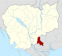 Map of Cambodia highlighting Svay Rieng | |
| Coordinates: 11°4′N 105°49′E / 11.067°N 105.817°ECoordinates: 11°4′N 105°49′E / 11.067°N 105.817°E | |
| Country |
|
| Provincial status | 1907 |
| Capital | Svay Rieng |
| Government | |
| • Governor | Chieng Am (CPP) |
| Area | |
| • Total | 2,966 km2 (1,145 sq mi) |
| Area rank | Ranked 21st |
| Population (2008)[1] | |
| • Total | 482,785 |
| • Rank | Ranked 13th |
| • Density | 160/km2 (420/sq mi) |
| • Density rank | Ranked 7th |
| Time zone | UTC+07 |
| Dialing code | +855 |
| ISO 3166 code | KH-20 |
| Districts | 7 |
| Communes | 80 |
| Villages | 690 |

Svay Rieng (Khmer: ស្វាយរៀង, IPA: [sʋaːj riəŋ] "Aligned Mangoes") is a province (khaet) of Cambodia. Located in the southeast, the province juts into Vietnam, which surrounds it to the north, east and south. The only other Cambodian province to border Svay Rieng is Prey Veng. The capital is Svay Rieng while the largest city is Bavet, which is the international border between Cambodia and Vietnam.
Districts
The province is subdivided into 8 districts.
- 2001 Chantrea - ចន្រ្ទា
- 2002 Kampong Rou - កំពង់រោទ៍
- 2003 Rumduol - រំដួល
- 2004 Romeas Haek - រមាសហែក
- 2005 Svay Chrum - ស្វាយជ្រុំ
- 2006 Svay Rieng - ស្វាយរៀង
- 2007 Svay Teab - ស្វាយទៀប
- 2008 Bavet - ក្រុងបាវិត
These 8 districts are subdivided into 80 khums and 690 phums.
Geography
A portion of the province juts into Vietnam, the Parrot's Beak. (Vietnamese: Mỏ Vẹt).
Notable people
- Khieu Samphan, former President and convicted war criminal
- Thun Sophea, kickboxer
References
- ↑ "General Population Census of Cambodia 2008 - Provisional population totals" (PDF). National Institute of Statistics, Ministry of Planning. 3 September 2008.
External links
 |
Tây Ninh Province, |
| ||
| Prey Veng Province | |
|||
| ||||
| | ||||
| Long An Province, |
| Capital city | | |
|---|---|---|
| Districts | ||
| Provinces | ||
|---|---|---|
| Municipalities | ||
This article is issued from Wikipedia - version of the 10/30/2016. The text is available under the Creative Commons Attribution/Share Alike but additional terms may apply for the media files.