Kampong Chhnang Province
| Kampong Chhnang ខេត្តកំពង់ឆ្នាំង | |
|---|---|
| Province | |
|
Rice field in Kampong Chhnang | |
 | |
| Country |
|
| Provincial status | 1907 |
| Capital | Kampong Chhnang |
| Government | |
| • Governor | Chhouk Chandoeun |
| Area | |
| • Total | 5,521.0 km2 (2,131.7 sq mi) |
| Area rank | Ranked 14th |
| Population (2011) | |
| • Total | 472,616 |
| • Rank | Ranked 14th |
| • Density | 86/km2 (220/sq mi) |
| • Density rank | Ranked 16th |
| Time zone | Indochina Time (UTC+7) |
| ISO 3166 code | KH-4 |

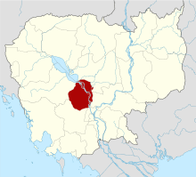
Kampong Chhnang (Khmer: ខេត្តកំពង់ឆ្នាំង, IPA: [kɑmpɔːŋ cʰnaːŋ] "Port of Pottery") is one of the central provinces (khaet) of Cambodia. Neighboring provinces are (from north clockwise) Kampong Thom, Kampong Cham, Kandal, Kampong Speu and Pursat. The capital city of Kampong Chhnang Province is Kampong Chhnang.[1][2]
Geography
Kampong Channang is a small province 91 kilometres (57 mi) from Phnom Penh. It is in the alluvial plain of central Cambodia and is drained by the Tonle Sap, a tributary of the Mekong river. The capital city of Phnom Penh has grown until it actually encompasses the provincial border of Kampong Chhnang.[3]
History
The name translates from Khmer literally to Port of Pottery. Archaeological remains from the area have revealed among many other findings artifacts from Dvaravati, a former kingdom in present-day Thailand, dating to the 6th through 11th centuries.
Kampong Chhnang Province centuries ago was a coastal city on the route between China and India; due to sedimentation from the Mekong river, the coast line moved much farther to sea. When the Tonle Sap river changed its course, the city lost its main water source and thus was deserted, the population moving to a city called Kampong Tralach. A city gradually formed around it, bring new life to Kampong Chhnang. A museum presents the archaeological record of the city's history.
Symbols
The provincial tree is Diospyros decandra. The provincial slogan is sweet pomelos, delicious rice, beautiful young ladies.
Administrative divisions
The province is subdivided into 8 districts (srok). The districts are further subdivided into 65 communes (khum) and 478 villages (phum). There is one city and 14 townships. There are also 102 khum administrative organizations (KAO).[4][5][6]
Tourism
References
- ↑ "The Official Tourism website of Kampong Chhnang, Cambodia". Kampong Chhnang Official Tourism Website. Retrieved December 3, 2016.
- ↑ "Introduction - Kampong Chhnang, Cambodia". Tourism of Cambodia. Retrieved December 3, 2016.
- ↑ "Geography - Kampong Chhnang, Cambodia". Tourism of Cambodia. Retrieved December 3, 2016.
- ↑ "Kampong Chhnang Province" (PDF). Cambodia investment. Retrieved December 3, 2016.
- ↑ "Map 4. Administrative Areas in Kampong Chhnang Province by District and Commune" (PDF). Stat Gov Japan. Retrieved December 3, 2016.
- ↑ "Map - Kampong Chhnang, Cambodia". Canby Publications Co. Retrieved December 3, 2016.
External links
 |
Tonlé Sap | Kampong Thom Province | Kampong Thom Province | |
| Pursat Province | |
Kampong Cham Province | ||
| ||||
| | ||||
| Kampong Speu Province | Kampong Speu Province | Kandal Province |
| Provinces | ||
|---|---|---|
| Municipalities | ||