Serei Saophoan District
| Serei Saophoan ស្រុកសិរីសោភ័ណ | |
|---|---|
| District (srok) | |
|
Small lake in Serei Saophoan District | |
 Map showing the location of the district within Banteay Meanchey Province. | |
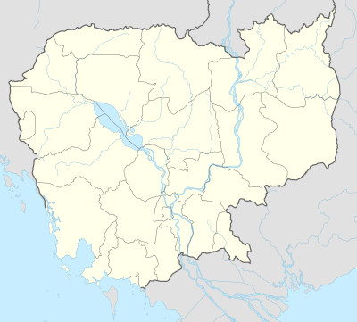 Serei Saophoan Location in Cambodia | |
| Coordinates: 13°35′N 102°59′E / 13.583°N 102.983°E | |
| Country |
|
| Province | Banteay Meanchey |
| Communes | 7 |
| Villages | 42 |
| Population (2008) | |
| • Total | 90,279 |
| Time zone | +7 |
| Geocode | 0106 |

Serei Saophoan (Khmer: ស្រុកសិរីសោភ័ណ, "Glorious and Auspicious"; Thai: ศรีโสภณ, rtgs: Si Sophon, pronounced [sǐː sǒː.pʰōn]) is a district (srok) in the centre of Banteay Meanchey Province, in north-western Cambodia. Serei Saophoan is the urban district of Banteay Meanchey province and the district capital is also the provincial capital Sisophon town. The town is located 359 kilometres north of Phnom Penh and 48 kilometres from the border with Thailand at Poipet. Serei Saophoan District is the central district of Banteay Meanchey and is surrounded by other Banteay Meanchey districts. Cambodia's main railway line from Phnom Penh to Poipet enters the district from the south and exits to the west.[1]
The district is easily accessed by road from Phnom Penh (359 km) Battambang (city) (68 km) and Siem Reap (city) (102 km). Serei Saophoan District is the smallest district in Banteay Meanchey province by land area. However, it has one of the largest district populations in the province due to its central location and access to transport infrastructure. National Highway 5 which begins in Phnom Penh and ends at Poipet and the National railway both bisect the district in parallel. National Highway 6 which begins in Phnom Penh also has its terminus at Sisophon town in Serei Saophoan. National road 56 begins at Sisophon town in the centre of the district and runs north east to Samraong in Oddar Meanchey province.[2]
Rehabilitation centre
A boot camp-style rehabilitation centre, chiefly for those addicted to drugs, is located within Serei Saophoan district, in Sisophon town. The camp is run by the military police, a division of the Royal Cambodian Armed Forces. Young men are sent to the centre by their parents because they take drugs, drink too much or are out of control. At the centre residents receive compulsory military training, massive amounts of exercise and self-criticism sessions 7 days per week for a minimum of five months.[3]
The centre submits its young inmates to a gruelling regime of military-style physical training. Residents are signed into the centre by their parents, regardless of their age, and attendance is voluntary. However, if the young men try to escape, the staff chase them, catch them and bring them back to the camp. There the other residents administer a beating.[4]
Location
Serei Saophoan district lies in the centre of the province. Reading from the north clockwise, Serei Saophoan borders with Svay Chek district to the north. The eastern border of the district is shared with Preah Netr Preah district. The Sisophon River runs through the district flowing from west to east.[5] To the south the district shares a border with Mongkol Borei district. The western border of the district joins with Ou Chrov district of Banteay Meanchey.[6]
Administration
The Serei Saophoan district governor reports to His Excellency Oung Ouen, the Governor of Banteay Meanchey. The following table shows the villages of Serei Saophoan district by commune.
| Khum (Commune) | Phum (Villages) |
|---|---|
| Kampong Svay | Kampong Svay, Kang Va, Phum Pir, Pongro, Souphi |
| Kaoh Pong Satv | Kaoh Pong Satv, Ta Sokh, Preah Angk, Snay Dangkot, Angkea Bos |
| Mkak | Mkak, Kbal Spean, Ta Ma, Kouk Lieb, Chhuk, Doun Lei, Baek Chan |
| Ou Ambel | Saesen, Kourothan, Roung Masin, Prohut, Ou Ambel |
| Phniet | Kantuot, Kampring, Phniet, Neak Ta, Thmei, Bangruh, Sala Krau |
| Preah Ponlea | Chak, Phum Muoy, Phum Bei, Phum Buon, Prey Ruessei, Preah Ponlea, Kbal Spean |
| Tuek Thla | Keab, Tumnob Chrey, Tuek Thla, Ba Nay, Phnum Bak, Dei Lou |
Demographics
The district is subdivided into 7 communes (khum) and 42 villages (phum).[7][8] According to the 1998 Census, the population of the district was 98,848 persons in 18,374 households in 1998. This population consisted of 48,056 males (48.6%) and 50,792 females (51.4%). With a population of almost 100,000 people, Serei Saophoan has one of the largest district populations in Banteay Meanchey province. The average household size in Serei Saophoan is 5.4 persons per household, which is slightly larger than the rural average for Cambodia (5.2 persons). The sex ratio in the district is 94.6%, with more females than males.[9]
References
- ↑ Total Road Atlas of Cambodia 2006 (3rd ed.). Total Cambodge. 2006. p. 33.
- ↑ Cambodia Road Network (Version 03-00 ed.). Ministry of Public Works and Transport. 2001.
- ↑ Samean, Yun; Fergal Quinn (July 15, 2008). "Tough Love for Wealthy Young Troublemakers". The Cambodia Daily. Retrieved 2009-03-22.
- ↑ Barton, Cat (24 March 2006). "Limited treatment options for drug addicts". Phnom Penh Post. Retrieved 2009-03-22.
- ↑ "Stung Mongkol Borei Sub-Basin". Asian Development Bank.
- ↑ "Banteay Meanchey Provincial Resources". Ministry of Commerce. Archived from the original on January 5, 2009. Retrieved 2009-03-22.
- ↑ "Banteay Meanchey Administration". Royal Government of Cambodia. Retrieved 2009-01-22.
- ↑ "Index Map 1-2. Provinces and Districts in Cambodia" (PDF). National Institute of Statistics, Ministry of Planning (Cambodia). 2013-12-31.
- ↑ General Population Census of Cambodia, 1998: Village Gazetteer. National Institute of Statistics. February 2000. pp. 1–15.
External links
- Banteay Meanchey at Royal Government of Cambodia website
- Banteay Meanchey at the Ministry of Commerce website
Capital: Serei Saophoan | ||
| Mongkol Borei District |  | |
| Phnum Srok District | ||
| Preah Netr Preah District | ||
| Ou Chrov District | ||
| Krong Serei Saophoan | ||
| Thma Puok District | ||
| Svay Chek District | ||
| Malai District | ||
| Krong Paoy Paet | ||
Coordinates: 13°35′N 102°59′E / 13.583°N 102.983°E