Barcelos, Amazonas
| Barcelos | ||
|---|---|---|
| Municipality | ||
| Municipality of Barcelos | ||
|
A view of the city | ||
| ||
| Nickname(s): "Capital do peixe ornamental" ("Capital of the ornamental fish") Cidade menina ("Girl City") | ||
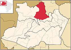 Location of Barcelos in the State of Amazonas | ||
 Barcelos Location in Brazil | ||
| Coordinates: 00°58′30″S 62°55′26″W / 0.97500°S 62.92389°WCoordinates: 00°58′30″S 62°55′26″W / 0.97500°S 62.92389°W | ||
| Country |
| |
| Region | North | |
| State |
| |
| Founded | May 27, 1758 | |
| Government | ||
| • Mayor | José Ribamar Beleza (PMDB) | |
| Area | ||
| • Total | 122,475.728 km2 (47,288.143 sq mi) | |
| Population (2012) | ||
| • Total | 25,948 | |
| • Density | 0.21/km2 (0.5/sq mi) | |
| [1] | ||
| Time zone | AST (UTC-4) | |
| • Summer (DST) | DST no longer used (UTC-4) | |
| Area code(s) | +55 92 | |
| HDI (2000) | 0.593 – medium[2] | |
| Website | Manaus, Amazonas | |

.svg.png)
Barcelos, (also Barcellos), formerly Mariuá, is a municipality located in the State of Amazonas, northern Brazil. Its population was 32,169 (2005) and its area is 122,476 square kilometres (47,288 sq mi),[3] making it the second largest municipality in Brazil (behind Altamira, Pará), equivalent in size to New York state in the United States and slightly larger than North Korea.
About
The city is served by Barcelos Airport with scheduled services to Manaus.
Since 1994, Barcelos has been the host of an annual festival celebrating ornamental fish,[4] which is a significant source of income for the region. Project Piaba uses Barcelos as the starting point for their annual research expedition into the Rio Negro area.[5]
The municipality contains part of the Amanã Sustainable Development Reserve.[6] It also contains part of the Amazonas National Forest.[7] It contains the 833,352 hectares (2,059,260 acres) Rio Unini Extractive Reserve, created in 2006.[8]
History
Barcelos was originally named Mariuá, village of the Manaus Indians. When the captaincy of São José do Rio Negro was formed in 1755, Francisco Xavier de Mendonça Furtado, Governor General of state of Grao Para e Maranhao chose the aldeia de São José do Javari, a village founded by Carmelite Friar Matias São Boaventuras Jesuits in 1728 near the mouth of the Javari River, as its capital. It was the capital of the captaincy of São José do Rio Negro from 1755-1791, and again from 1799-1808.
References
- ↑ "2012 Populational Estimate" (PDF). Censo Populacional 2012. Instituto Brasileiro de Geografia e Estatística (IBGE). July 2012. Retrieved August 31, 2012.
- ↑ "Archived copy". Archived from the original on 2009-10-03. Retrieved 2009-12-17. - UNDP
- ↑ IBGE - "Archived copy". Archived from the original on January 9, 2007. Retrieved August 3, 2014.
- ↑ Carey, Randy (March 2007). "Hope Along the Rio Negro Part 1: The View from Manaus". Tropical Fish Magazine. Retrieved 9 August 2015.
- ↑ "Project Piaba". Project Piaba. Retrieved 9 August 2015.
- ↑ RDS Amanã (in Portuguese), ISA: Instituto Socioambiental, retrieved 2016-05-05
- ↑ Unidade de Conservação: Floresta Nacional do Amazonas (in Portuguese), MMA: Ministério do Meio Ambiente, retrieved 2016-05-19
- ↑ RESEX Rio Unini (in Portuguese), ISA: Instituto Socioambiental, retrieved 2016-09-14
External links
Capital: Manaus | ||||||||||||||||||||||||
| Mesoregion Centro Amazonense |
|  | ||||||||||||||||||||||
| Mesoregion Norte Amazonense |
| |||||||||||||||||||||||
| Mesoregion Sudoeste Amazonense |
| |||||||||||||||||||||||
| Mesoregion Sul Amazonense |
| |||||||||||||||||||||||