Itacoatiara, Amazonas
| Itacoatiara | |||
|---|---|---|---|
| Municipality | |||
| Município de Itacoatiara Municipality of Itacoatiara | |||
| |||
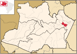 | |||
 Itacoatiara Location in Brazil | |||
| Coordinates: 03°08′34″S 58°26′38″W / 3.14278°S 58.44389°WCoordinates: 03°08′34″S 58°26′38″W / 3.14278°S 58.44389°W | |||
| Country | Brazil | ||
| Region | North | ||
| State |
| ||
| Founded | April 24, 1874 | ||
| Government | |||
| • Mayor | Mamoud Amed Parti (Social Democratic Party of Brazil) | ||
| Area | |||
| • Municipality | 8,891.993 km2 (3,433.218 sq mi) | ||
| Elevation | 40 m (130 ft) | ||
| Population (2014) | |||
| • Metro | 95,714 | ||
| • Metro density | 10.016/km2 (25.94/sq mi) | ||
| Time zone | BRT (UTC−4) | ||
| • Summer (DST) | DST no longer used (UTC−4) | ||


Itacoatiara is a municipality in central eastern portion of state of Amazonas, northern Brazil. It is 176 km east by air or 270 km downstream by river from Manaus. It is the third most populous town in the state, on the bank of the Amazon River. Its population was 95,714 (2014) and its area is 8,600 km².[1] The town is known as "city of painted stone" - which is its name translated from Tupi. Itacoatiara has an important port, which is responsible for a considerable amount of cargo transportation in Amazonas.
History
- In 1655, an aldea named Arroquis, on Albi Island on the Madeira River, was founded by Portuguese Jesuit António Vieira. It was thereafter moved four times due to aggression by the Mura indigenous people.
- In 1757, the inhabitants of aldea Abacaxi (where did the inhabitants of Arroquis go?) moved to the left bank of the Amazon River, where Itacoatiara is now located.
- In 1758, Francisco Xavier de Mendonça passed through the region for the second time in order to found the captaincy of São José do Rio Negro.
- In 1759, the aldea was elevated to the category of village, and was then called Serpa. Itacoatiara became an actual town by law 74 of December 10, 1857, but in 1858 it was once more considered a village, named Nossa Senhora do Rosário de Serpa. Finally, on April 25, 1874, by law 283, Itacoatiara was again elevated to the category of town, with its current name.
See also
- Silves another old town, originally a mission, nearby
References
Capital: Manaus | ||||||||||||||||||||||||
| Mesoregion Centro Amazonense |
|  | ||||||||||||||||||||||
| Mesoregion Norte Amazonense |
| |||||||||||||||||||||||
| Mesoregion Sudoeste Amazonense |
| |||||||||||||||||||||||
| Mesoregion Sul Amazonense |
| |||||||||||||||||||||||
This article is issued from Wikipedia - version of the 6/15/2016. The text is available under the Creative Commons Attribution/Share Alike but additional terms may apply for the media files.