Coari
| Coari | |||
|---|---|---|---|
| Municipality | |||
 | |||
| |||
| Nickname(s): Cidade do Gás | |||
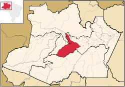 Coari municipality (red) in Amazonas state | |||
| Coordinates: 04°05′06″S 63°08′27″W / 4.08500°S 63.14083°WCoordinates: 04°05′06″S 63°08′27″W / 4.08500°S 63.14083°W | |||
| Country |
| ||
| Region | North | ||
| State |
| ||
| Government | |||
| • Mayor | Manoel Adail Amaral Pinheiro (PRP) | ||
| Area | |||
| • Municipality | 57,921.646 km2 (22,363.673 sq mi) | ||
| Elevation | 40 m (120 ft) | ||
| Population (2014) | |||
| • Density | 1.334/km2 (3.46/sq mi) | ||
| • Metro | 82,209 | ||
| Time zone | AST(UTC-4 (UTC-4) | ||
| • Summer (DST) | DST no longer used (UTC-4) | ||
| ZIP code | 69460-000 | ||
| Website | http://www.coari.am.gov.br/ | ||


Coari (Choary) is a Brazilian municipality in the Amazon region.
Location
The municipal seat of Coari is one of the largest cities of the Amazonas state. It is the seat of the Roman Catholic Diocese of Coari. The area has reserves of oil and natural gas. Coari is served by Coari Airport located 6 km from downtown Coari. Porto Urucu Airport located in the district of Porto Urucu 470 km away serves the population residing and working for Petrobras.
Conservation
The municipality contains part of the Amanã Sustainable Development Reserve.[1] It contains a small portion of the 1,008,167 hectares (2,491,230 acres) Piagaçu-Purus Sustainable Development Reserve, established in 2003.[2] The municipality contains 66.15% of the 217,486 hectares (537,420 acres) Catuá-Ipixuna Extractive Reserve, established in 2003 as the first extractive reserve in the state of Amazonas.[3]
References
- ↑ RDS Amanã (in Portuguese), ISA: Instituto Socioambiental, retrieved 2016-05-05
- ↑ RDS Piagaçu-Purus (in Portuguese), ISA: Instituto Socioambiental, retrieved 2016-08-20
- ↑ RESEX Catuá-Ipixuna (in Portuguese), ISA: Instituto Socioambiental, retrieved 2016-08-30
External links
Capital: Manaus | ||||||||||||||||||||||||
| Mesoregion Centro Amazonense |
|  | ||||||||||||||||||||||
| Mesoregion Norte Amazonense |
| |||||||||||||||||||||||
| Mesoregion Sudoeste Amazonense |
| |||||||||||||||||||||||
| Mesoregion Sul Amazonense |
| |||||||||||||||||||||||