Rio Negro (Amazon)
| Río Negro | |
| Guainía River | |
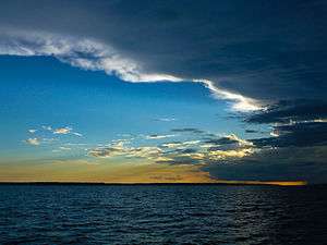 Sunset over the Rio Negro, upstream from Manaus | |
| Countries | |
|---|---|
| Tributaries | |
| - left | Branco River (and many smaller rivers) |
| - right | Vaupés River (and many smaller rivers) |
| Source | highlands of Colombia |
| - location | Guainía Department, Amazon region, Colombia |
| Mouth | Amazon River |
| - location | Manaus, Amazonas State, Brazil |
| - coordinates | 3°08′00″S 59°54′30″W / 3.13333°S 59.90833°WCoordinates: 3°08′00″S 59°54′30″W / 3.13333°S 59.90833°W |
| Length | 2,250 km (1,400 mi) [1] |
| Basin | 691,000 km2 (267,000 sq mi) |
| Discharge | mouth |
| - average | 28,000 m3/s (988,800 cu ft/s) [2] |
 Map showing the Rio Negro in the Amazon Basin | |
The Rio Negro (Portuguese: Rio Negro [ˈʁi.u nɛɡɾu]; Spanish: Río Negro [ˈri.o ˈneɣɾo] "Black River") is the largest left tributary of the Amazon, the largest blackwater river in the world, and one of the world's ten largest rivers in average discharge.
Geography
Upper course
The source of the Rio Negro lies in Colombia, in the Department of Guainía where the river is known as Guainía River.[3] The young river generally flows in an east-northeasterly direction through the Puinawai National Reserve, passing several small indigenous settlements on its way, such as Cuarinuma, Brujas, Santa Rosa and Tabaquén. After roughly 400 km the river starts forming the border between Colombia's Department of Guainía and Venezuela's Amazonas State. After passing the Colombian community of Tonina and Macanal the river turns Southwest. Maroa is the first Venezuelan town the river passes. 120 km further downstream the river receives the Casiquiare canal from the right-hand, forming a unique link between the Orinoco and the Amazon river basin. Henceforth the river is called Rio Negro.
Middle course
The river now continues in a southeastern direction passing the Venezuelan town of San Carlos de Río Negro, its largest settlement on the river, and Colombia's San Felipe. In this stretch the river is constantly fed with tributaries from both sides, and it quickly grows in size creating large river islands, a common feature for all rivers in the Amazon basin. After forming the border between Colombia and Venezuela for 260 km the rio Negro reaches the Piedra del Cocuy, an igneous rock formation from the Precambrian era, belonging to the Guyana Shield. Here the Tripoint of Colombia, Venezuela and Brazil is found in the middle of the river and it now completely enters Amazonas State, Brazil. After passing Cucuí, the river continues south, only temporarily turning west for several kilometers. In Missão Boa Vista the Içana River joins the Rio Negro and in São Joaquim the Uaupes River, the largest tributary of the Rio Negro, also enters from the right hand side. The Rio Negro now turns markedly towards the east, forming several rapids and small islets on its way. It then passes Sao Gabriel da Cachoeira an important commercial city. After several more rapids and imposing views of the Adormecida mountain chain the river leaves the Guyana shield it traversed in its upper and middle course.
Lower course
After the Marié River enters the Rio Negro the river continues its eastward course forming many large islands and becoming very wide at several locations. It passes local communities such as Santa Isabel do Rio Negro. During the wet season, the river floods the country far and wide here, sometimes to a width of 30 kilometres (19 mi), for long distances. During this season, from April until October, it is a succession of lagoons, full of long islands and intricate channels with a lot of water wildlife. Near Carvoeiro the last major tributary of the Rio Negro, the Branco River joins the Rio Negro and the river temporarily forms the border between the state of Roraima and Amazonas State, Brazil. The river now takes a more southeastern course, becoming again very wide in many stretches before reaching the biggest city on its course Manaus.

The Anavilhanas National Park, a 350,018 hectares (864,910 acres) conservation unit that was originally an ecological station created in 1981, protects part of the Anavilhanas river archipelago in this part of the river.[4] Below the archipelago it meets the Solimões River to form the Amazon River.
History
The river was named by the Spanish explorer Francisco de Orellana, who first came upon it in 1541. By the middle of the 17th century, Jesuits had settled along its banks in the midst of numerous tribes: Manau, Aruák, and Trumá Indians. After 1700 slaving along the river was common, and indigenous populations were greatly diminished after contact with infectious European diseases.[5]
Fauna
While the name Rio Negro means Black River, its waters are similar in color to strong tea. The dark color comes from humic acid due to an incomplete breakdown of phenol-containing vegetation from sandy clearings. The river was named because it looks black from a distance.
Much has been written on the productivity of the Rio Negro and other blackwater rivers. The older idea that these are "hunger rivers" is giving way, with new research, to the recognition that the Rio Negro, for example, supports a large fishing industry and has numerous turtle beaches. If explorers did not find many Indians along the Rio Negro during the 17th century, it is likely that their populations were reduced because of new infectious diseases and warfare rather than low river productivity.
Rio Negro has a very high species richness. About 700 fish species have been documented in the river basin, and it is estimated that the total is 800–900 fish species, including almost 100 endemics and several undescribed species.[6] Among these are many that are important in the aquarium trade, including the cardinal tetra.[6]
Notes
- ↑ Ziesler, R.; Ardizzone, G.D. (1979). "Amazon River System". The Inland waters of Latin America. Food and Agriculture Organization of the United Nations. ISBN 92-5-000780-9. Archived from the original on 8 November 2014.
- ↑ Seyler, Patrick; Laurence Maurice-Bourgoin; Jean Loup Guyot. "Hydrological Control on the Temporal Variability of Trace Element Concentration in the Amazon River and its Main Tributaries". Geological Survey of Brazil (CPRM). Retrieved 24 July 2010.
- ↑ Penn, James R (2001). Rivers of the World: A Social, Geographical and Environmental Sourcebook. Santa Barbara: ABC Clio.
- ↑ PARNA de Anavilhanas (in Portuguese), ISA: Instituto Socioambiental, retrieved 2016-04-30
- ↑ Penn, James R (2001). Rivers of the World: A Social, Geographical and Environmental Sourcebook. Santa Barbara: ABC Clio.
- 1 2 Hales, J., and P. Petry (2013). Rio Negro. Freshwater Ecoregions of the World. Retrieved 12 February 2013
References
- Goulding, M., Carvalho, M. L., & Ferreira, E. J. G. (1988). Rio Negro, Rich Life in Poor Water : Amazonian Diversity and Foodchain Ecology as seen through Fish Communities. The Hague: SPB Academic Publishing. ISBN 90-5103-016-9
- Saint-Paul, U., Berger, U., Zuanon, J., Villacorta Correa, M. A., García, M., Fabré, N. N., et al. (2000). "Fish communities in central Amazonian white- and blackwater floodplains," Environmental Biology of Fishes, 57(3), 235-250.
- Sioli, H. (1955). "Beiträge zur regionalen Limnologie des Amazonasgebietes. III. Über einige Gewässer des oberen Rio Negro-Gebietes." Arch. Hydrobiol., 50(1), 1-32.
- Wallace, A. R. (1853). A narrative of travels on the Amazon and Rio Negro, with an account of the native tribes, and observations on the climate, geology, and natural history of the Amazon Valley. London: Reeve.
- Wright, R. (2005). História indígena e do indigenismo no Alto Rio Negro. São Paulo, Brazil: UNICAMP & Instituto Socioambiental. ISBN 85-7591-042-6.
| Wikimedia Commons has media related to Rio Negro. |