Japurá
| Japurá | |||
|---|---|---|---|
| Municipality | |||
| |||
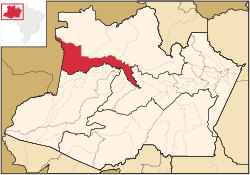 Location of the municipality inside Amazonas | |||
 Japurá Location in Brazil | |||
| Coordinates: 1°49′34″S 66°35′56″W / 1.82611°S 66.59889°WCoordinates: 1°49′34″S 66°35′56″W / 1.82611°S 66.59889°W | |||
| Country |
| ||
| Region | North | ||
| State |
| ||
| Time zone | BRT (UTC−4) | ||
| • Summer (DST) | DST no longer used (UTC−4) | ||


Japurá is a municipality located in the Brazilian state of Amazonas. Its population was 13,026 (2005) and its area is 55,791 km².[1] It forms the Japurá microregion together with the municipality Maraã (to the east of the Japurá municipality). The southern border of both the municipality and the microregion is the Japurá River.
The municipality contains the Juami-Japurá Ecological Station, which covers the entire Juami River basin.[2] The municipality contains 55% of the 146,950 hectares (363,100 acres) Auatí-Paraná Extractive Reserve, created in 2001.[3]
References
- ↑ IBGE -
- ↑ Unidade de Conservação: Estação Ecológica Juami-Japurá (in Portuguese), MMA: Ministério do Meio Ambiente, retrieved 2016-05-07
- ↑ RESEX Auatí-Paraná (in Portuguese), ISA: Instituto Socioambiental, retrieved 2016-10-21
Capital: Manaus | ||||||||||||||||||||||||
| Mesoregion Centro Amazonense |
|  | ||||||||||||||||||||||
| Mesoregion Norte Amazonense |
| |||||||||||||||||||||||
| Mesoregion Sudoeste Amazonense |
| |||||||||||||||||||||||
| Mesoregion Sul Amazonense |
| |||||||||||||||||||||||
This article is issued from Wikipedia - version of the 10/21/2016. The text is available under the Creative Commons Attribution/Share Alike but additional terms may apply for the media files.