Ariton, Alabama
| Ariton, Alabama | |
|---|---|
| Town | |
 Location in Dale County and the state of Alabama | |
| Coordinates: 31°35′53″N 85°43′7″W / 31.59806°N 85.71861°W | |
| Country | United States |
| State | Alabama |
| County | Dale |
| Area | |
| • Total | 5.1 sq mi (13.2 km2) |
| • Land | 5.1 sq mi (13.2 km2) |
| • Water | 0 sq mi (0 km2) |
| Elevation | 459 ft (140 m) |
| Population (2010)[1] | |
| • Total | 764 |
| • Density | 150/sq mi (58.0/km2) |
| Time zone | Central (CST) (UTC-6) |
| • Summer (DST) | CDT (UTC-5) |
| ZIP code | 36311 |
| Area code(s) | 334 |
| FIPS code | 01-02428 |
| GNIS feature ID | 0151663 |
Ariton is a town in Dale County, Alabama, United States. At the 2010 census the population was 764.[1] It was incorporated in April 1906.[2]
Ariton is part of the Ozark Micropolitan Statistical Area. And Serves as the home of the Purple Cats.
Geography
Ariton is located in northwestern Dale County at 31°35′54″N 85°43′8″W / 31.59833°N 85.71889°W (31.598204, -85.718761).[3] Alabama State Routes 51 and 123 pass through the center of town as Main Street. AL 51 leads northeast 11 miles (18 km) to Clio and southwest 3.5 miles (5.6 km) to U.S. Route 231, while AL 123 leads west 3.5 miles (5.6 km) to US 231 and southeast 12 miles (19 km) to Ozark, the Dale County seat.
According to the U.S. Census Bureau, the town has a total area of 5.1 square miles (13.2 km2), all land.[1]
Demographics
| Historical population | |||
|---|---|---|---|
| Census | Pop. | %± | |
| 1910 | 431 | — | |
| 1920 | 625 | 45.0% | |
| 1930 | 611 | −2.2% | |
| 1940 | 561 | −8.2% | |
| 1950 | 620 | 10.5% | |
| 1960 | 687 | 10.8% | |
| 1970 | 643 | −6.4% | |
| 1980 | 844 | 31.3% | |
| 1990 | 743 | −12.0% | |
| 2000 | 772 | 3.9% | |
| 2010 | 764 | −1.0% | |
| Est. 2015 | 746 | [4] | −2.4% |
| U.S. Decennial Census[5] 2013 Estimate[6] | |||
2000 Census data
As of the census[7] of 2000, there were 772 people, 306 households, and 220 families residing in the town. The population density was 152.3 people per square mile (58.8/km2). There were 335 housing units at an average density of 66.1 per square mile (25.5/km2). The racial makeup of the town was 69.30% White, 29.27% Black or African American, 0.13% Native American, and 1.30% from two or more races. 0.78% of the population were Hispanic or Latino of any race.
There were 306 households out of which 39.2% had children under the age of 18 living with them, 47.1% were married couples living together, 20.6% had a female householder with no husband present, and 27.8% were non-families. 26.5% of all households were made up of individuals and 15.7% had someone living alone who was 65 years of age or older. The average household size was 2.52 and the average family size was 3.02.
In the town the population was spread out with 28.5% under the age of 18, 8.4% from 18 to 24, 27.7% from 25 to 44, 18.4% from 45 to 64, and 17.0% who were 65 years of age or older. The median age was 36 years. For every 100 females there were 84.2 males. For every 100 females age 18 and over, there were 72.0 males.
The median income for a household in the town was $21,083, and the median income for a family was $25,781. Males had a median income of $27,250 versus $17,639 for females. The per capita income for the town was $11,502. About 25.1% of families and 25.9% 55 of the population were below the poverty line, including 34.5% of those under age 18 and 22.2% of those age 65 or over.
Notable people
- Eunice Hutto Morelock, pioneer faculty member at Bob Jones College and possibly the first female chief academic officer of a coeducational college in the United States
- Willie Mae "Big Mama" Thornton, American rhythm and blues singer and songwriter[8]
Leo Jolly, prep running back and University of Alabama signee in 1984.
Climate
The climate in this area is characterized by hot, humid summers and generally mild to cool winters. According to the Köppen Climate Classification system, Ariton has a humid subtropical climate, abbreviated "Cfa" on climate maps. [9]
| Climate data for Ariton, Alabama | |||||||||||||
|---|---|---|---|---|---|---|---|---|---|---|---|---|---|
| Month | Jan | Feb | Mar | Apr | May | Jun | Jul | Aug | Sep | Oct | Nov | Dec | Year |
| Average high °C (°F) | 16 (61) |
18 (64) |
22 (71) |
26 (79) |
29 (85) |
33 (91) |
33 (91) |
33 (91) |
31 (88) |
27 (80) |
21 (70) |
17 (62) |
26 (78) |
| Average low °C (°F) | 4 (39) |
5 (41) |
9 (48) |
12 (54) |
17 (62) |
20 (68) |
21 (70) |
21 (70) |
19 (66) |
13 (56) |
8 (46) |
5 (41) |
13 (55) |
| Average precipitation mm (inches) | 117 (4.6) |
130 (5) |
145 (5.7) |
117 (4.6) |
94 (3.7) |
117 (4.6) |
160 (6.3) |
124 (4.9) |
109 (4.3) |
58 (2.3) |
81 (3.2) |
124 (4.9) |
1,374 (54.1) |
| Source: Weatherbase [10] | |||||||||||||
References
- 1 2 3 "Geographic Identifiers: 2010 Demographic Profile Data (G001): Ariton town, Alabama". U.S. Census Bureau, American Factfinder. Retrieved October 2, 2015.
- ↑ http://www.encyclopediaofalabama.org/article/h-3424
- ↑ "US Gazetteer files: 2010, 2000, and 1990". United States Census Bureau. 2011-02-12. Retrieved 2011-04-23.
- ↑ "Annual Estimates of the Resident Population for Incorporated Places: April 1, 2010 to July 1, 2015". Retrieved July 2, 2016.
- ↑ "U.S. Decennial Census". Census.gov. Archived from the original on May 11, 2015. Retrieved June 6, 2013.
- ↑ "Annual Estimates of the Resident Population: April 1, 2010 to July 1, 2013". Retrieved June 3, 2014.
- ↑ "American FactFinder". United States Census Bureau. Archived from the original on 2013-09-11. Retrieved 2008-01-31.
- ↑ Big Mama Thornton: The Life and Music. McFarland Inc. ISBN 978-0-7864-7759-3
- ↑ Climate Summary for Ariton, Alabama
- ↑ "Weatherbase.com". Weatherbase. 2013. Retrieved on November 3, 2013.
Coordinates: 31°35′54″N 85°43′08″W / 31.598204°N 85.718761°W
Municipalities and communities of Dale County, Alabama, United States | ||
|---|---|---|
| Cities | 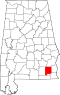 | |
| Towns | ||
| CDP | ||
| Unincorporated communities | ||
| Footnotes | ‡This populated place also has portions in an adjacent county or counties | |