Ozark, Alabama
| Ozark, Alabama | |
|---|---|
| City | |
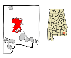 Location in Dale County and the state of Alabama | |
| Coordinates: 31°26′53″N 85°38′31″W / 31.44806°N 85.64194°W | |
| Country | United States |
| State | Alabama |
| County | Dale |
| Settled | 1822 |
| Incorporated | October 27, 1870 |
| Government | |
| • Type | Mayor/City Council |
| • Mayor | Billy Blackwell |
| Area | |
| • Total | 34.5 sq mi (89.3 km2) |
| • Land | 34.2 sq mi (88.7 km2) |
| • Water | 0.2 sq mi (0.6 km2) |
| Elevation | 417 ft (127 m) |
| Population (2010)[1] | |
| • Total | 14,907 |
| • Estimate (2014)[2] | 14,700 |
| • Density | 429/sq mi (165.7/km2) |
| Time zone | Central (CST) (UTC-6) |
| • Summer (DST) | CDT (UTC-5) |
| ZIP codes | 36360-36361 |
| Area code(s) | 334 |
| FIPS code | 01-57648 |
| GNIS feature ID | 0152832 |
| Website |
www |
Ozark is a city in and the county seat of Dale County, Alabama, United States. As of the 2010 census, the population of the city was 14,907.[1]
Ozark is the principal city of the Ozark Micropolitan Statistical Area, as well as a part of the Dothan-Enterprise-Ozark Combined Statistical Area. Fort Rucker, the primary flight training base for Army Aviation, abuts Ozark.
History
The Ozark area was originally inhabited by the Muscogee people. It is said that Ozark received its name after a traveler visited and was reminded of the Ozark Mountains in Arkansas.
The first known European settler in Ozark was John Merrick, Sr., a veteran of the Revolutionary War, in 1822. In honor of him, the town was named Merricks. It was later changed to Woodshop, which was its name when the town received its post office. The first appearance of the name Ozark was in 1855, when the citizens requested a name change.[3]
The county seat was moved from Newton to Ozark 1870.[3][4]
Ozark is home to three sites listed on the National Register of Historic Places: the Claybank Log Church, the Samuel Lawson Dowling House, and the J. D. Holman House.
Geography
Ozark is located at 31°26′53″N 85°38′31″W / 31.44806°N 85.64194°W (31.448169, −85.642009).[5] It is part of the Wiregrass Region.
According to the U.S. Census Bureau, the city has a total area of 34.5 square miles (89 km2) of which 34.2 square miles (89 km2) is land and 0.2 square miles (0.52 km2) (0.70%) is water.
Demographics
| Historical population | |||
|---|---|---|---|
| Census | Pop. | %± | |
| 1880 | 512 | — | |
| 1890 | 1,195 | 133.4% | |
| 1900 | 1,570 | 31.4% | |
| 1910 | 2,229 | 42.0% | |
| 1920 | 2,518 | 13.0% | |
| 1930 | 3,103 | 23.2% | |
| 1940 | 3,601 | 16.0% | |
| 1950 | 5,238 | 45.5% | |
| 1960 | 9,534 | 82.0% | |
| 1970 | 13,555 | 42.2% | |
| 1980 | 13,188 | −2.7% | |
| 1990 | 12,922 | −2.0% | |
| 2000 | 15,119 | 17.0% | |
| 2010 | 14,907 | −1.4% | |
| Est. 2015 | 14,719 | [6] | −1.3% |
| U.S. Decennial Census[7] 2013 Estimate[8] | |||
As of the census of 2000, there were 15,119 people, 6,126 households, and 4,233 families residing in the city. The population density was 441.5 inhabitants per square mile (170.5/km2). There were 6,955 housing units at an average density of 203.1 per square mile (78.4/km2). The racial makeup of the city was 68.28% White, 28.30% Black or African American, 0.67% Native American, 0.70% Asian, 0.05% Pacific Islander, 0.46% from other races, and 1.53% from two or more races. 2.08% of the population were Hispanic or Latino of any race.
There were 6,126 households out of which 31.4% had children under the age of 18 living with them, 48.8% were married couples living together, 16.9% had a female householder with no husband present, and 30.9% were non-families. 27.7% of all households were made up of individuals and 10.6% had someone living alone who was 65 years of age or older. The average household size was 2.40 and the average family size was 2.92.
In the city the population was spread out with 24.9% under the age of 18, 8.5% from 18 to 24, 26.0% from 25 to 44, 24.7% from 45 to 64, and 15.9% who were 65 years of age or older. The median age was 39 years. For every 100 females there were 87.8 males. For every 100 females age 18 and over, there were 83.4 males.
The median income for a household in the city was $29,330, and the median income for a family was $38,633. Males had a median income of $30,236 versus $19,564 for females. The per capita income for the city was $15,984. About 14.8% of families and 19.0% of the population were below the poverty line, including 27.0% of those under age 18 and 18.0% of those age 65 or over.
2010 census
As of the census of 2010, there were 14,907 people, 6,209 households, and 4,064 families residing in the city. The population density was 440 inhabitants per square mile (170/km2). There were 6,920 housing units at an average density of 201.1 per square mile (77.6/km2). The racial makeup of the city was 64.8% White, 30.2% Black or African American, 0.7% Native American, 0.9% Asian, 0.0% Pacific Islander, 0.8% from other races, and 2.6% from two or more races. 3.2% of the population were Hispanic or Latino of any race.
There were 6,209 households out of which 26.1% had children under the age of 18 living with them, 43.3% were married couples living together, 17.5% had a female householder with no husband present, and 34.5% were non-families. 30.5% of all households were made up of individuals and 12.0% had someone living alone who was 65 years of age or older. The average household size was 2.35 and the average family size was 2.91.
In the city the population was spread out with 23.1% under the age of 18, 8.4% from 18 to 24, 23.1% from 25 to 44, 28.2% from 45 to 64, and 17.2% who were 65 years of age or older. The median age was 41.2 years. For every 100 females there were 90.7 males. For every 100 females age 18 and over, there were 92.6 males.
The median income for a household in the city was $41,079, and the median income for a family was $52,061. Males had a median income of $41,513 versus $28,227 for females. The per capita income for the city was $22,103. About 13.6% of families and 18.4% of the population were below the poverty line, including 27.2% of those under age 18 and 14.4% of those age 65 or over.
Education
Ozark is served by the Ozark City Schools. Schools located in the city are Carroll High School (grades 9 through 12), Carroll Career Center (grades 9 through 12), D.A. Smith Middle School (grades 6 through 8), Harry M. Mixon Elementary School (grades 1 through 5), Joseph W. Lisenby Elementary School (grades 1 through 5) and Mamie Thompkins School (Kindergarten).
There is one private school in Ozark – Harvest Christian School (K-12).
Post-secondary education is available at Enterprise State Community College's Alabama Aviation Center at Ozark. Programs are offered in Aviation maintenance technology.
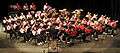 Carroll High School Band 2009
 Carroll High School Marching Band "Pride of the Wiregrass" 2007
Media
Radio stations
- WAQG 91.7 FM (Contemporary Christian)
- WDBT 103.9 FM (News/Talk)
- WOAB 104.9 FM (Adult standards)
- WOZK 900 AM (MOR)
- WQLS 1210 AM (Gospel)
Newspaper
- The Southern Star- weekly
Notable people
- Larry Donnell, tight end for the New York Giants
- Wilbur Jackson, National Football League
- Meg McGuffin, Miss Alabama 2015
- Steve McLendon, nose tackle/defensive end, Pittsburgh Steelers
- Byron Mitchell, former super middleweight boxing champion
- Marc Ronan, Major League Baseball catcher
- Naseeb Saliba, co-founder of Tutor-Saliba Corporation
- Josh Savage, professional football player
See also
References
- 1 2 "Geographic Identifiers: 2010 Demographic Profile Data (G001): Ozark city, Alabama". U.S. Census Bureau, American Factfinder. Retrieved October 2, 2015.
- ↑ "Annual Estimates of the Resident Population for Incorporated Places: April 1, 2010 to July 1, 2014". Retrieved June 4, 2015.
- 1 2 Watson, Fred Shelton (1968). Forgotten trails: a history of Dale County, Alabama, 1824–1966. Birmingham, Alabama: Banner Press. p. 288.
- ↑ Hoskins Morton, Patricia (10 December 2010). "Dale County". Encyclopedia of Alabama. Retrieved 1 February 2010.
- ↑ "US Gazetteer files: 2010, 2000, and 1990". United States Census Bureau. 2011-02-12. Retrieved 2011-04-23.
- ↑ "Annual Estimates of the Resident Population for Incorporated Places: April 1, 2010 to July 1, 2015". Retrieved July 2, 2016.
- ↑ United States Census Bureau. "Census of Population and Housing". Retrieved June 7, 2014.
- ↑ "Annual Estimates of the Resident Population: April 1, 2010 to July 1, 2013". Retrieved June 7, 2014.
External links
Coordinates: 31°26′53″N 85°38′31″W / 31.448169°N 85.642009°W
Municipalities and communities of Dale County, Alabama, United States | ||
|---|---|---|
| Cities | 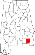 | |
| Towns | ||
| CDP | ||
| Unincorporated communities | ||
| Footnotes | ‡This populated place also has portions in an adjacent county or counties | |