Echo, Alabama
| Echo, Alabama | |
|---|---|
| Unincorporated community | |
 Echo  Echo | |
| Coordinates: 31°28′33″N 85°27′57″W / 31.47583°N 85.46583°WCoordinates: 31°28′33″N 85°27′57″W / 31.47583°N 85.46583°W | |
| Country | United States |
| State | Alabama |
| County | Dale |
| Elevation | 453 ft (138 m) |
| Time zone | Central (CST) (UTC-6) |
| • Summer (DST) | CDT (UTC-5) |
| Area code(s) | 334 |
| GNIS feature ID | 117842[1] |
Echo, also known as Marshalls Cross Roads, is an unincorporated community in Dale County, Alabama, United States. Echo is located on Alabama State Route 27, 10.4 miles (16.7 km) east of Ozark.
History
Traditional explanation holds the community was named when early settlers were constructing a log cabin and heard an echo as two logs hit each other.[2] A post office operated under the name Echo from 1851 to 1904.[3]
Company B (known as "The Dale County Grays") of the 33rd Regiment Alabama Infantry was partially made up of men from Echo.[4] A portion of the 15th Regiment Alabama Infantry also came from Echo.[5]
Demographics
Echo was listed on the 1880 U.S. Census as an unincorporated community with a population of 123.
| Historical population | |||
|---|---|---|---|
| Census | Pop. | %± | |
| 1880 | 123 | — | |
| U.S. Decennial Census[6] | |||
References
- ↑ "Echo". Geographic Names Information System. United States Geological Survey.
- ↑ Foscue, Virginia (1989). Place Names in Alabama. Tuscaloosa: The University of Alabama Press. p. 50. ISBN 0-8173-0410-X.
- ↑ "Dale County". Jim Forte Postal History. Retrieved 28 December 2015.
- ↑ Tait, Terri. "33rd Alabama Co. B". usgennet.org. Retrieved 28 December 2015.
- ↑ James P. Faust (29 October 2014). The Fighting Fifteenth Alabama Infantry: A Civil War History and Roster. McFarland. pp. 166–167. ISBN 978-0-7864-9612-9.
- ↑ "U.S. Decennial Census". Census.gov. Retrieved June 6, 2013.
Municipalities and communities of Dale County, Alabama, United States | ||
|---|---|---|
| Cities | 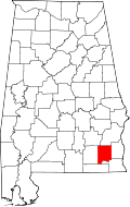 | |
| Towns | ||
| CDP | ||
| Unincorporated communities | ||
| Footnotes | ‡This populated place also has portions in an adjacent county or counties | |
This article is issued from Wikipedia - version of the 10/22/2016. The text is available under the Creative Commons Attribution/Share Alike but additional terms may apply for the media files.