Clopton, Alabama
| Clopton, Alabama | |
|---|---|
| Unincorporated community | |
 Clopton  Clopton | |
| Coordinates: 31°36′31″N 85°25′48″W / 31.60861°N 85.43000°WCoordinates: 31°36′31″N 85°25′48″W / 31.60861°N 85.43000°W | |
| Country | United States |
| State | Alabama |
| County | Dale |
| Elevation | 505 ft (154 m) |
| Time zone | Central (CST) (UTC-6) |
| • Summer (DST) | CDT (UTC-5) |
| ZIP code | 36317 |
| Area code(s) | 334 |
| GNIS feature ID | 116275[1] |
Clopton is an unincorporated community in Dale County, Alabama, United States. Clopton is located on Alabama State Route 105, 10.9 miles (17.5 km) west-northwest of Abbeville.[2] Clopton had a post office from August 22, 1853, to November 19, 2011; it still has its own ZIP code, 36317.[3][4]
Demographics
| Historical population | |||
|---|---|---|---|
| Census | Pop. | %± | |
| 1880 | 142 | — | |
| U.S. Decennial Census[5] | |||
Clopton was listed as an unincorporated community in the 1880 U.S. Census with a population of 142.
Notable person
- Henry B. Steagall, U.S. Representative from 1915 to 1943. Co-sponsored the Glass-Steagall Act and Wagner-Steagall National Housing Act.
References
- ↑ "Clopton". Geographic Names Information System. United States Geological Survey.
- ↑ General Highway Map: Dale County, Alabama (PDF) (Map). Alabama Department of Transportation. 2010. Retrieved February 11, 2013.
- ↑ United States Postal Service (2012). "USPS - Look Up a ZIP Code". Retrieved 2012-02-15.
- ↑ "Postmaster Finder - Post Offices by ZIP Code". United States Postal Service. Retrieved February 11, 2013.
- ↑ "U.S. Decennial Census". Census.gov. Archived from the original on May 11, 2015. Retrieved June 6, 2013.
Municipalities and communities of Dale County, Alabama, United States | ||
|---|---|---|
| Cities | 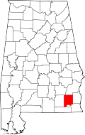 | |
| Towns | ||
| CDP | ||
| Unincorporated communities | ||
| Footnotes | ‡This populated place also has portions in an adjacent county or counties | |
This article is issued from Wikipedia - version of the 11/26/2016. The text is available under the Creative Commons Attribution/Share Alike but additional terms may apply for the media files.