Ambler Heights Historic District
|
Ambler Heights Historic District | |
|
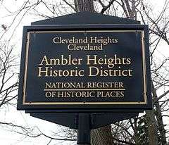
Entrance sign | |
  | |
| Location | Roughly bounded by Martin Luther King, Jr. Boulevard, Cedar Glen, N. Park Boulevard, and along Harcourt Dr., Cleveland Heights, Ohio |
|---|---|
| Coordinates | 41°29′50″N 81°36′4″W / 41.49722°N 81.60111°WCoordinates: 41°29′50″N 81°36′4″W / 41.49722°N 81.60111°W |
| Area | 73 acres (30 ha) |
| Architect | Meade and Hamilton; et al. |
| Architectural style | Late 19th and 20th Century revivals, late 19th and early 20th Century American Movements |
| NRHP Reference # | 02000883[1] |
| Added to NRHP | August 22, 2002 |
Ambler Heights Historic District is a historic district in Cleveland Heights, Ohio, United States. Listed on the National Register of Historic Places in 2002, it includes 112 contributing buildings in an area of 73 acres (300,000 m2), which was created between 1903 and 1927.[2]
References
- ↑ National Park Service (2009-03-13). "National Register Information System". National Register of Historic Places. National Park Service.
- ↑ "Ambler Heights Historic District". City of Cleveland Heights, Ohio. Retrieved November 2, 2014.


This article is issued from Wikipedia - version of the 11/25/2016. The text is available under the Creative Commons Attribution/Share Alike but additional terms may apply for the media files.