Aiguille d'Argentière
| Aiguille d'Argentière | |
|---|---|
|
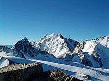
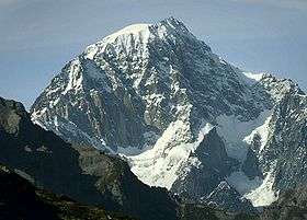
The eastern side of the Aiguille d'Argentière | |
| Highest point | |
| Elevation | 3,901 m (12,799 ft) |
| Prominence | 473 m (1,552 ft) [1] |
| Parent peak | Grandes Jorasses |
| Coordinates | 45°57′35.14″N 7°01′13.15″E / 45.9597611°N 7.0203194°ECoordinates: 45°57′35.14″N 7°01′13.15″E / 45.9597611°N 7.0203194°E |
| Geography | |
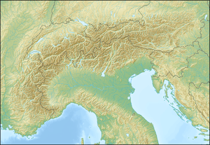 Aiguille d'Argentière Location in the Alps | |
| Location | Haute-Savoie, France / Valais, Switzerland |
| Parent range | Graian Alps |
| Geology | |
| Mountain type | Granite |
| Climbing | |
| First ascent | 15 July 1864 by Edward Whymper and A. Reilly with guides Michel Croz, M. Payot, H. Charlet |
| Easiest route | West flank and north-west ridge (PD) |

The Aiguille d'Argentière (3,901 metres (12,799 ft)) is a mountain in the Mont Blanc massif on the border between France and Switzerland.
The first ascent of the mountain was by a British party comprising Edward Whymper and A. Reilly with guides Michel Croz, M. Payot, H. Charlet on 15 July 1864. The route they took was via the west flank and the north-west ridge.
See also

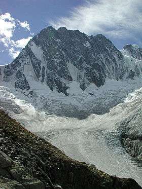
The Aiguille d'Argentière above the Saleina Glacier
The Aiguille d'Argentière from the north
References
- ↑ Retrieved from the Swisstopo and IGN topographic maps. The key col is the Brêche de l'Amône (3,428 m), north of Mont Dolent.
External links
| Wikimedia Commons has media related to Aiguille d'Argentière. |
This article is issued from Wikipedia - version of the 5/23/2016. The text is available under the Creative Commons Attribution/Share Alike but additional terms may apply for the media files.