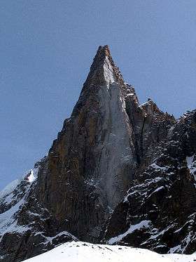
Aiguille du Chardonnet
| Aiguille du Chardonnet | |
|---|---|
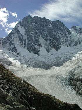
 View from Argentière (west side) | |
| Highest point | |
| Elevation | 3,824 m (12,546 ft) |
| Prominence | 503 m (1,650 ft) [1] |
| Coordinates | 45°58′08″N 07°00′05″E / 45.96889°N 7.00139°ECoordinates: 45°58′08″N 07°00′05″E / 45.96889°N 7.00139°E |
| Geography | |
 Aiguille du Chardonnet | |
| Parent range | Mont Blanc Massif |
The Aiguille du Chardonnet (3,824 m) is a mountain in the Mont Blanc massif in Haute-Savoie, France. It lies between the Glacier du Tour and the Glacier d'Argentière. The border with Switzerland (elevation: 3,680 m at its nearest point) runs just east of the summit.
References
External links
This article is issued from Wikipedia - version of the 12/4/2015. The text is available under the Creative Commons Attribution/Share Alike but additional terms may apply for the media files.