Mont Blanc du Tacul
| Mont Blanc du Tacul | |
|---|---|
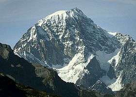
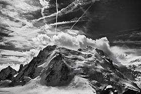 The northern side of Mont Blanc du Tacul seen from the Aiguille du Midi | |
| Highest point | |
| Elevation | 4,248 m (13,937 ft) |
| Prominence | 219 m ↓ Col Maudit [1] |
| Isolation | 1.38 km → Mont Maudit [1] |
| Coordinates | 45°51′23″N 06°53′16″E / 45.85639°N 6.88778°ECoordinates: 45°51′23″N 06°53′16″E / 45.85639°N 6.88778°E |
| Geography | |
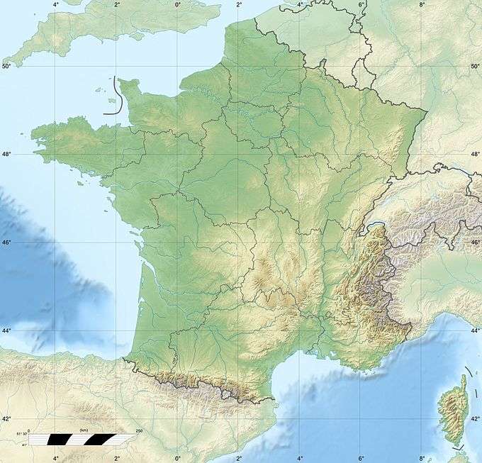 Mont Blanc du Tacul France | |
| Location | Haute-Savoie, France |
| Parent range | Graian Alps |
| Geology | |
| Mountain type | Granite |
| Climbing | |
| First ascent | Charles Hudson, Edward John Stevenson, Christopher and James Grenville Smith, E. S. Kennedy, Charles Ainslie and G. C. Joad on 8 August 1855 |
| Easiest route | North-west face (PD) |
Mont Blanc du Tacul (4,248 m) is a mountain in the Mont Blanc massif of the French Alps situated midway between the Aiguille du Midi and Mont Blanc.
The official first ascent of Mont Blanc du Tacul was by a guideless party comprising Charles Hudson, Edward John Stevenson, Christopher and James Grenville Smith, E. S. Kennedy, Charles Ainslie and G. C. Joad on 8 August 1855. However, Courmayeur guides may have already ascended the peak during their attempts in 1854 and 1855 to force a way up Mont Blanc from the Italian side.[2]
References
- 1 2 Mont Blanc du Tacul, France at peakbagger.com, retrieved 20 Feb 2016
- ↑ For this claim see Helmut Dumler and Willi P. Burkhardt, The High Mountains of the Alps, London: Diadem, 1994, p. 219
External links

Mont Blanc du Tacul (far left), Mont Maudit (left) and Mont Blanc (centre)
This article is issued from Wikipedia - version of the 2/21/2016. The text is available under the Creative Commons Attribution/Share Alike but additional terms may apply for the media files.