Courmayeur
| Courmayeur | ||
|---|---|---|
| Comune | ||
| Comune di Courmayeur Commune de Courmayeur | ||
|
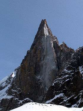
Courmayeur from the Torino Hut in August 2009 | ||
| ||
 Courmayeur Location of Courmayeur in Italy | ||
| Coordinates: IT 45°47′N 06°58′E / 45.783°N 6.967°ECoordinates: IT 45°47′N 06°58′E / 45.783°N 6.967°E | ||
| Country | Italy | |
| Region | Aosta Valley | |
| Province / Metropolitan city | none | |
| Frazioni | Dolonne, Entrèves, La Palud, Villair Dessous, Villair Dessus, Larzey, Entrelevie, La Villette, La Saxe | |
| Government | ||
| • Mayor | Fabrizia Derriard (Independent) | |
| Area | ||
| • Total | 210 km2 (80 sq mi) | |
| Highest elevation | 4,810 m (15,780 ft) | |
| Lowest elevation | 1,224 m (4,016 ft) | |
| Population (2010) | ||
| • Total | 2,870 | |
| • Density | 14/km2 (35/sq mi) | |
| Demonym(s) | Courmayeurins | |
| Time zone | CET (UTC+1) | |
| • Summer (DST) | CEST (UTC+2) | |
| Postal code | 11013 | |
| Dialing code | 0165 | |
| Patron saint | St. Pantaleo | |
| Saint day | July 27 | |
| Website | comune.courmayeur.ao.it | |

.svg.png)
Courmayeur is a town and comune in northern Italy, in the autonomous region of Aosta Valley. At an elevation of 1,224 m (4,016 ft) above sea level, it is located at the foot of the southern side of Mont Blanc, at 4,810 m (15,781 ft) the highest point in the Alps and western Europe (see Seven Summits), and is crossed by the Dora Baltea. Courmayeur shares administration of Mont Blanc with its neighboring commune of Saint-Gervais-les-Bains in France, and is consequently able to claim the title of highest commune in Italy. Courmayeur also shares access to the famous glacial ski run of the Vallée Blanche with another French town, Chamonix, which sits at the opposite, northern, side of the Mont Blanc massif.
History
The ancient Curia Maior was always a popular tourist destination, thanks to its spa, and the Mont-Blanc landscapes. During World War II, under the fascist regime and its "italianist" rule, the town was briefly rebaptized "Cormaiore".
Tourism
Courmayeur’s picturesque mountain scenery make it an attractive year-round destination. It is one of Europe’s most famous ski locations, and contains the Giardino Botanico Alpino Saussurea, which describes itself as Europe's highest botanical garden. In the summer months Courmayeur is a popular destination for hikers.
The Courmayeur Noir in festival, an annual film and literature event, was introduced in 1991 and takes place in December.
Transport and hiking
Courmayeur is well-connected to northwestern Italy, and is 220 km (140 mi) from Milan. The Mont Blanc Tunnel, 11.6 km (7.2 mi) in length, links the region to France; Lyon is 240 km (150 mi) away and can be reached in a few hours, and Geneva, Switzerland, is just 100 km (60 mi) away. Regular road transport services are available to Courmayeur from Geneva.

from Dolonne
The nearby village of La Palud is the base station of the Skyway Monte Bianco, the cable car to the Pointe Helbronner. This links to the Vallée Blanche Aerial Tramway going to the Aiguille du Midi, which connects to the Téléphérique de l'Aiguille du Midi, the cable car from Chamonix.
Dolonne, a sister-town of Courmayeur, has many residential areas and hotels and a large sports centre. It is connected to Courmayeur by a bridge that straddles a tributary flowing from Mont Blanc.
Another mountain adjacent to Courmayeur is Mont Chétif at 2,343 m (7,687 ft), a hiker-friendly mountain with a statue of the Virgin Mary at its summit, overlooking the town.
Sister cities
 Chamonix, France
External links
| Wikimedia Commons has media related to Courmayeur. |
 Courmayeur travel guide from Wikivoyage
- Official website (Italian)
- Courmayeur Noir in festival (English) (Italian)
- Sci Club Courmayeur Monte Bianco (Italian)