Zenia, California
| Zenia, California | |
|---|---|
| Unincorporated community | |
 Zenia, California | |
| Coordinates: 40°12′20″N 123°29′31″W / 40.20556°N 123.49194°WCoordinates: 40°12′20″N 123°29′31″W / 40.20556°N 123.49194°W | |
| Country | United States |
| State | California |
| County | Trinity |
| Elevation | 2,969 ft (905 m) |
| Time zone | Pacific (PST) (UTC-8) |
| • Summer (DST) | PDT (UTC-7) |
| ZIP code | 95595 |
| Area code(s) | 530 |
| GNIS feature ID | 252841[1] |
Zenia is an unincorporated community in Trinity County, California, United States. Zenia is 6.5 miles (10.5 km) northeast of Alderpoint. Zenia has a post office with ZIP code 95595, which opened in 1899.[2] Zenia was first named 'Poison Camp' by men who went there in the 1860s after larkspur in the area which poisoned their cattle. Postmaster George Croyden named the community Zenia after a girl.[3]
References
- ↑ U.S. Geological Survey Geographic Names Information System: Zenia, California
- ↑ ZIP Code Lookup Archived June 14, 2011, at the Wayback Machine.
- ↑ Durham, David L. (1998). California's Geographic Names: A Gazetteer of Historic and Modern Names of the State. Quill Driver Books. p. 172. ISBN 1-884995-14-4.
Municipalities and communities of Trinity County, California, United States | ||
|---|---|---|
| CDPs | 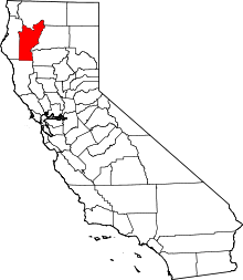 | |
| Unincorporated communities | ||
| Indian reservation | ||
| Ghost towns | ||
This article is issued from Wikipedia - version of the 11/13/2016. The text is available under the Creative Commons Attribution/Share Alike but additional terms may apply for the media files.