Wrightsville, Madison County, Ohio
| Wrightsville, Ohio | |
|---|---|
| Unincorporated community | |
 Wrightsville, Ohio Location of Wrightsville, Ohio | |
| Coordinates: 39°51′40″N 83°14′50″W / 39.86111°N 83.24722°W | |
| Country | United States |
| State | Ohio |
| Counties | Madison |
| Elevation[1] | 951 ft (290 m) |
| Time zone | Eastern (EST) (UTC-5) |
| • Summer (DST) | EDT (UTC-4) |
| ZIP code | 43123 |
| Area code(s) | 614 |
| GNIS feature ID | 2030260[1] |
Wrightsville is an unincorporated community in Fairfield Township, Madison County, Ohio, United States.[2] It is located at 39°51′40″N 83°14′50″W / 39.86111°N 83.24722°WCoordinates: 39°51′40″N 83°14′50″W / 39.86111°N 83.24722°W,[3] at the intersection of Ohio State Route 665 and Georgesville-Wrightsville Road, approximately four miles north of Kiousville.[2] Some national maps mistakenly show Wrightsville in Franklin County.[4]
The Wrightsville Post Office was established on January 23, 1888, but was discontinued on January 15, 1901. The mail service is now sent through the Georgesville branch.[3]
References
- 1 2 "US Board on Geographic Names". United States Geological Survey. 2007-10-25. Retrieved 2008-01-31.
- 1 2 Franklin County Engineer's Office, Franklin County Road Atlas, Map 40, 2009
- 1 2 U.S. Geological Survey Geographic Names Information System: Wrightsville Post Office
- ↑ Rand McNally. The Road Atlas '06. Chicago: Rand McNally, 2006, 80.
Municipalities and communities of Madison County, Ohio, United States | ||
|---|---|---|
| City | 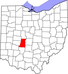 | |
| Villages | ||
| Townships | ||
| CDPs | ||
| Unincorporated communities | ||
| Footnotes | ‡This populated place also has portions in an adjacent county or counties | |
This article is issued from Wikipedia - version of the 5/11/2015. The text is available under the Creative Commons Attribution/Share Alike but additional terms may apply for the media files.