Kileville, Ohio
| Kileville, Ohio | |
|---|---|
| Unincorporated community | |
|
Skyline of Kileville | |
 Kileville, Ohio Location of Kileville, Ohio | |
| Coordinates: 40°6′16″N 83°12′39″W / 40.10444°N 83.21083°W | |
| Country | United States |
| State | Ohio |
| Counties | Madison |
| Elevation[1] | 948 ft (289 m) |
| Time zone | Eastern (EST) (UTC-5) |
| • Summer (DST) | EDT (UTC-4) |
| ZIP code | 43064 |
| Area code(s) | 614 |
| GNIS feature ID | 1064933[1] |


Kileville is an unincorporated community in Darby Township, Madison County, Ohio, United States. It is located at 40°6′16″N 83°12′39″W / 40.10444°N 83.21083°WCoordinates: 40°6′16″N 83°12′39″W / 40.10444°N 83.21083°W,[2] along Ohio State Route 161, between Plain City and Dublin.[3]
Kileville was platted on October 2, 1895, by James Kile, a farmer who owned the land.[4] It is located on the Toledo & Ohio Central railroad, but is only a small stop. As of 1915, Kileville was classified as a village, and consisted of one general store, one blacksmith, one post office, and one grain elevator.[4]
Kileville was first electrified in 1920, when a power line was extended from Plain City. As of 1921, the Kileville Lighting Company had a total of nine customers.[5]
References
- 1 2 "US Board on Geographic Names". United States Geological Survey. 2007-10-25. Retrieved 2008-01-31.
- ↑ U.S. Geological Survey Geographic Names Information System: Kileville, Ohio
- ↑ Rand McNally. The Road Atlas '06. Chicago: Rand McNally, 2006, 80.
- 1 2 Bryan, Chester E., History of Madison County, Ohio, B.F. Bowen & Company, Inc., Indianapolis, Indiana, 1915, Pg. 175.
- ↑ Public Utilities Commission of Ohio, Report of the Public Utilities Commission of Ohio, 1921, Pg. 242
Municipalities and communities of Madison County, Ohio, United States | ||
|---|---|---|
| City | 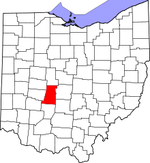 | |
| Villages | ||
| Townships | ||
| CDPs | ||
| Unincorporated communities | ||
| Footnotes | ‡This populated place also has portions in an adjacent county or counties | |