Winterfield Township, Michigan
| Winterfield Township, Michigan | |
|---|---|
| Township | |
 Winterfield Township Location within the state of Michigan | |
| Coordinates: 44°6′50″N 85°1′52″W / 44.11389°N 85.03111°WCoordinates: 44°6′50″N 85°1′52″W / 44.11389°N 85.03111°W | |
| Country | United States |
| State | Michigan |
| County | Clare |
| Organized | March 18, 1871[1] |
| Area | |
| • Total | 36.6 sq mi (94.8 km2) |
| • Land | 36.1 sq mi (93.4 km2) |
| • Water | 0.5 sq mi (1.4 km2) |
| Elevation | 1,076 ft (328 m) |
| Population (2010) | |
| • Total | 459 |
| • Density | 13/sq mi (4.9/km2) |
| Time zone | Eastern (EST) (UTC-5) |
| • Summer (DST) | EDT (UTC-4) |
| ZIP codes |
48625 (Harrison), 49665 (Marion) |
| FIPS code | 26-87980[2] |
| GNIS feature ID | 1627282[3] |
| Website |
winterfieldtownship |
Winterfield Township is a civil township of Clare County in the U.S. state of Michigan. The population was 459 at the 2010 census.[4]
Communities
There are no named settlements of note within the township.
- The city of Harrison is to the southeast, and the Harrison ZIP code 48625 serves the southeast corner of Winterfield Township.[5]
- The village of Marion is to the west in Osceola County, and the Marion ZIP code 49665 serves most of Winterfield Township.[6]
Geography
Winterfield Township is in the northwestern corner of Clare County and is bordered to the west by Osceola County and to the north by Missaukee County. According to the United States Census Bureau, the township has a total area of 36.6 square miles (94.8 km2), of which 36.1 square miles (93.4 km2) is land and 0.54 square miles (1.4 km2), or 1.53%, is water.[4] The Muskegon River crosses the southeast corner of the township and is joined by the Clam River entering from the north.
Demographics
As of the census[2] of 2000, there were 483 people, 184 households, and 142 families residing in the township. The population density was 13.2 per square mile (5.1/km²). There were 386 housing units at an average density of 10.6 per square mile (4.1/km²). The racial makeup of the township was 95.86% White, 1.04% Native American, 1.66% from other races, and 1.45% from two or more races. Hispanic or Latino of any race were 1.04% of the population.
There were 184 households out of which 29.9% had children under the age of 18 living with them, 59.8% were married couples living together, 13.0% had a female householder with no husband present, and 22.3% were non-families. 17.9% of all households were made up of individuals and 10.3% had someone living alone who was 65 years of age or older. The average household size was 2.63 and the average family size was 2.94.
In the township the population was spread out with 26.7% under the age of 18, 7.7% from 18 to 24, 21.7% from 25 to 44, 27.7% from 45 to 64, and 16.1% who were 65 years of age or older. The median age was 40 years. For every 100 females there were 105.5 males. For every 100 females age 18 and over, there were 98.9 males.
The median income for a household in the township was $26,953, and the median income for a family was $30,455. Males had a median income of $32,500 versus $22,813 for females. The per capita income for the township was $14,322. About 18.8% of families and 22.5% of the population were below the poverty line, including 31.0% of those under age 18 and 13.7% of those age 65 or over.
References
- ↑ Acts of the Legislature of the State of Michigan. W.S. George. 1871. pp. 83–84 [No. 361]. Retrieved September 2008.
The People of the State of Michigan enact, That township twenty north, of range five west, and townships nineteen and twenty north, of range six west, are hereby organized into a separate township by the name of Winterfield, and the first township meeting shall be held at the house of Sylvester Hill, in said township, on the first Monday in April next....This act shall take immediate effect. Approved March 18, 1871.
Check date values in:|access-date=(help) - 1 2 "American FactFinder". United States Census Bureau. Retrieved 2008-01-31.
- ↑ U.S. Geological Survey Geographic Names Information System: Winterfield Township, Michigan
- 1 2 "Geographic Identifiers: 2010 Demographic Profile Data (G001): Winterfield township, Clare County, Michigan". U.S. Census Bureau, American Factfinder. Retrieved September 30, 2014.
- ↑ 48625 5-Digit ZCTA, 486 3-Digit ZCTA - Reference Map - American FactFinder, U.S. Census Bureau, 2000 census
- ↑ 49665 5-Digit ZCTA, 496 3-Digit ZCTA - Reference Map - American FactFinder, U.S. Census Bureau, 2000 census
External links
Municipalities and communities of Clare County, Michigan, United States | ||
|---|---|---|
| Cities | 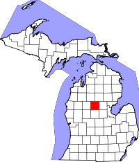 | |
| Village | ||
| Townships | ||
| Unincorporated communities | ||
| Footnotes | ‡This populated place also has portions in an adjacent county or counties | |