Surrey Township, Michigan
| Surrey Township, Michigan | |
|---|---|
| Township | |
 Surrey Township Location within the state of Michigan | |
| Coordinates: 43°51′1″N 84°53′18″W / 43.85028°N 84.88833°WCoordinates: 43°51′1″N 84°53′18″W / 43.85028°N 84.88833°W | |
| Country | United States |
| State | Michigan |
| County | Clare |
| Area | |
| • Total | 35.8 sq mi (92.8 km2) |
| • Land | 35.1 sq mi (90.9 km2) |
| • Water | 0.7 sq mi (1.8 km2) |
| Elevation | 965 ft (294 m) |
| Population (2010) | |
| • Total | 3,606 |
| • Density | 103/sq mi (39.7/km2) |
| Time zone | Eastern (EST) (UTC-5) |
| • Summer (DST) | EDT (UTC-4) |
| FIPS code | 26-77580[1] |
| GNIS feature ID | 1627142[2] |
| Website |
surreytownship |
Surrey Township is a civil township of Clare County in the U.S. state of Michigan. The population was 3,606 at the 2010 census.[3] Lake Thirteen and the village of Farwell are located in the township.
Geography
Surrey Township is located in southern Clare County and is bordered to the south by Isabella County. U.S. Route 10 crosses the township, entering from the west as a two-lane highway, then expanding to a four-lane expressway across the center and eastern parts of the township. M-115 crosses the township from northwest to southeast, passing through the village of Farwell in the southeast.
According to the United States Census Bureau, the township has a total area of 35.8 square miles (92.8 km2), of which 35.1 square miles (90.9 km2) is land and 0.69 square miles (1.8 km2), or 1.99%, is water.[3]
Demographics
As of the census[1] of 2000, there were 3,555 people, 1,444 households, and 984 families residing in the township. The population density was 100.8 per square mile (38.9/km²). There were 1,989 housing units at an average density of 56.4 per square mile (21.8/km²). The racial makeup of the township was 97.72% White, 0.28% African American, 0.98% Native American, 0.28% Asian, 0.11% from other races, and 0.62% from two or more races. Hispanic or Latino of any race were 1.10% of the population.
There were 1,444 households out of which 27.2% had children under the age of 18 living with them, 54.2% were married couples living together, 10.3% had a female householder with no husband present, and 31.8% were non-families. 27.1% of all households were made up of individuals and 12.0% had someone living alone who was 65 years of age or older. The average household size was 2.39 and the average family size was 2.86.
In the township the population was spread out with 22.5% under the age of 18, 7.1% from 18 to 24, 25.5% from 25 to 44, 26.0% from 45 to 64, and 19.0% who were 65 years of age or older. The median age was 42 years. For every 100 females there were 93.0 males. For every 100 females age 18 and over, there were 90.4 males.
The median income for a household in the township was $28,350, and the median income for a family was $32,475. Males had a median income of $30,938 versus $21,779 for females. The per capita income for the township was $17,027. About 7.7% of families and 11.0% of the population were below the poverty line, including 12.8% of those under age 18 and 4.2% of those age 65 or over.
References
- 1 2 "American FactFinder". United States Census Bureau. Retrieved 2008-01-31.
- ↑ U.S. Geological Survey Geographic Names Information System: Surrey Township, Michigan
- 1 2 "Geographic Identifiers: 2010 Demographic Profile Data (G001): Surrey township, Clare County, Michigan". U.S. Census Bureau, American Factfinder. Retrieved September 30, 2014.
External links
Municipalities and communities of Clare County, Michigan, United States | ||
|---|---|---|
| Cities | 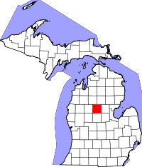 | |
| Village | ||
| Townships | ||
| Unincorporated communities | ||
| Footnotes | ‡This populated place also has portions in an adjacent county or counties | |