Hatton Township, Michigan
| Hatton Township, Michigan | |
|---|---|
| Township | |
 Hatton Township Location within the state of Michigan | |
| Coordinates: 43°56′30″N 84°46′33″W / 43.94167°N 84.77583°WCoordinates: 43°56′30″N 84°46′33″W / 43.94167°N 84.77583°W | |
| Country | United States |
| State | Michigan |
| County | Clare |
| Area | |
| • Total | 36.1 sq mi (93.6 km2) |
| • Land | 35.9 sq mi (92.9 km2) |
| • Water | 0.3 sq mi (0.7 km2) |
| Elevation | 1,106 ft (337 m) |
| Population (2010) | |
| • Total | 933 |
| • Density | 26/sq mi (10.0/km2) |
| Time zone | Eastern (EST) (UTC-5) |
| • Summer (DST) | EDT (UTC-4) |
| ZIP codes |
48617 (Clare), 48622 (Farwell), 48625 (Harrison) |
| FIPS code | 26-37160[1] |
| GNIS feature ID | 1626450[2] |
Hatton Township is a civil township of Clare County in the U.S. state of Michigan. The population was 933 at the 2010 census.[3]
Communities
There are no incorporated municipalities in the township.
- Hatton is an unincorporated community in the southwest of the township at 43°55′22″N 84°49′07″W / 43.92278°N 84.81861°W.[4] It was a station on the Pere Marquette Railway, beginning circa 1881. A post office was established May 18, 1882, with James Landry as the first postmaster. A fire in 1910 destroyed most of the settlement.[5]
- The city of Clare is to the south, and the Clare ZIP code 48617 serves the southeast part of Hatton Township.[6]
- The village of Farwell is to the southwest, and the Farwell ZIP code 48622 serves the southwest part of Hatton Township.[7]
- The city of Harrison is to the north, and the Harrison ZIP code 48625 serves parts of northern and western Hatton Township.[8]
Geography
Hatton Township is located southeast of the center of Clare County, between the cities of Harrison (to the north) and Clare (to the south). U.S. Route 127 crosses the township connecting the two cities, with access in the township from Exit 168.
According to the United States Census Bureau, the township has a total area of 36.1 square miles (93.6 km2), of which 35.9 square miles (92.9 km2) is land and 0.27 square miles (0.7 km2), or 0.70%, is water.[3]
Demographics
As of the census[1] of 2000, there were 923 people, 333 households, and 245 families residing in the township. The population density was 25.7 per square mile (9.9/km²). There were 466 housing units at an average density of 13.0 per square mile (5.0/km²). The racial makeup of the township was 97.29% White, 0.65% Native American, 0.65% Asian, 0.11% from other races, and 1.30% from two or more races. Hispanic or Latino of any race were 0.76% of the population.
There were 333 households out of which 36.3% had children under the age of 18 living with them, 61.0% were married couples living together, 6.0% had a female householder with no husband present, and 26.4% were non-families. 20.1% of all households were made up of individuals and 7.2% had someone living alone who was 65 years of age or older. The average household size was 2.77 and the average family size was 3.16.
In the township the population was spread out with 31.2% under the age of 18, 6.6% from 18 to 24, 25.1% from 25 to 44, 25.5% from 45 to 64, and 11.6% who were 65 years of age or older. The median age was 35 years. For every 100 females there were 101.5 males. For every 100 females age 18 and over, there were 102.9 males.
The median income for a household in the township was $30,461, and the median income for a family was $33,229. Males had a median income of $36,000 versus $19,583 for females. The per capita income for the township was $15,848. About 10.2% of families and 11.3% of the population were below the poverty line, including 12.3% of those under age 18 and 12.6% of those age 65 or over.
References
- 1 2 "American FactFinder". United States Census Bureau. Retrieved 2008-01-31.
- ↑ U.S. Geological Survey Geographic Names Information System: Hatton Township, Michigan
- 1 2 "Geographic Identifiers: 2010 Demographic Profile Data (G001): Hatton township, Clare County, Michigan". U.S. Census Bureau, American Factfinder. Retrieved September 29, 2014.
- ↑ U.S. Geological Survey Geographic Names Information System: Hatton, Michigan
- ↑ Romig, Walter (1986) [1973]. Michigan Place Names. Detroit, Michigan: Wayne State University Press. ISBN 0-8143-1838-X.
- ↑ 48617 5-Digit ZCTA, 486 3-Digit ZCTA - Reference Map - American FactFinder, U.S. Census Bureau, 2000 census
- ↑ 48622 5-Digit ZCTA, 486 3-Digit ZCTA - Reference Map - American FactFinder, U.S. Census Bureau, 2000 census
- ↑ 48625 5-Digit ZCTA, 486 3-Digit ZCTA - Reference Map - American FactFinder, U.S. Census Bureau, 2000 census
Municipalities and communities of Clare County, Michigan, United States | ||
|---|---|---|
| Cities | 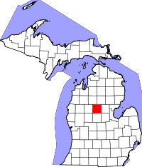 | |
| Village | ||
| Townships | ||
| Unincorporated communities | ||
| Footnotes | ‡This populated place also has portions in an adjacent county or counties | |